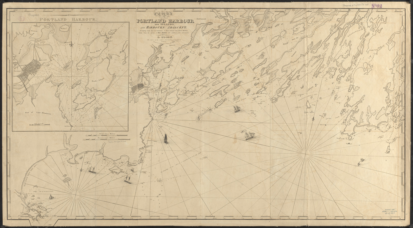
Chart of Portland Harbour and islands, and harbours adjacent, extending from the river Kennebec to Wood Island and Winter Harbour, drawn from the survey of Des Barres with additions and corrections
Item Information
- Title:
- Chart of Portland Harbour and islands, and harbours adjacent, extending from the river Kennebec to Wood Island and Winter Harbour, drawn from the survey of Des Barres with additions and corrections
- Cartographer:
- Moody, Lemuel, 1767-1846
- Engraver:
- Johnson, D. G.
- Name on Item:
-
by L. Moody ; engd. by D.G. Johnson
- Date:
-
1825
- Format:
-
Maps/Atlases
- Location:
-
Boston Public Library
Norman B. Leventhal Map & Education Center - Collection (local):
-
Norman B. Leventhal Map & Education Center Collection
- Subjects:
-
Nautical charts--Maine--Portland Harbor
Portland Harbor (Me.)--Maps
- Places:
-
MaineCumberland (county)Portland Harbor
- Extent:
- 1 map ; 68 x 122 cm
- Terms of Use:
-
No known copyright restrictions.
No known restrictions on use.
- Publisher:
-
[Portland, Maine] :
[Lemuel Moody]
- Scale:
-
Scale approximately 1:50,500
- Language:
-
English
- Notes:
-
Relief shown by soundings.
Oriented with north towards the upper right.
Inset: Portland Harbour.
"Entered according to Act of Congress, July 13th, 1825."
Includes illustrations of ships.
- Identifier:
-
06_01_015478
- Call #:
-
G3732.P7P5 1825 .M66
- Barcode:
-
39999085937009


