Toggle navigation
LMEC Home
Exhibitions
Georeferencing
Tools for Teachers
Collections
My Favorites
Sign Up / Log In
Search
Search the map portal
Map Collection
Map Collection
Map Sets
Search
Search
Search for
Search In
All Fields
Creator
Title
Subject
Place
Search All Digital Collections
Advanced Search
59 Results
My Search
Start Over
Date
1720
to
1724
Remove constraint Date: <span class='from'>1720</span> to <span class='to'>1724</span>
Filter your Search
Place
North and Central America
35
United States
16
North America
14
South America
11
Europe
9
New York
6
America
5
Louisiana
5
more
Place
»
Topic
North America--Maps--Early works to 1800
9
America--Maps--Early works to 1800
5
South America--Maps--Early works to 1800
5
Western Hemisphere--Maps--Early works to 1800
5
Manuscript maps--Early works to 1800
4
Louisiana--Maps--Early works to 1800
3
Mississippi River Valley--Maps--Early works to 1800
3
World maps--Early works to 1800
3
more
Topic
»
Date
1720
to
1724
[remove]
59
Date range begin
–
Date range end
Current results range from
1699
to
1800
1720
to
1720
44
1721
to
1721
30
1722
to
1722
26
1723
to
1723
27
1724
to
1724
25
Creator
Moll, Herman, d. 1732
11
Homann, Johann Baptist, 1663-1724
5
Senex, John, d. 1740
5
Bowen, Emanuel, 1693 or 1694-1767
3
L'Isle, Guillaume de, 1675-1726
3
Ogilby, John, 1600-1676
3
Bowles, John, 1701-1779
2
Bowles, Thomas, d. 1767
2
more
Creator
»
Format
Maps/Atlases
59
Manuscripts
8
Georeferenced
Yes
1
No
58
Collection
Norman B. Leventhal Map & Education Center Collection
41
American Revolutionary War-Era Maps
11
William L. Clements Library Collection
7
Boston and New England Maps
6
British Library Collection
3
Newberry Library Collection
3
Ralph Finos Map Collection at Phillips Academy
3
Mapping Boston Collection
2
more
Collection
»
Available to use
No known restrictions
42
Creative Commons license
6
Search Constraints
Sort by relevance
relevance
title
date (asc)
date (desc)
Number of results to display per page
20 per page
10
per page
20
per page
50
per page
100
per page
View results as:
grid view
map view
Search Results
1.
[A map of part of New York, comprehending the country between New York and Quebec, the river Connecticut, &c., to shew "the way...
2.
[A map of part of New York, comprehending the country between New York and Quebec, the river Connecticut, &c., to shew "the way...
3.
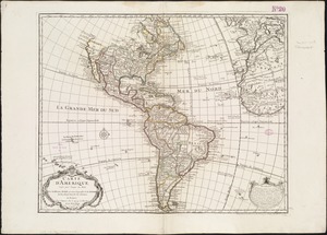
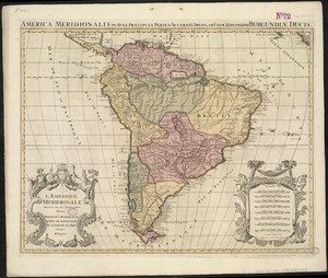
L'Amerique Meridionale divisée en ses principales parties
4.
[Amerique septentrionale]
5.
Amplissimae regionis Mississipi seu provinciae Ludovicianae â R.P. Ludovico Hennepin Francisc. Miss. in America septentrionali...
6.
Amplissimae regionis Mississipi seu Provinciae Ludovicianae â R.P. Ludovico Hennepin Francisc Miss in America Septentrionali...
7.
Carte d'Amerique : dressée pour l'usage du Roy
8.
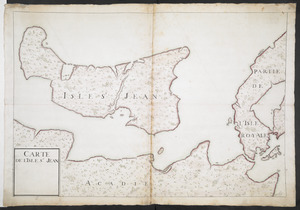
CARTE DE L'ISLE ST JEAN
9.
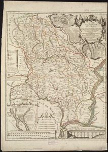
Carte du diocèse d'Uzès
10.
Carte du Gouvernement de l'Amerique
11.
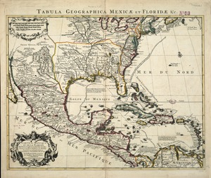
Carte du Mexique et de la Florida : des terres angloises et des Isles Antilles, du cours et des environs de la Riviere de...
12.
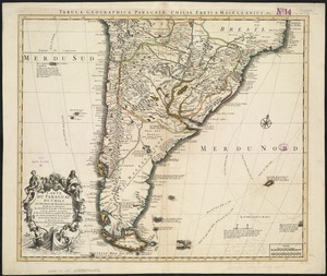
Carte du Paraguay, du Chili, du Detroit de Magellan &c
13.
Cuba, ciudad capittal de la ysla del mismo nombre y su famoso puerto sittuado en la costa del sur de gra. ysla, los 20 grados y...
14.
Le Diocese de Limoges : divisé en ses dix huict Archipretré et les Gouvernemens de la Marche et du Limosin dans les quels il...
15.
A draft of the Golden & adjacent Islands, with part of ye Isthmus of Darien as it was taken by Capt. Ienefer where ye Scots...
16.
The empire of Germany : divided into its general and perticuler parts & most humbly inscrib'd to ye most noble Lord Christopher...
17.
The English Empire in America, Newfound-land, Canada, Hudsons Bay &c. in plano
18.
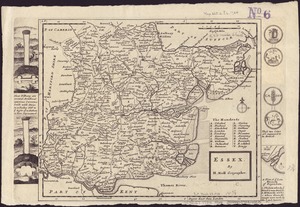
Essex
19.
The Gulf coast from the Mississippi Delta to the Bay of St. Joseph
20.
The harbour of Casco Bay and islands adjacent
‹ Prev
Next ›
1
2
3
![[A map of part of New York, comprehending the country between New York and Quebec, the river Connecticut, &c., to shew "the way from Albany to Canada ..... part by land and part by water;" drawn about 1720, on a scale of 31 miles to an inch]](https://bpldcassets.blob.core.windows.net/derivatives/images/commonwealth:6108vw070/image_thumbnail_300.jpg)
![[A map of part of New York, comprehending the country between New York and Quebec, the river Connecticut, &c., to shew "the way from Albany to Canada ..... part by land and part by water;" drawn about 1720, on a scale of 31 miles to an inch]](https://bpldcassets.blob.core.windows.net/derivatives/images/commonwealth:6108vw09j/image_thumbnail_300.jpg)
![[Amerique septentrionale]](https://bpldcassets.blob.core.windows.net/derivatives/images/commonwealth:8336h2955/image_thumbnail_300.jpg)