Toggle navigation
LMEC Home
Exhibitions
Georeferencing
Tools for Teachers
Collections
My Favorites
Sign Up / Log In
Search
Search the map portal
Map Collection
Map Collection
Map Sets
Search
Search
Search for
Search In
All Fields
Creator
Title
Subject
Place
Search All Digital Collections
Advanced Search
11 Results
My Search
Start Over
Place
trinidad and tobago
Remove constraint Place: trinidad and tobago
Filter your Search
Place
North and Central America
10
Tobago
6
Trinidad and Tobago
5
Trinidad
3
Cayenne
1
Chaguaramas
1
Curacao
1
French Guiana
1
more
Place
»
Topic
Coasts--Trinidad and Tobago--Trinidad--Maps, Manuscript--Early works to 1800
2
Tobago (Trinidad and Tobago)--Administrative and political divisions--Maps--Early works to 1800
2
Tobago (Trinidad and Tobago)--Maps--Early works to 1800
2
Trinidad--Maps, Manuscript--Early works to 1800
2
Atlantic Coast (Guiana)--Maps--Early works to 1800
1
Cayenne (French Guiana)--Maps--Early works to 1800
1
Chaguaramas (Trinidad and Tobago)--Maps, Manuscript--Early works To 1800
1
Coasts--Guiana--Maps--Early works to 1800
1
more
Topic
»
Date
Date range begin
–
Date range end
Current results range from
1768
to
1829
View distribution
Creator
Jefferys, Thomas, -1771
2
Bayly, John Abraham, fl. 1755-1794
1
Byres, John
1
Edwards, Bryan, 1743-1800
1
Heather, William, 1764-1812
1
Hooper, S. (Samuel)
1
Jefferys, Thomas, d. 1771
1
John Thomson and Co.
1
more
Creator
»
Format
Maps/Atlases
11
Manuscripts
4
Georeferenced
No
11
Collection
American Revolutionary War-Era Maps
9
Norman B. Leventhal Map & Education Center Collection
5
Library of Congress Collection
4
Maritime Charts and Atlases
3
Richard H. Brown Revolutionary War Map Collection at Mount Vernon
2
Available to use
Creative Commons license
6
No known restrictions
5
Search Constraints
Sort by relevance
relevance
title
date (asc)
date (desc)
Number of results to display per page
20 per page
10
per page
20
per page
50
per page
100
per page
View results as:
grid view
map view
Search Results
1.
Tobago
2.
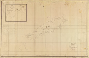
Tobago from actual surveys and observations
3.
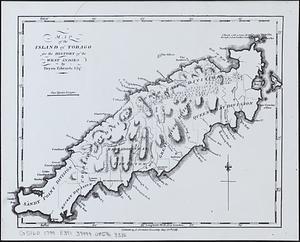
Map of the island of Tobago for the History of the West Indies
4.
West India Islands
5.
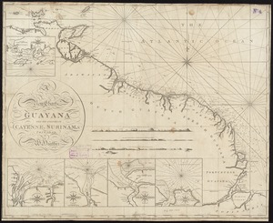
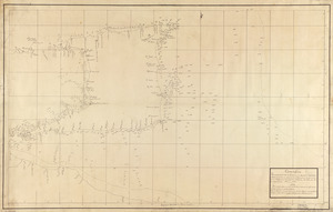
A new chart of Guyana with the colonies of Cayenne, Surinam, & Trinadad
6.
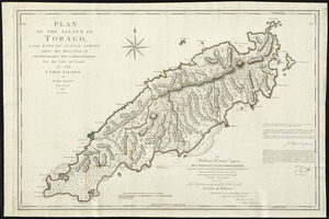
Plan of the island of Tobago laid down by actual survey under the direction of the honorable the Commissioners for the Sale of...
7.
Carta esférica de la Ysla de Tabago
8.
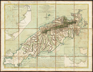
Tabago
9.
Carta esférica que comprehende la Ysla de Trinidad con sus adyacentes, bajos, sondas y veriles
10.
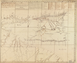
Plano de la Ysla Trinidad de Barlovento situado entre las latitudes septentrionales de 10⁰51ʹ y la de 9⁰44ʹ y entre las...
11.
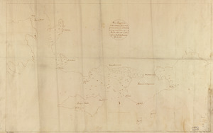
Plano geométrico de la boca de monos y puertos de Charguaramas y Carenero en la Ya. de Trinidad