West India Islands

Item Information
- Title:
- West India Islands
- Publisher:
- John Thomson and Co.
- Date:
-
[1829]
- Format:
-
Maps/Atlases
- Location:
-
Boston Public Library
Norman B. Leventhal Map & Education Center - Collection (local):
-
Norman B. Leventhal Map & Education Center Collection
- Subjects:
-
Windward Islands (West Indies)--Maps
Grenada--Maps
Tobago (Trinidad and Tobago)--Maps
Trinidad--Maps
Curaçao--Maps
- Places:
-
Grenada
Trinidad and Tobago
Curacao (territory)
- Extent:
- 4 maps on 1 sheet : color ; each 25 x 30 cm on 51 x 60 cm
- Terms of Use:
-
No known copyright restrictions.
No known restrictions on use.
- Publisher:
-
[Edinburgh] :
[John Thomson & Co.]
- Scale:
-
Scales differ
- Language:
-
English
- Table of Contents:
-
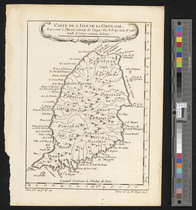
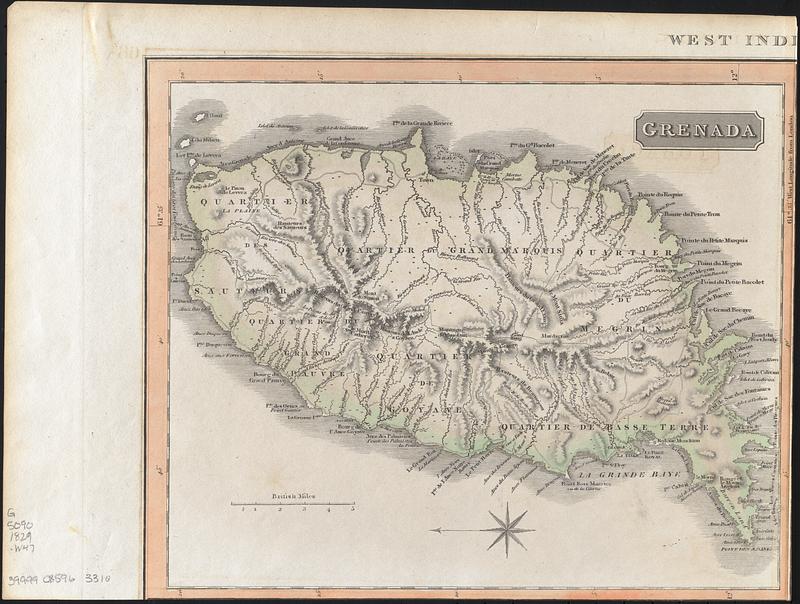
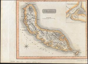
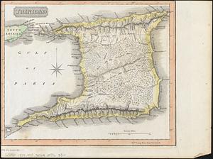
Grenada [scale approximately 1:140,000]
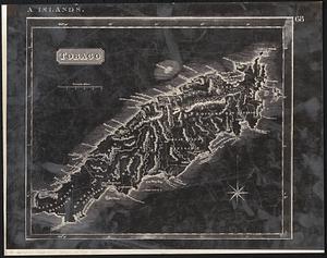
Tobago [scale approximately 1:170,000]
Trinidad [scale approximately 1:460,000
Curaçao [scale approximately 1:310,000] ; inset Fort Amsterdam
- Notes:
-
Shows rivers, woods and settlements.
Relief shown by hachures.
Imprint derived from the atlas in which this state of the map was issued.
Later state with date and engraver's name removed and number added.
In upper right: 68.
"Drawn & engraved for Thomson's New general atlas."
Boston Public Library copy cut into separate sheets and lacking map of Tobago, which is replaced by a negative photocopy.
- Notes (date):
-
This date is inferred.
- Identifier:
-
06_01_017825-A
06_01_017825-B
06_01_017825-C
06_01_017825-D
- Call #:
-
G5090 1829 .W47
- Barcode:
-
39999085963310