Toggle navigation
LMEC Home
Exhibitions
Georeferencing
Tools for Teachers
Collections
My Favorites
Sign Up / Log In
Search
Search the map portal
Map Collection
Map Collection
Map Sets
Search
Search
Search for
Search In
All Fields
Creator
Title
Subject
Place
Search All Digital Collections
Advanced Search
23 Results
My Search
Start Over
levy
Remove constraint levy
Filter your Search
Place
North and Central America
18
United States
14
Canada
5
Franklin (county)
4
Quebec
4
Saint Lawrence River
4
Lévis
3
Berkshire (county)
2
more
Place
»
Topic
United States--History--French and Indian War, 1754-1763--Maps
5
Lévis (Québec)--Maps
3
Saint Lawrence River--Maps
3
Québec Campaign, Québec, 1759--Maps
2
Amherst, Jeffery Amherst, Baron, 1717-1797
1
Beauport (Québec)--Maps
1
Chronology, Historical--Charts, diagrams, etc.
1
Chronology--Charts, diagrams, etc
1
more
Topic
»
Date
Date range begin
–
Date range end
Current results range from
1760
to
1988
View distribution
Creator
Leonard, Levi
6
Amherst, Jeffery Amherst, Baron, 1717-1797
2
Royal United Services Institute for Defence and Security Studies
2
Blake, George S. (George Smith), 1803-1871
1
Bliss, H. I.
1
Buell, Lucretia H., 1800-1860
1
Carter, Levi
1
Carter, Matthew
1
more
Creator
»
Format
Maps/Atlases
21
Documents
1
Manuscripts
1
Prints
1
Georeferenced
No
23
Collection
American Revolutionary War-Era Maps
8
Norman B. Leventhal Map & Education Center Collection
8
Town plans, 1830
6
William L. Clements Library Collection
6
Urban Maps
3
Boston and New England Maps
2
British Library Collection
2
Boston Redevelopment Authority Collection
1
more
Collection
»
Available to use
No known restrictions
15
Creative Commons license
2
Search Constraints
Sort by relevance
relevance
title
date (asc)
date (desc)
Number of results to display per page
20 per page
10
per page
20
per page
50
per page
100
per page
View results as:
grid view
map view
Search Results
1.
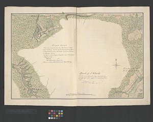
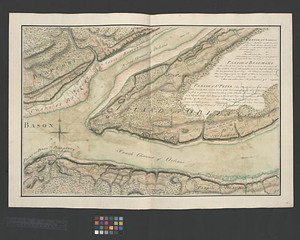
Point Levi. Parish of St. Charles
2.
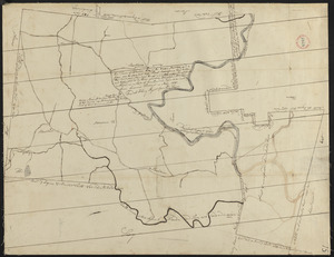
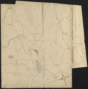
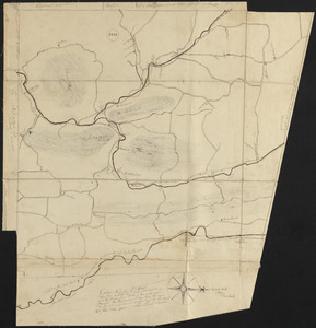
Plan of Charlemont made by Levi Leonard, dated September 1830
3.
Plan of Florida, Massachusetts, made by Levi Leonard, dated 1830
4.
Plan of Savoy made by Levi Leonard, dated June 1831
5.
Plan of Ashfield made by Levi Leonard, dated December 25, 1830
6.
Plan of Colrain made by Levi Leonard, dated November 29, 1830
7.
Plan of Heath made by Levi Leonard, dated October 20, 1830
8.
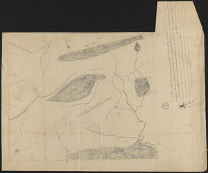
Plan of Orrington surveyed by Levi Carter, dated April 28, 1795.
9.
Plan of the Battery on the South Shore Erected against Fort Levy on the 21. of August 1760
10.
Parish of St. Charles
11.
Parish of St. Lawrence. Parish of Beaumont. Parish of St. Peter
12.
Draught of the river St. Lawrence from Lake Ontario to Montreal
13.
New Congress Street improvements
14.
A topographical map of Steuben Co., New York : from actual surveys
15.
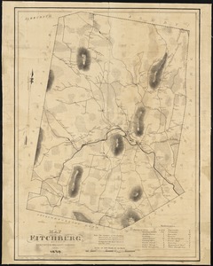
A map of Fitchburg, Mass
16.
Yaggy's geographical study [title page] : comprising physical, political, geological and astronomical geography
17.
Genealogical, chronological and geographical chart embracing Biblical and profane history of ancient times from Adam to Christ
18.
Chart of Narraganset Bay : surveyed in 1832
19.
A map of the world
20.
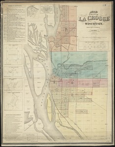
Map of the city of La Crosse, Wisconsin
‹ Prev
Next ›
1
2


![Yaggy's geographical study [title page]](https://bpldcassets.blob.core.windows.net/derivatives/images/commonwealth:3f463530h/image_thumbnail_300.jpg)