Toggle navigation
LMEC Home
Exhibitions
Georeferencing
Tools for Teachers
Collections
My Favorites
Sign Up / Log In
Search
Search the map portal
Map Collection
Map Collection
Map Sets
Search
Search
Search for
Search In
All Fields
Creator
Title
Subject
Place
Search All Digital Collections
Advanced Search
206 Results
My Search
Start Over
Ohio
Remove constraint Ohio
Filter your Search
Place
North and Central America
181
United States
122
Ohio
50
Ohio River
21
Pennsylvania
18
Allegheny (county)
10
Pittsburgh
10
Virginia
10
more
Place
»
Topic
Ohio--Maps
28
United States--Maps
10
Northeastern States--Maps--Early works to 1800
8
Ohio River Valley--Maps, Manuscript--Early works to 1800
8
North America--Maps--Early works to 1800
6
Ohio--Boundaries--Michigan--Maps
6
Pennsylvania--Maps
6
Railroads--Ohio--Maps
6
more
Topic
»
Date
Date range begin
–
Date range end
Current results range from
1753
to
1934
View distribution
Creator
Hutchins, Thomas, 1730-1789
15
United States. Post Office Dept
10
Amherst, Jeffery Amherst, Baron, 1717-1797
7
Evans, Lewis, 1700?-1756
7
Royal United Services Institute for Defence and Security Studies
7
Jefferys, Thomas, -1771
6
George, III, King of Great Britain, 1738-1820
5
George, IV, King of Great Britain, 1762-1830
5
more
Creator
»
Format
Maps/Atlases
204
Manuscripts
32
Prints
2
Drawings/Illustrations
1
Georeferenced
Yes
21
No
185
Collection
Norman B. Leventhal Map Center Collection
124
American Revolutionary War-Era Maps
94
William L. Clements Library Collection
30
British Library Collection
14
Richard H. Brown Revolutionary War Map Collection at Mount Vernon
13
Library of Congress Collection
12
Urban Maps
11
American Antiquarian Society Collection
5
more
Collection
»
Available to use
No known restrictions
126
Creative Commons license
42
Search Constraints
Sort by date (desc)
relevance
title
date (asc)
date (desc)
Number of results to display per page
20 per page
10
per page
20
per page
50
per page
100
per page
View results as:
grid view
map view
Search Results
1.
Being a cartograph of Ohio : the oldest state west of the thirteen original colonies; now the fourth state in the Union in...
2.
George Washington's map, accompanying his "journal to the Ohio", 1754
3.
Tri-state power map : Pennsylvania -- New York -- New Jersey
4.
Radio map of the United States
5.
Geologic map of Ohio
6.
Map of Cleveland and vicinity
7.
State of Ohio coal fields and producing districts
8.
Map of Akron, Ohio : prepared for Akron Chamber of Commerce
9.
The Fred'k A. Schmidt Co. map of metropolitan Cincinnati
10.
Muskingum County, Ohio
11.
A geological map of Ohio
12.
Map fifth division railway mail service
13.
Map ninth division railway mail service
14.
The colonies in 1660, New England and New Netherland showing extent and dates of settlement
15.
A map of the British Empire in America with the French and Spanish settlements adjacent throughout
16.
Novi Belgii Novaeque Angliae nec non partis Virginiae tabula
17.
A description of the towne of Mannados or New Amsterdam : as it was in September, 1661, lying in lattitude 40 de. and 40 m.,...
18.
Map of the Jesuit missions in Huronia
19.
Map showing distribution of indian stocks and tribes, between 1710-1720
20.
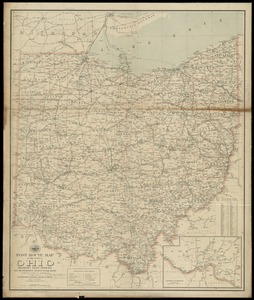
Post route map of the state of Ohio showing post offices with the intermediate distances on mail routes in operation on the 1st...
‹ Prev
Next ›
1
2
3
4
5
…
10
11