Toggle navigation
LMEC Home
Exhibitions
Georeferencing
Tools for Teachers
Collections
My Favorites
Sign Up / Log In
Search
Search the map portal
Map Collection
Map Collection
Map Sets
Search
Search
Search for
Search In
All Fields
Creator
Title
Subject
Place
Search All Digital Collections
Advanced Search
161 Results
My Search
Start Over
1876
Remove constraint 1876
Filter your Search
Place
North and Central America
107
United States
72
Suffolk (county)
19
Boston
17
Chile
12
Europe
12
South America
9
Vermont
9
more
Place
»
Topic
Coasts--Chile--Maps
11
Long Trail (Vt.)--Maps
9
Trails--Vermont--Maps
9
Boston (Mass.)--Maps
8
Hiking--Vermont--Maps
5
Gettysburg (Pa.)--Maps
4
Gettysburg, Battle of, Gettysburg, Pa., 1863--Maps
4
Hiking--Vermont--Long Trail--Maps
4
more
Topic
»
Date
Date range begin
–
Date range end
Current results range from
1760
to
1932
View distribution
Creator
United States. Hydrographic Office
50
Boston (Mass.). Park Commissioners
9
Congdon, Herbert Wheaton, 1876-1965
9
Campbell-Copeland, T. (Thomas)
7
Harper & Brothers
7
Bailey, H. H. (Howard Heston), 1836-1878
6
O.H. Bailey & Co
6
Bachelder, John B. (John Badger), 1825-1894
4
more
Creator
»
Format
Maps/Atlases
159
Manuscripts
3
Books
2
Ephemera
1
Georeferenced
Yes
14
No
147
Collection
Norman B. Leventhal Map Center Collection
157
Boston and New England Maps
52
Maritime Charts and Atlases
52
Urban Maps
48
American Revolutionary War-Era Maps
2
David Judkins Weaver Papers
1
Library of Congress Collection
1
MacLean Collection Map Library
1
more
Collection
»
Available to use
No known restrictions
156
Creative Commons license
2
Search Constraints
Sort by date (asc)
relevance
title
date (asc)
date (desc)
Number of results to display per page
20 per page
10
per page
20
per page
50
per page
100
per page
View results as:
grid view
map view
Search Results
1.
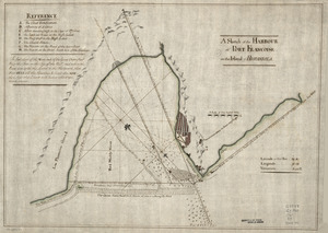
A Sketch of the harbour of Port Francoise on the Island of Hispaniola
2.
The United States of America with the British possessions of Canada, Nova Scotia, New Brunwsick, and Newfoundland, divided with...
3.
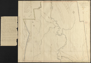
Plan of Sheffield made by Chester Owen, dated 1830
4.
Canal du Cap-Cod : plan général du tracé du canal
5.
Boston
6.
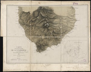
Carte de la portion S.O de l'ile de la Guadeloupe : levée en 1842
7.
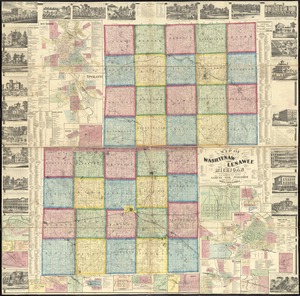
Map of the counties of Washtenaw and Lenawee, Michigan
8.
The Great Bahama Bank, from Old Bahama Channel to Exuma
9.
Map[s] illustrating the military operations of the Atlanta campaign ... 1864
10.
Africa, north coast, Strait of Gibraltar, Ceuta anchorages and approaches : from the French surveys 1855, corrected to 1876
11.
Atlas of Norfolk County Mass. : from recent and actual surveys & records
12.
Back Bay and Parker Hill parks : Parker Hill and Jamaica parkways : Boston and Roxbury districts
13.
Baltic Sea : additional plans to chart no. 293
14.
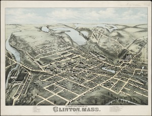
Bird's eye view of Clinton, Mass : 1876
15.
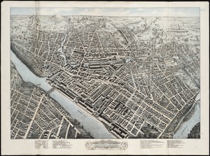
Birds eye view of Lowell, Mass : 1876
16.
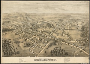
Bird's eye view of Morristown, Morris Co., New Jersey : 1876
17.
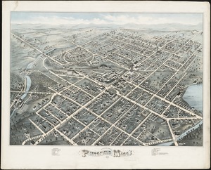
Bird's eye view of Pittsfield, Mass : 1876
18.
Bird's eye view of the city of Portland, Maine, 1876
19.
Bird's-eye view of the city of Philadelphia : its streets, avenues, and public buildings--and of the Centennial buildings in...
20.
Birmingham, Conn : 1876
‹ Prev
Next ›
1
2
3
4
5
…
8
9


![Map[s] illustrating the military operations of the Atlanta campaign ... 1864](https://bpldcassets.blob.core.windows.net/derivatives/images/commonwealth:3f463432v/image_thumbnail_300.jpg)