Toggle navigation
LMEC Home
Exhibitions
Georeferencing
Tools for Teachers
Collections
My Favorites
Sign Up / Log In
Search
Search the map portal
Map Collection
Map Collection
Map Sets
Search
Search
Search for
Search In
All Fields
Creator
Title
Subject
Place
Search All Digital Collections
Advanced Search
200 Results
My Search
Start Over
1868
Remove constraint 1868
Filter your Search
Place
United States
139
North and Central America
85
Boston
28
Europe
27
Suffolk (county)
26
Asia
9
Massachusetts
5
New York
5
more
Place
»
Topic
United States--Maps
71
Elections--United States--Maps
33
Boston (Mass.)--Maps
19
Population density--United States--Maps
14
Pictorial maps
13
Suffrage--United States--Maps
6
Voting--United States--Maps
6
Boston Harbor (Mass.)--Maps
4
more
Topic
»
Date
Date range begin
–
Date range end
Current results range from
1817
to
1932
View distribution
Creator
Paullin, Charles Oscar, 1868 or 1869-1944
70
Wright, John Kirtland, 1891-1969
70
United States. Hydrographic Office
17
Mitchell, S. Augustus (Samuel Augustus), 1792-1868
15
Mitchell, S. Augustus, (Samuel Augustus), Jr
14
Harvey, William, 1796-1873
12
Hodder and Stoughton
12
Lancaster, Elizabeth Lilian, 1852-1939
12
more
Creator
»
Format
Maps/Atlases
198
Objects/Artifacts
1
Photographs
1
Prints
1
Georeferenced
Yes
35
No
165
Collection
Norman B. Leventhal Map Center Collection
194
Boston and New England Maps
36
Urban Maps
36
Maritime Charts and Atlases
18
Mapping Boston Collection
7
Robert E. Diefenbach Map Collection at Phillips Academy
4
MacLean Collection Map Library
1
Town plans, 1830
1
Available to use
No known restrictions
122
Creative Commons license
7
Search Constraints
Sort by date (asc)
relevance
title
date (asc)
date (desc)
Number of results to display per page
20 per page
10
per page
20
per page
50
per page
100
per page
View results as:
grid view
map view
Search Results
1.
New-Hampshire : from late survey
2.
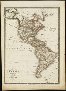
Karte von America
3.
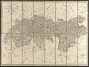
General-reise-karte von der Schweiz und Tyrol mit Vorarlberg und einem beträchtlichen theile der angränzenden länder,...
4.
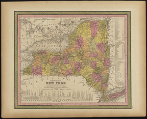
Map of the state of New York
5.
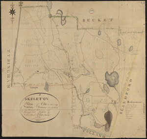
Plan of Otis made by Luke Barber, dated Mar. 10, 1831
6.
Plan of Boston
7.
Plan of Boston
8.
Map of the island of Nantucket, including Tuckernuck
9.
Mitchell's national map of the American Republic or United States of North America : together with maps of the vicinities of...
10.
Map of the states of Ohio, Indiana and Illinois with the settled parts of Michigan & Wisconsin
11.
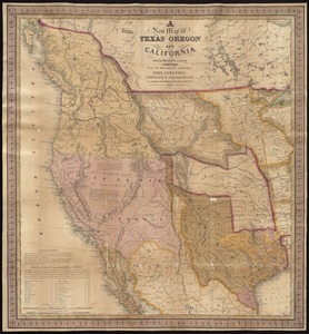
A new map of Texas, Oregon, and California with the regions adjoining
12.
Massachusetts and Rhode Island
13.
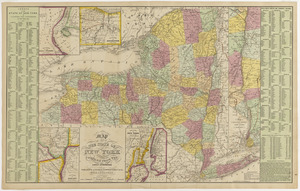
A new map of New York with its canals, roads & distances
14.
Map of the state of New York compiled from the latest authorities
15.
City of Washington
16.
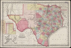
New map of the state of Texas
17.
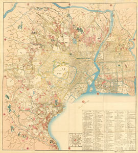
Kaisei On’edo oezu
18.
Plan of Boston
19.
Ausicht von Boston : nach der natur aufgenommen
20.
Post route map of the states of New Hampshire, Vermont, Massachusetts, Rhode Island, Connecticut, and parts of New York and Maine
‹ Prev
Next ›
1
2
3
4
5
…
9
10