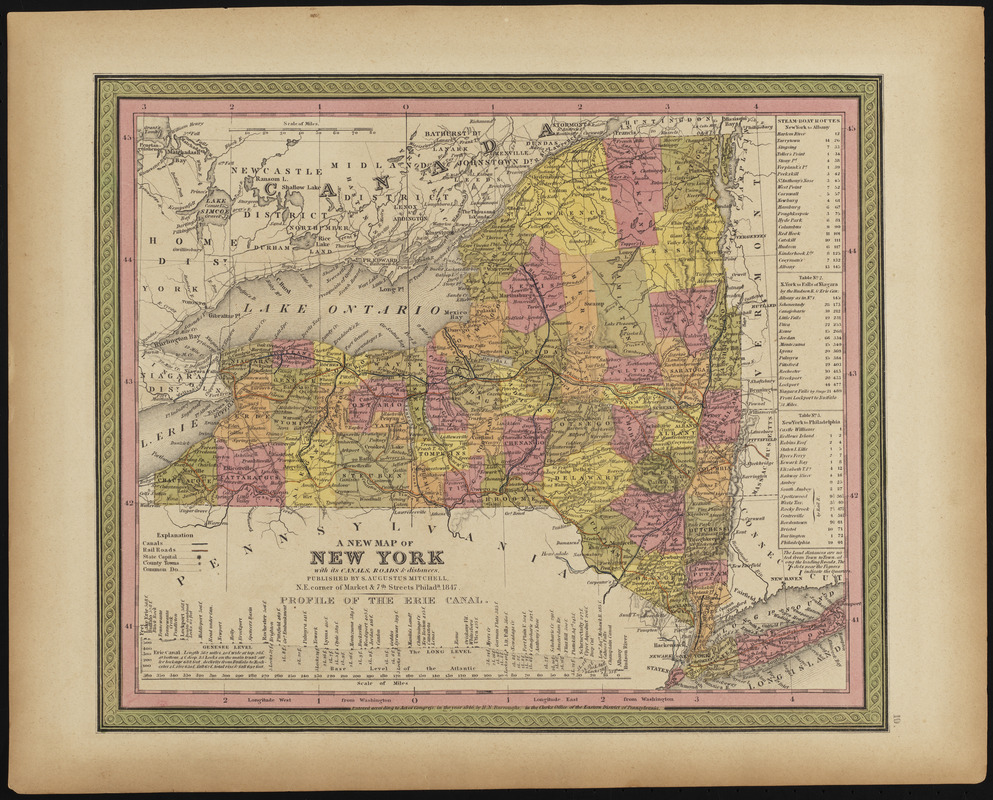
A new map of New York with its canals, roads & distances
Item Information
- Title:
- A new map of New York with its canals, roads & distances
- Cartographer:
- Mitchell, S. Augustus (Samuel Augustus), 1792-1868
- Date:
-
1847
- Format:
-
Maps/Atlases
- Location:
-
Phillips Academy
Archives and Special Collections - Collection (local):
-
Robert E. Diefenbach Map Collection
- Places:
-
New York
- Extent:
- 1 map : col. ; 26 x 32 cm
- Terms of Use:
-
We believe that this item has no known US copyright restrictions. Though not required, if you want to credit us as the source, please use the following statement, "From The Trustees of Phillips Academy." Doing so helps us track how our collection is used and helps justify freely releasing even more content in the future.
This work is in the public domain under a Creative Commons No Rights Reserved License (CC0).
- Publisher:
-
Philada. [i.e. Philadelphia] :
S. Augustus Mitchell
- Scale:
-
Scale ca. 1:203,704
- Language:
-
English
- Notes:
-
Title from item.
From A new universal atlas, containing maps of the various empires, kingdoms, states and republics of the world, 1847.
- Notes (date):
-
Date from item.
- Identifier:
-
2018_045