Toggle navigation
LMEC Home
Exhibitions
Georeferencing
Tools for Teachers
Collections
My Favorites
Sign Up / Log In
Search
Search the map portal
Map Collection
Map Collection
Map Sets
Search
Search
Search for
Search In
All Fields
Creator
Title
Subject
Place
Search All Digital Collections
Advanced Search
87 Results
My Search
Start Over
Subject
'Boston (Mass.)--Maps'
Remove constraint Subject: 'Boston (Mass.)--Maps'
Filter your Search
Place
North and Central America
85
United States
85
Boston
72
Suffolk (county)
72
Boston Harbor
17
Massachusetts
3
South Boston
3
Dorchester
2
more
Place
»
Topic
Boston (Mass.)--Aerial views
36
Boston (Mass.)--Pictorial works--Early works to 1800
18
Sieges--Massachusetts--Boston--Pictorial works--Early works to 1800
11
Boston (Mass.)--History--Revolution, 1775-1783--Aerial views--Early works to 1800
5
Boston (Mass.)--History--Siege, 1775-1776--Aerial views--Early works to 1800
5
Boston Harbor (Mass.)--Aerial views
5
Boston (Mass.)--Pictorial works
4
Boston Bay (Mass.)--Navigation
4
more
Topic
»
Date
Date range begin
–
Date range end
Current results range from
1773
to
1991
View distribution
Creator
Williams, Richard, active 1750-1776
11
George, III, King of Great Britain, 1738-1820
7
George, IV, King of Great Britain, 1762-1830
7
O.H. Bailey & Co
7
Des Barres, Joseph F. W. (Joseph Frederick Wallet), 1722-1824
6
Bache, A. D. (Alexander Dallas), 1806-1867
4
United States Coast Survey
4
Bachmann, John, fl. 1849-1885
3
more
Creator
»
Format
Maps/Atlases
63
Drawings/Illustrations
15
Manuscripts
13
Prints
8
Books
1
Objects/Artifacts
1
Photographs
1
Georeferenced
Yes
1
No
86
Collection
Norman B. Leventhal Map Center Collection
70
Boston and New England Maps
55
Urban Maps
45
American Revolutionary War-Era Maps
22
Maritime Charts and Atlases
9
Richard H. Brown Revolutionary War Map Collection at Mount Vernon
9
Boston Redevelopment Authority Collection
8
British Library Collection
7
more
Collection
»
Available to use
No known restrictions
65
Creative Commons license
22
Search Constraints
Sort by relevance
relevance
title
date (asc)
date (desc)
Number of results to display per page
20 per page
10
per page
20
per page
50
per page
100
per page
View results as:
grid view
map view
Search Results
1.
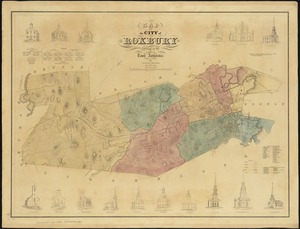
Map of the city of Roxbury
2.
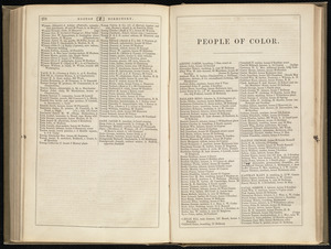
People of color
3.
Plan of the property known as Rowe's Wharf : enlarged from a plan made by Alex. Wadsworth in April, 1867
4.
Mattapan, Massachusetts, 1890
5.
Hyde Park, Massachusetts : 1890
6.
Jamaica Plain, Massachusetts : Ward 23, City of Boston, 1891
7.
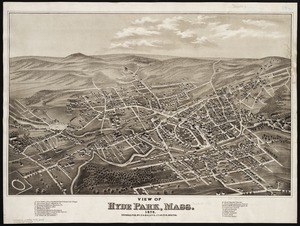
View of Hyde Park, Mass., 1879
8.
Aerial photograph of South Boston
9.
Aerial photograph of South Boston
10.
View of East Boston, Mass : 1879
11.
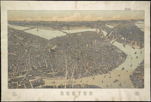
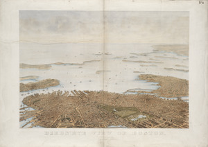
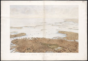
Bird's eye view of Boston
12.
Bird's eye view of Boston
13.
Bird's eye view of Boston
14.
Bird's eye view of Boston
15.
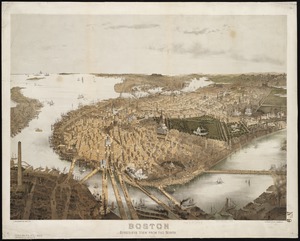
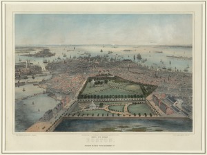
[Bird's-eye view of Boston]
16.
Bird's-eye view of Boston and its environs
17.
Bird's-eye view of Boston, United States
18.
Boston : bird's-eye view from the north
19.
Boston : 1899
20.
Boston Highlands, Massachusetts : Wards 19, 20, 21 & 22 of Boston
‹ Prev
Next ›
1
2
3
4
5


![[Bird's-eye view of Boston]](https://bpldcassets.blob.core.windows.net/derivatives/images/commonwealth:9s161d217/image_thumbnail_300.jpg)