Toggle navigation
LMEC Home
Exhibitions
Georeferencing
Tools for Teachers
Collections
My Favorites
Sign Up / Log In
Search
Search the map portal
Map Collection
Map Collection
Map Sets
Search
Search
Search for
Search In
All Fields
Creator
Title
Subject
Place
Search All Digital Collections
Advanced Search
190 Results
My Search
Start Over
Date
1925
to
1929
Remove constraint Date: <span class='from'>1925</span> to <span class='to'>1929</span>
Filter your Search
Place
North and Central America
163
United States
158
Massachusetts
49
Boston
32
Suffolk (county)
32
Asia
11
Bristol (county)
11
Europe
8
more
Place
»
Topic
Fire risk assessment
23
Insurance surveys
23
Textile factories
19
Boston (Mass.)--Maps
17
Cotton manufacture
9
Pictorial maps
6
Tokyo (Japan)--Maps
5
Landowners--Massachusetts--Boston--Maps
4
more
Topic
»
Date
1925
to
1929
[remove]
190
Date range begin
–
Date range end
Current results range from
1770
to
1999
1925
to
1925
57
1926
to
1926
55
1927
to
1927
56
1928
to
1928
67
1929
to
1929
38
Creator
Geological Survey (U.S.)
23
Associated Factory Mutual Fire Insurance Companies
12
Associated Mutual Insurance Companies
8
United States. Forest Service
7
Boston (Mass.). Department of Parks
6
Good, L. S.
5
Mehurin, E. L.
5
American Geographical Society of New York
4
more
Creator
»
Format
Maps/Atlases
189
Objects/Artifacts
1
Photographs
1
Georeferenced
Yes
6
No
184
Collection
Norman B. Leventhal Map & Education Center Collection
160
Boston and New England Maps
40
American Textile History Museum Image Collection
23
Urban Maps
21
Massachusetts Real Estate Atlases
4
David Judkins Weaver Papers
3
American Revolutionary War-Era Maps
1
Campus Maps from Phillips Academy Archives and Special Collections
1
more
Collection
»
Available to use
No known restrictions
157
Creative Commons license
4
Search Constraints
Sort by relevance
relevance
title
date (asc)
date (desc)
Number of results to display per page
20 per page
10
per page
20
per page
50
per page
100
per page
View results as:
grid view
map view
Search Results
161.
Shawmut 1630--Boston 1930 : three hundred years of progress
162.
Shawmut 1630--Boston 1930 : three hundred years of progress
163.
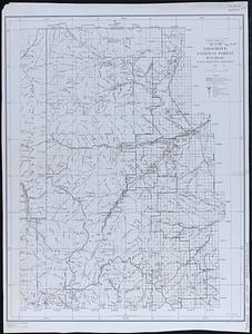
Shoshone National Forest, Wyoming
164.
Showing rental values in greater Tokyo - 1926
165.
A small map of the sea coast of New England together with the outlines of several of the provinces lying thereon, 1738
166.
Soil reconnoissance, Montana 1925 : Chouteau County
167.
The south part of New-England, as it is planted this yeare, 1635
168.
South western districts
169.
Southeast States road map
170.
St. Joe National Forest, Idaho
171.
Standard railway map of South Africa = Standaard spoorwegkaart van Suidafrika
172.
State of Virginia : stations and transmission lines used in public service in 1925 and gaging stations
173.
Street map of Philadelphia : issued by the Philadelphia Hotel Association, Philadelphia, Pa.
174.
Street plan of greater Tokyo - decided 1927
175.
Structure map of northeastern Oklahoma
176.
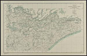
Superior National Forest, Minnesota, fourth principal meridian, 1928
177.
System of state roads
178.
To his excellency William Shirley Esqr., Captain General and Commander in Chief, in and over his Majesty's province of the...
179.
Tonto National Forest, Arizona
180.
Topographic & detail sheets of Rainy Lake & upper boundary waters
‹ Prev
Next ›
1
2
…
5
6
7
8
9
10