Toggle navigation
LMEC Home
Exhibitions
Georeferencing
Tools for Teachers
Collections
My Favorites
Sign Up / Log In
Search
Search the map portal
Map Collection
Map Collection
Map Sets
Search
Search
Search for
Search In
All Fields
Creator
Title
Subject
Place
Search All Digital Collections
Advanced Search
14163 Results
Filter your Search
Place
North and Central America
10,810
United States
8,817
Massachusetts
2,819
Suffolk (county)
1,687
Boston
1,643
Europe
1,428
Canada
1,010
New York
683
more
Place
»
Topic
Boston (Mass.)--Maps
753
City planning--Massachusetts--Boston--Maps
419
United States--History--Revolution, 1775-1783--Maps
331
United States--Maps
331
Real property--Massachusetts--Boston--Maps
254
Urban renewal--Massachusetts--Boston--Maps
254
North America--Maps--Early works to 1800
241
Massachusetts--Maps
236
more
Topic
»
Date
Date range begin
–
Date range end
Current results range from
1482
to
2023
View distribution
Creator
United States. Hydrographic Office
597
Boston Redevelopment Authority
404
Des Barres, Joseph F. W. (Joseph Frederick Wallet), 1722-1824
247
Jefferys, Thomas, -1771
172
United States. National Ocean Service
170
Royal United Services Institute for Defence and Security Studies
160
George, III, King of Great Britain, 1738-1820
152
George, IV, King of Great Britain, 1762-1830
151
more
Creator
»
Format
Maps/Atlases
13,977
Manuscripts
985
Prints
102
Books
53
Drawings/Illustrations
44
Photographs
15
Objects/Artifacts
13
Documents
7
more
Format
»
Georeferenced
Yes
979
No
13,184
Collection
Norman B. Leventhal Map & Education Center Collection
9,161
American Revolutionary War-Era Maps
3,628
Boston and New England Maps
2,935
Urban Maps
2,511
Maritime Charts and Atlases
1,169
William L. Clements Library Collection
910
Library of Congress Collection
618
Boston Redevelopment Authority Collection
475
more
Collection
»
Available to use
No known restrictions
10,407
Creative Commons license
1,678
Search Constraints
Sort by relevance
relevance
title
date (asc)
date (desc)
Number of results to display per page
20 per page
10
per page
20
per page
50
per page
100
per page
View results as:
grid view
map view
Search Results
13681.
A view of the Great Bridge near Norfolk in Virginia where the action happened between a detachment of the 14th Regt: & a body...
13682.
A view of the landing place above the town of Quebec, describing the assault of the enemys post, on the banks of the River St....
13683.
A view of the Rivers Kenebec and Chaudiere, with Colonel Arnold's route to Quebec
13684.
View of the South End
13685.
A view of the taking of Quebeck by the English forces commanded by Gen. Wolfe Sep. 13th 1759
13686.
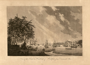
A view of the town & harbour of Halifax, from Dartmouth shore
13687.
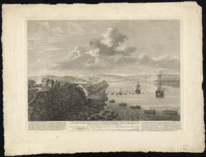
A VIEW of the TOWN & HARBOUR of LOUISBOURG
13688.
View of Thompsonville, Conn : 1878
13689.
View of Unionville, Conn : 1878
13690.
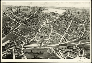
View of Wakefield, Mass : 1882
13691.
View of Wakefield, Mass., 1882
13692.
View of Wallingford, Connecticut : 1881
13693.
View of Waltham, Mass
13694.
View of Warren, Mass : 1879
13695.
View of Warren, R.I : 1877
13696.
View of Watertown, Mass : 1879
13697.
View of Webster, Mass : 1878
13698.
View of Westerly, R.I : 1877
13699.
View of Westport, Conn : 1878
13700.
View of Whitman and Brockton, showing location of some of the most desirable building lots, for sale by W.V. Everson, 120...
‹ Prev
Next ›
1
2
…
681
682
683
684
685
686
687
688
689
…
708
709