Toggle navigation
LMEC Home
Exhibitions
Georeferencing
Tools for Teachers
Collections
My Favorites
Sign Up / Log In
Search
Search the map portal
Map Collection
Map Collection
Map Sets
Search
Search
Search for
Search In
All Fields
Creator
Title
Subject
Place
Search All Digital Collections
Advanced Search
13385 Results
Filter your Search
Place
North and Central America
9,353
United States
7,078
Suffolk (county)
1,664
Boston
1,621
Europe
1,035
Canada
949
Massachusetts
794
New York
532
more
Place
»
Topic
Boston (Mass.)--Maps
741
City planning--Massachusetts--Boston--Maps
418
United States--History--Revolution, 1775-1783--Maps
329
United States--Maps
315
Urban renewal--Massachusetts--Boston--Maps
254
Real property--Massachusetts--Boston--Maps
252
Massachusetts--Maps
219
Insurance surveys
197
more
Topic
»
Date
Date range begin
–
Date range end
Current results range from
1482
to
2023
View distribution
Creator
United States. Hydrographic Office
595
Boston Redevelopment Authority
403
Des Barres, Joseph F. W. (Joseph Frederick Wallet), 1722-1824
247
Royal United Services Institute for Defence and Security Studies
160
Jefferys, Thomas, -1771
154
George, III, King of Great Britain, 1738-1820
152
George, IV, King of Great Britain, 1762-1830
151
O.H. Bailey & Co
148
more
Creator
»
Format
Maps/Atlases
13,205
Manuscripts
985
Prints
102
Books
49
Drawings/Illustrations
44
Photographs
15
Objects/Artifacts
13
Documents
7
more
Format
»
Georeferenced
Yes
979
No
12,406
Collection
Norman B. Leventhal Map Center Collection
8,891
American Revolutionary War-Era Maps
3,305
Boston and New England Maps
2,804
Urban Maps
2,397
Maritime Charts and Atlases
1,150
William L. Clements Library Collection
910
Library of Congress Collection
618
Boston Redevelopment Authority Collection
475
more
Collection
»
Available to use
No known restrictions
9,952
Creative Commons license
1,677
Search Constraints
Sort by date (asc)
relevance
title
date (asc)
date (desc)
Number of results to display per page
20 per page
10
per page
20
per page
50
per page
100
per page
View results as:
grid view
map view
Search Results
12501.
American Woolen Company et al, "Foxcroft Division," Dover-Foxcroft, Maine [insurance map]
12502.
American Woolen Company et al, "Kennebec Mills," Fairfield, Maine [insurance map]
12503.
American Woolen Company et al, "Vassalboro Mills," North Vassalboro, Maine [insurance map]
12504.
Atlas of town of Weymouth Massachusetts
12505.
Bates Manufacturing Company "Androscoggin Division," Lewiston, Maine [insurance map]
12506.
Bates Manufacturing Company "Hill Division," Lewiston, Maine [insurance map]
12507.
Factory Street Realty, Inc., et al., BLDG; Fitchburg Realty Corporation, et al., TEN., Nashua, N.H. [insurance map]
12508.
Gay days around America : a pleasure map of festivals, pageants, and special events best reached by Greyhound ... the...
12509.
Independent Lock Company "Plants Nos. 2 & 3," Fitchburg, Mass. [insurance map]
12510.
The Linen Thread Co., Inc. "Gloucester Mill," Gloucester, Mass. [insurance map]
12511.
MacKenzie & Winslow, Inc., tenanted, Fall River, Mass. [insurance map]
12512.
Maine Spinning Company, Skowhegan, Maine [insurance map]
12513.
A map of the West Indies and the Spanish Main
12514.
Nauset Warehouse (Bldg.), Beacon Manufacturing Company, Tenant, New Bedford, Mass. [insurance map]
12515.
New England Theatres, Inc. "Capitol Theatre," New Bedford, Mass. [insurance map]
12516.
The pictorial map, United States stamps
12517.
Rollstone Foundry, Inc., Foster Machine Company, Ten., Fitchburg, Mass. [insurance map]
12518.
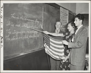
School for newcomers, Temple Kehillath Israel
12519.
The Sheffield Corporation, et al., Greenfield, Mass. [insurance map]
12520.
Storrow Memorial Embankment : plan of additions and changes under the requirements of Chapter 262, Acts of 1949
‹ Prev
Next ›
1
2
…
622
623
624
625
626
627
628
629
630
…
669
670
![American Woolen Company et al, "Foxcroft Division," Dover-Foxcroft, Maine [insurance map]](https://bpldcassets.blob.core.windows.net/derivatives/images/commonwealth:4j03df07b/image_thumbnail_300.jpg)
![American Woolen Company et al, "Kennebec Mills," Fairfield, Maine [insurance map]](https://bpldcassets.blob.core.windows.net/derivatives/images/commonwealth:4j03df11x/image_thumbnail_300.jpg)
![American Woolen Company et al, "Vassalboro Mills," North Vassalboro, Maine [insurance map]](https://bpldcassets.blob.core.windows.net/derivatives/images/commonwealth:4j03df35h/image_thumbnail_300.jpg)

![Bates Manufacturing Company "Androscoggin Division," Lewiston, Maine [insurance map]](https://bpldcassets.blob.core.windows.net/derivatives/images/commonwealth:4j03df215/image_thumbnail_300.jpg)
![Bates Manufacturing Company "Hill Division," Lewiston, Maine [insurance map]](https://bpldcassets.blob.core.windows.net/derivatives/images/commonwealth:4j03df23q/image_thumbnail_300.jpg)
![Factory Street Realty, Inc., et al., BLDG; Fitchburg Realty Corporation, et al., TEN., Nashua, N.H. [insurance map]](https://bpldcassets.blob.core.windows.net/derivatives/images/commonwealth:ww72c008s/image_thumbnail_300.jpg)

![Independent Lock Company "Plants Nos. 2 & 3," Fitchburg, Mass. [insurance map]](https://bpldcassets.blob.core.windows.net/derivatives/images/commonwealth:ww72bx82g/image_thumbnail_300.jpg)
![The Linen Thread Co., Inc. "Gloucester Mill," Gloucester, Mass. [insurance map]](https://bpldcassets.blob.core.windows.net/derivatives/images/commonwealth:ww72bz006/image_thumbnail_300.jpg)
![MacKenzie & Winslow, Inc., tenanted, Fall River, Mass. [insurance map]](https://bpldcassets.blob.core.windows.net/derivatives/images/commonwealth:ww72bx34t/image_thumbnail_300.jpg)
![Maine Spinning Company, Skowhegan, Maine [insurance map]](https://bpldcassets.blob.core.windows.net/derivatives/images/commonwealth:4j03df39m/image_thumbnail_300.jpg)

![Nauset Warehouse (Bldg.), Beacon Manufacturing Company, Tenant, New Bedford, Mass. [insurance map]](https://bpldcassets.blob.core.windows.net/derivatives/images/commonwealth:ww72bz70w/image_thumbnail_300.jpg)
![New England Theatres, Inc. "Capitol Theatre," New Bedford, Mass. [insurance map]](https://bpldcassets.blob.core.windows.net/derivatives/images/commonwealth:ww72bz76j/image_thumbnail_300.jpg)

![Rollstone Foundry, Inc., Foster Machine Company, Ten., Fitchburg, Mass. [insurance map]](https://bpldcassets.blob.core.windows.net/derivatives/images/commonwealth:ww72bx841/image_thumbnail_300.jpg)
![The Sheffield Corporation, et al., Greenfield, Mass. [insurance map]](https://bpldcassets.blob.core.windows.net/derivatives/images/commonwealth:ww72bz02r/image_thumbnail_300.jpg)
