Toggle navigation
LMEC Home
Exhibitions
Georeferencing
Tools for Teachers
Collections
My Favorites
Sign Up / Log In
Search
Search the map portal
Map Collection
Map Collection
Map Sets
Search
Search
Search for
Search In
All Fields
Creator
Title
Subject
Place
Search All Digital Collections
Advanced Search
14164 Results
My Search
Start Over
Filter your Search
Place
North and Central America
10,811
United States
8,818
Massachusetts
2,820
Suffolk (county)
1,688
Boston
1,644
Europe
1,428
Canada
1,010
New York
683
more
Place
»
Topic
Boston (Mass.)--Maps
753
City planning--Massachusetts--Boston--Maps
419
United States--History--Revolution, 1775-1783--Maps
331
United States--Maps
331
Real property--Massachusetts--Boston--Maps
254
Urban renewal--Massachusetts--Boston--Maps
254
North America--Maps--Early works to 1800
241
Massachusetts--Maps
236
more
Topic
»
Date
Date range begin
–
Date range end
Current results range from
1482
to
2023
View distribution
Creator
United States. Hydrographic Office
597
Boston Redevelopment Authority
404
Des Barres, Joseph F. W. (Joseph Frederick Wallet), 1722-1824
247
Jefferys, Thomas, -1771
172
United States. National Ocean Service
170
Royal United Services Institute for Defence and Security Studies
160
George, III, King of Great Britain, 1738-1820
152
George, IV, King of Great Britain, 1762-1830
151
more
Creator
»
Format
Maps/Atlases
13,978
Manuscripts
985
Prints
102
Books
53
Drawings/Illustrations
44
Photographs
15
Objects/Artifacts
13
Documents
7
more
Format
»
Georeferenced
Yes
979
No
13,185
Collection
Norman B. Leventhal Map & Education Center Collection
9,162
American Revolutionary War-Era Maps
3,629
Boston and New England Maps
2,936
Urban Maps
2,511
Maritime Charts and Atlases
1,169
William L. Clements Library Collection
910
Library of Congress Collection
618
Boston Redevelopment Authority Collection
475
more
Collection
»
Available to use
No known restrictions
10,408
Creative Commons license
1,678
Search Constraints
Sort by relevance
relevance
title
date (asc)
date (desc)
Number of results to display per page
20 per page
10
per page
20
per page
50
per page
100
per page
View results as:
grid view
map view
Search Results
12441.
South Cove property ownership 1962
12442.
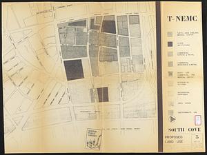
South Cove proposed land use
12443.
The South Cove territory, comprising every part which is coloured on this map
12444.
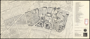
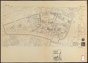
South Cove urban renewal area Massachusetts R-92 : illustrative site plan
12445.
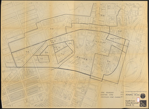
South Cove urban renewal area R-92 : zoning plan
12446.
South Cove urban renewal area R-92 : disposition plan
12447.
The south east coast of Cape Breton Island
12448.
The south east coast of Nova Scotia
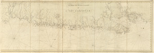
12449.
The south east coast of the island of St. John : surveyed under the direction of the Right Honourable the Lords of Trade and...
12450.
A south east view of the city of New York, in North America = Vue de sud est de la ville de New York, dans l'Amerique...
12451.
South Easton, Massachusetts : 1888
12452.
South end of Lake Huron and head of the St. Clair River
12453.
South end of Lake Michigan
12454.
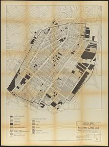
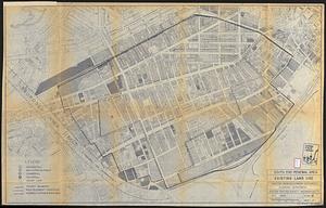
South End project no. Mass. r-56 : existing land use
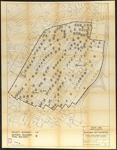
12455.
South End project no. Mass. r-56 : building deficiencies
12456.
South End renewal area : locality map
12457.
South End renewal area : location map
12458.
South End renewal area : existing conditions & proposed treatment areas
12459.
South End renewal area : existing land use
12460.
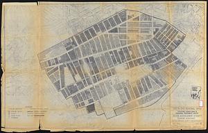
South End renewal area : blighted areas
‹ Prev
Next ›
1
2
…
619
620
621
622
623
624
625
626
627
…
708
709