Toggle navigation
LMEC Home
Exhibitions
Georeferencing
Tools for Teachers
Collections
My Favorites
Sign Up / Log In
Search
Search the map portal
Map Collection
Map Collection
Map Sets
Search
Search
Search for
Search In
All Fields
Creator
Title
Subject
Place
Search All Digital Collections
Advanced Search
111 Results
My Search
Start Over
Date
1845
Remove constraint Date: <span class='single'>1845</span>
Filter your Search
Place
North and Central America
46
United States
37
Oceania
32
Europe
15
Massachusetts
13
French Polynesia
9
Fiji
8
Germany
6
more
Place
»
Topic
United States Exploring Expedition (1838-1842)
16
Tuamotu Archipelago (French Polynesia)--Maps
6
China--Maps
5
Boston (Mass.)--Maps
4
Korea--Maps
4
Massachusetts--Maps
4
Europe, Central--Maps
3
Germany--Maps
3
more
Topic
»
Date
1845
[remove]
111
Date range begin
–
Date range end
Current results range from
1770
to
1990
1845
to
1845
111
Creator
United States Exploring Expedition (1838-1842)
34
Wilkes, Charles, 1798-1877
31
Sherman & Smith
19
Boynton, George W., -1884
3
Knight, J. (Engraver)
3
Bache, A. D. (Alexander Dallas), 1806-1867
2
Collinson, Richard, Sir, 1811-1883
2
Hassler, F. R. (Ferdinand Rudolph), 1770-1843
2
more
Creator
»
Format
Maps/Atlases
111
Manuscripts
13
Georeferenced
Yes
11
No
100
Collection
Norman B. Leventhal Map & Education Center Collection
89
Maritime Charts and Atlases
38
American Revolutionary War-Era Maps
13
Urban Maps
12
Boston and New England Maps
10
Library of Congress Collection
5
MacLean Collection Map Library
4
Robert E. Diefenbach Map Collection at Phillips Academy
4
more
Collection
»
Available to use
No known restrictions
94
Creative Commons license
8
Search Constraints
Sort by relevance
relevance
title
date (asc)
date (desc)
Number of results to display per page
20 per page
10
per page
20
per page
50
per page
100
per page
View results as:
grid view
map view
Search Results
101.
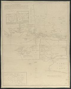
[Sketch of the region of the island of Cape Breton, between the parallels of forty-five and forty-eight degrees of latitude]
102.
St. Pablo, Paumotu Group ; Nukutipipi or Margaret Island, Paumotu Group ; Heretua or Archangel of Quiros, Paumotu Group ; Teku...
103.
Swains Island ; Jarvis' Island ; Birnies Island, Phœnix Group ; Enderbury' Island, Phœnix Group - Hull's Island, Phœnix Group ;...
104.
Taiara or King's Island ; Henuake, Honden or Dog Id. ; Penrhyns Island ; Two groups
105.
Taputeouea or Drummond's Island, Kingsmill Group ; Peacock's anchorage at Drummond's Island, Kingsmill Group
106.
This map of Kentucke
107.
To Captain Krusenstern, of the Imperial Russian Navy, as a tribute for his laudable exertions to benefit navigation and...
108.
Typo de la carta cosmographica de Gaspar Vopellio Medeburgense
109.
Whippy Harbour, south side of Viti Levu ; Suva Harbour, south side of Viti Levu ; Granby Harbour, south side of Viti Levu ;...
110.
Willard's new map of the Hudson River
111.
Yeojido
‹ Prev
Next ›
1
2
3
4
5
6
![[Sketch of the region of the island of Cape Breton, between the parallels of forty-five and forty-eight degrees of latitude]](https://bpldcassets.blob.core.windows.net/derivatives/images/commonwealth:4m90fh38k/image_thumbnail_300.jpg)