Toggle navigation
LMEC Home
Exhibitions
Georeferencing
Tools for Teachers
Collections
My Favorites
Sign Up / Log In
Search
Search the map portal
Map Collection
Map Collection
Map Sets
Search
Search
Search for
Search In
All Fields
Creator
Title
Subject
Place
Search All Digital Collections
Advanced Search
13385 Results
Filter your Search
Place
North and Central America
9,353
United States
7,286
Suffolk (county)
1,664
Boston
1,621
Europe
1,035
Canada
949
Massachusetts
806
New York
534
more
Place
»
Topic
Boston (Mass.)--Maps
741
City planning--Massachusetts--Boston--Maps
418
United States--History--Revolution, 1775-1783--Maps
329
United States--Maps
315
Urban renewal--Massachusetts--Boston--Maps
254
Real property--Massachusetts--Boston--Maps
252
Massachusetts--Maps
219
Insurance surveys
197
more
Topic
»
Date
Date range begin
–
Date range end
Current results range from
1482
to
2023
View distribution
Creator
United States. Hydrographic Office
595
Boston Redevelopment Authority
403
Des Barres, Joseph F. W. (Joseph Frederick Wallet), 1722-1824
247
Royal United Services Institute for Defence and Security Studies
160
Jefferys, Thomas, -1771
154
George, III, King of Great Britain, 1738-1820
152
George, IV, King of Great Britain, 1762-1830
151
O.H. Bailey & Co
148
more
Creator
»
Format
Maps/Atlases
13,205
Manuscripts
985
Prints
102
Books
49
Drawings/Illustrations
44
Photographs
15
Objects/Artifacts
13
Documents
7
more
Format
»
Georeferenced
Yes
979
No
12,406
Collection
Norman B. Leventhal Map Center Collection
8,891
American Revolutionary War-Era Maps
3,305
Boston and New England Maps
2,804
Urban Maps
2,397
Maritime Charts and Atlases
1,150
William L. Clements Library Collection
910
Library of Congress Collection
618
Boston Redevelopment Authority Collection
475
more
Collection
»
Available to use
No known restrictions
9,952
Creative Commons license
1,677
Search Constraints
Sort by date (desc)
relevance
title
date (asc)
date (desc)
Number of results to display per page
20 per page
10
per page
20
per page
50
per page
100
per page
View results as:
grid view
map view
Search Results
11761.
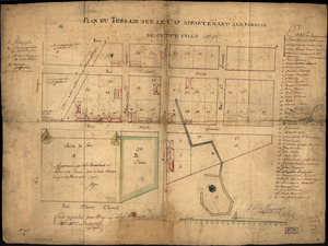
Plan du terrain sur le cap appartenant à la paroise de cette uille 1756
11762.
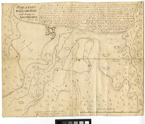
Plan of Fort-William-Henry and camp, at Lake George
11763.
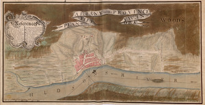
PLAN, of the CITY, of ALBANY, in the PROVINCE, of, NEW, YORK
11764.
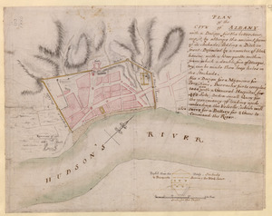
PLAN of the CITY of ALBANY with a Design for the better securing it, by altering the ancient form of its Stockade; Adding a...
11765.
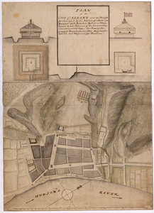
PLAN of the CITY of ALBANY with the Designs for Securing it by the Addition of a Ditch, and Rampart; with Detached Redouts or...
11766.
PLAN of the COUNTRY from FORT EDWARD to CROWN POINT
11767.
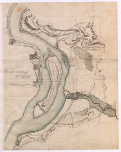
Plan of the Environs of Fort Edward
11768.
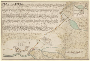
PLAN of the FORTS at the Onoida or Great Carrying Place in the Province of New York in America built by Major Charles Craven by...
11769.
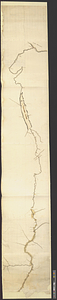
Plan of the river &c from Albany to Oswego in America
11770.
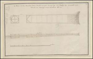
A Plan of the Wooden Peer built in Lake George by Col. Bagly in novemb:r 1756 Which he charged Genr:l Winslow 60:L for
11771.
Plano del desembocadero del Río Misipipi en el seno Mexicano con parte del territorio de la Movila, el qual incluien los...
11772.
Plano del puerto del Guárico, cuyo conocimto. y entrada es del modo siguiente
11773.
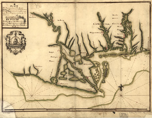
Plano. I descripcion de la costa, desde el Cavo Cañaveral, hasta cerca de la boca de la Vir[g]inia : contando, costa de...
11774.
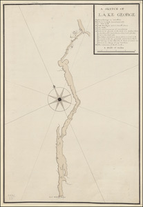
A SKETCH OF LAKE GEORGE
11775.
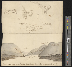
Topographick plan by the eye, 1754 & 6
11776.
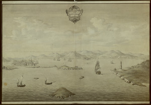
A VIEW of the TOWN & HARBOUR of LOUISBOURG
11777.
Vorstellung einiger Gegenden und Plaetze in Nord-America unter Franzoesisch und Englische Jurisdiction gehoerig
11778.
A new and accurate map of the English empire in North America : representing their rightful claim as confirm'd by charters, and...
11779.
A general map of the middle British colonies, in America; viz Virginia, Maryland, Delaware, Pensilvania, New-Jersey, New-York,...
11780.
A map of the British and French dominions in North America with the roads, distances, limits, and extent of the settlements,...
‹ Prev
Next ›
1
2
…
585
586
587
588
589
590
591
592
593
…
669
670

![Plano. I descripcion de la costa, desde el Cavo Cañaveral, hasta cerca de la boca de la Vir[g]inia](https://bpldcassets.blob.core.windows.net/derivatives/images/commonwealth:q524nf34m/image_thumbnail_300.jpg)