Toggle navigation
LMEC Home
Exhibitions
Georeferencing
Tools for Teachers
Collections
My Favorites
Sign Up / Log In
Search
Search the map portal
Map Collection
Map Collection
Map Sets
Search
Search
Search for
Search In
All Fields
Creator
Title
Subject
Place
Search All Digital Collections
Advanced Search
13385 Results
Filter your Search
Place
North and Central America
10,111
United States
8,249
Massachusetts
2,691
Suffolk (county)
1,664
Boston
1,621
Europe
1,386
Canada
949
New York
640
more
Place
»
Topic
Boston (Mass.)--Maps
741
City planning--Massachusetts--Boston--Maps
418
United States--History--Revolution, 1775-1783--Maps
329
United States--Maps
315
Urban renewal--Massachusetts--Boston--Maps
254
Real property--Massachusetts--Boston--Maps
252
Massachusetts--Maps
219
Insurance surveys
197
more
Topic
»
Date
Date range begin
–
Date range end
Current results range from
1482
to
2023
View distribution
Creator
United States. Hydrographic Office
595
Boston Redevelopment Authority
403
Des Barres, Joseph F. W. (Joseph Frederick Wallet), 1722-1824
247
Royal United Services Institute for Defence and Security Studies
160
Jefferys, Thomas, -1771
154
George, III, King of Great Britain, 1738-1820
152
George, IV, King of Great Britain, 1762-1830
151
O.H. Bailey & Co
148
more
Creator
»
Format
Maps/Atlases
13,205
Manuscripts
985
Prints
102
Books
49
Drawings/Illustrations
44
Photographs
15
Objects/Artifacts
13
Documents
7
more
Format
»
Georeferenced
Yes
979
No
12,406
Collection
Norman B. Leventhal Map & Education Center Collection
8,891
American Revolutionary War-Era Maps
3,305
Boston and New England Maps
2,804
Urban Maps
2,397
Maritime Charts and Atlases
1,150
William L. Clements Library Collection
910
Library of Congress Collection
618
Boston Redevelopment Authority Collection
475
more
Collection
»
Available to use
No known restrictions
9,952
Creative Commons license
1,677
Search Constraints
Sort by relevance
relevance
title
date (asc)
date (desc)
Number of results to display per page
20 per page
10
per page
20
per page
50
per page
100
per page
View results as:
grid view
map view
Search Results
10761.
Profile of Huntington Avenue/St. James Avenue from Harcourt Street to Berkeley Street
10762.
Profile of the river St. Lawrence between Montreal and Quebec shewing the deepening of the ship channel
10763.
Progress chart of the Survey of the Northern & North Western Lakes, July 1st, 1873 : primary triangulation, telegraphic...
10764.
Progress map of Signal Corps telegraph lines & cables in the military division of the Philippines : based on map of Montero y...
10765.
Progress map of Signal Corps telegraph lines & cables in the military division of the Philippines : based on map of Montero y...
10766.
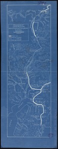
Progress of construction, government railroad, Alaska
10767.
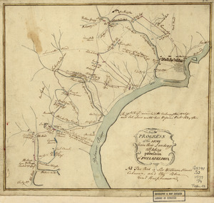
Progress of the army from their landing till taking possession of Philadelphia
10768.
Progress of the British army from Elk River to Philadelphia, 1777
10769.
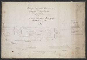
Project for Fortifying the Admiralls Point going into Trinity Harbour Newfoundland Octob.r 1745
10770.
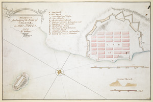
PROJECT for Fortifying the Town of HALLIFAX ; in NOVA SCOTIA
10771.
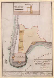
PROJECT for taking POST at CROWN POINT
10772.
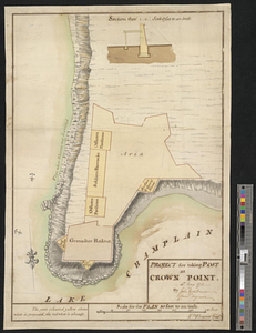
Project for taking post at Crown Point, 13th May 1774 : 13th May 1774
10773.
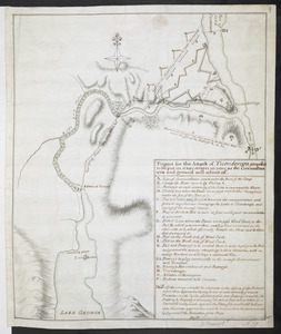
Project for the attack of Ticonderoga : proposed to be put in execution as near as the circumstances and ground will admit of....
10774.
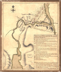
Project for the Attack of Ticonderoga, proposed to be put in executino as near as the circumstances and ground will admit of
10775.
Properties of the Trustees of Reservations and other protected open space
10776.
Property atlas of city of Lowell, northern district, Middlesex County, Massachusetts, showing the entire city complete in one...
10777.
Property map, South Cove urban renewal area R-92
10778.
Property map, South Cove urban renewal area R-92
10779.
Property qualifications for suffrage, 1775
10780.
Property qualifications for suffrage, 1800
‹ Prev
Next ›
1
2
…
535
536
537
538
539
540
541
542
543
…
669
670