Toggle navigation
LMEC Home
Exhibitions
Georeferencing
Tools for Teachers
Collections
My Favorites
Sign Up / Log In
Search
Search the map portal
Map Collection
Map Collection
Map Sets
Search
Search
Search for
Search In
All Fields
Creator
Title
Subject
Place
Search All Digital Collections
Advanced Search
14164 Results
Filter your Search
Place
North and Central America
10,832
United States
8,868
Massachusetts
2,832
Suffolk (county)
1,688
Boston
1,644
Europe
1,428
Canada
1,010
New York
684
more
Place
»
Topic
Boston (Mass.)--Maps
753
City planning--Massachusetts--Boston--Maps
419
United States--History--Revolution, 1775-1783--Maps
331
United States--Maps
331
Real property--Massachusetts--Boston--Maps
254
Urban renewal--Massachusetts--Boston--Maps
254
North America--Maps--Early works to 1800
241
Massachusetts--Maps
236
more
Topic
»
Date
Date range begin
–
Date range end
Current results range from
1482
to
2023
View distribution
Creator
United States. Hydrographic Office
597
Boston Redevelopment Authority
404
Des Barres, Joseph F. W. (Joseph Frederick Wallet), 1722-1824
247
Jefferys, Thomas, -1771
172
United States. National Ocean Service
170
Royal United Services Institute for Defence and Security Studies
160
George, III, King of Great Britain, 1738-1820
152
George, IV, King of Great Britain, 1762-1830
151
more
Creator
»
Format
Maps/Atlases
13,978
Manuscripts
985
Prints
102
Books
53
Drawings/Illustrations
44
Photographs
15
Objects/Artifacts
13
Documents
7
more
Format
»
Georeferenced
Yes
979
No
13,185
Collection
Norman B. Leventhal Map & Education Center Collection
9,162
American Revolutionary War-Era Maps
3,629
Boston and New England Maps
2,936
Urban Maps
2,511
Maritime Charts and Atlases
1,169
William L. Clements Library Collection
910
Library of Congress Collection
618
Boston Redevelopment Authority Collection
475
more
Collection
»
Available to use
No known restrictions
10,408
Creative Commons license
1,678
Search Constraints
Sort by relevance
relevance
title
date (asc)
date (desc)
Number of results to display per page
20 per page
10
per page
20
per page
50
per page
100
per page
View results as:
grid view
map view
Search Results
10181.
Plan of Suffolk Street District : showing estates & buildings as proposed to be taken by the City of Boston under the Act of...
10182.
Plan of Sullivan surveyed by Agreen Crabtree, dated June 8, 1795.
10183.
Plan of Sunderland made by Josiah Gould, dated June, 1830
10184.
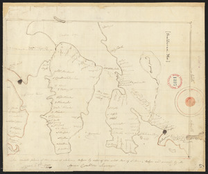
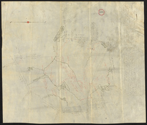
Plan of Sunderland surveyed by William Bowmen, dated November, 1794.
10185.
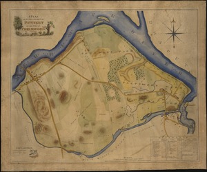
A plan of sundry farms etc. at Patucket in the town of Chelmsford
10186.
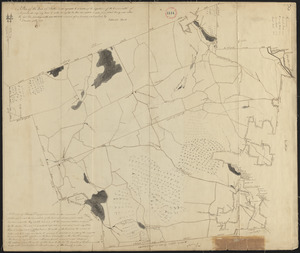
Plan of Sutton, made by Ebenzer Waters, dated Novmeber 1794.
10187.
Plan of Sutton made by Zephaniah Keach, dated December 29, 1830
10188.
Plan of Swansey made by William Peck, dated November 1830
10189.
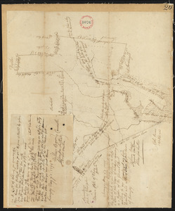
Plan of Swanzey, surveyor's name not given, dated May 1, 1795.
10190.
Plan of Taunton, surveyor's name not given, dated 1795.
10191.
Plan of Taunton, surveyor's name not given, dated 1830
10192.
Plan of Templeton made by Jason Lamb, dated 1830
10193.
Plan of ten different tracts of land, containing in the whole 20.089 acres, situate partly, in districts of 96, Camden, &...
10194.
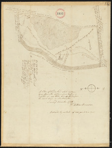
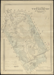
Plan of Tewksbury made by John G. Hales, dated 1831
10195.
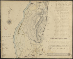
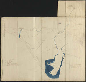
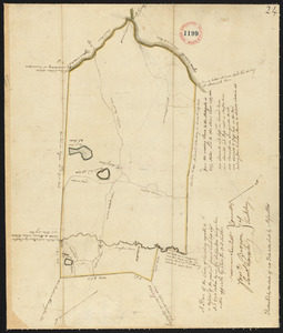
Plan of Tewksbury surveyed by Moses Abbott, dated 1794-5.
10196.
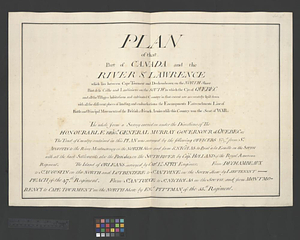
Plan of that part of Canada and the River St. Lawrence which lies between Cape Tourment and Dechambeaux on the north shore...
10197.
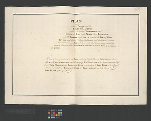
Plan of that part of Canada and the River St. Lawrence which lies between Dechambeaux and Pointe du Lac on the north shore...
10198.
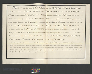
Plan of that part of Canada and the River St. Lawrence which lies between Point du Lac and Repentigny on the north shore &...
10199.
Plan of that part of Canada and the River St. Lawrence which lies between Pointe du Lac and Repentigny on the North Shore and...
10200.
A Plan of that part of the boundary between the states of North and South Carolina : lying between that part of said boundary...
‹ Prev
Next ›
1
2
…
506
507
508
509
510
511
512
513
514
…
708
709