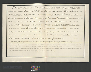
Plan of that part of Canada and the River St. Lawrence which lies between Pointe du Lac and Repentigny on the North Shore and Nicolette and Varrenes on the South containing the Lake St. Pierre and all the islands ... formed by the rivers Nicolette St. Francois, Iamaska, Masquinonge &c. which empty themselves in to the lake ... containing also the River Sorrel from where it falls in to the St. Lawrence to the Isle des Noix on Lake Champlain where it takes its rise, and the River Assumption as far as the last settlements ... with all the villages, fortified posts, habitations, and cultivated country throughout the whole extent ... the whole from a survey carried on under the directions of the Honourable Brigadier General Murray Governour of Quebec &c. The tract of Country contained in this plan was surveyed by the following officers. viz, All the south shore from Varrenes to Nicolette and the River Sorel to St. Ours also the Islands Dupas, St. Ignace, Madame, de Grace, au Pierre, du Moine, and Isle de Barque, by Capt. Holland, of the Royal American Regiment ... The Islands of Bouchard, and Contrecoeur, by Lieut. Peach, of the 47th. Regiment...from Repentigny to Bertier by Lieut. Montresor Engineer ... from Bertier to Point du Lac, and the river Assomption, and Bertier and the rest of the islands at the entrance of the lake by Lieut. Fusier of the Royal American Regiment. as was also the remainder of the River Sorel as far as Isle aux Noix
This map is also available in American Revolutionary Geographies Online (ARGO), a collections portal especially built for material relating to the American Revolutionary War Era. Visit ARGO to learn more about this item and explore the historical geography of North America in the late eighteenth century.
Item Information
- Title:
- Plan of that part of Canada and the River St. Lawrence which lies between Pointe du Lac and Repentigny on the North Shore and Nicolette and Varrenes on the South containing the Lake St. Pierre and all the islands ... formed by the rivers Nicolette St. Francois, Iamaska, Masquinonge &c. which empty themselves in to the lake ... containing also the River Sorrel from where it falls in to the St. Lawrence to the Isle des Noix on Lake Champlain where it takes its rise, and the River Assumption as far as the last settlements ... with all the villages, fortified posts, habitations, and cultivated country throughout the whole extent ... the whole from a survey carried on under the directions of the Honourable Brigadier General Murray Governour of Quebec &c. The tract of Country contained in this plan was surveyed by the following officers. viz, All the south shore from Varrenes to Nicolette and the River Sorel to St. Ours also the Islands Dupas, St. Ignace, Madame, de Grace, au Pierre, du Moine, and Isle de Barque, by Capt. Holland, of the Royal American Regiment ... The Islands of Bouchard, and Contrecoeur, by Lieut. Peach, of the 47th. Regiment...from Repentigny to Bertier by Lieut. Montresor Engineer ... from Bertier to Point du Lac, and the river Assomption, and Bertier and the rest of the islands at the entrance of the lake by Lieut. Fusier of the Royal American Regiment. as was also the remainder of the River Sorel as far as Isle aux Noix
- Date:
-
[ca. 1761]
- Format:
-
Documents
- Location:
- William L. Clements Library
- Collection (local):
-
William L. Clements Library Collection
- Extent:
- 1 ms. page ; 45.4 x 67.2 cm.
- Terms of Use:
-
The University of Michigan Library provides access to these materials for educational and research purposes. These materials may be under copyright. If you decide to use any of these materials, you are responsible for making your own legal assessment and securing any necessary permission. If you have questions about the collection, please contact the William L. Clements Library.
Contact host institution for more information.
- Language:
-
English
- Catalog Record:
-
Catalog record
- Notes:
-
Title page which corresponds to 1 key map (sheet 16) and 20 component maps (sheets 17-31 and 44-48) of part of the Saint Lawrence Valley.
Corresponding maps are individually cataloged and present bodies of water, islands, villages and fortifications between Pointe du Lac, Repentigny, Nicolette, and Varrenes.
Corresponding maps: Parish of Omchis. Parish of Pointe du Lac. Parish of Nicolet. (sheet 17) -- The Parish of Omachis. (sheet 18) -- Parish of St. Joseph [of Masquinonge]. Parish of the River du Loup. (sheet 19) -- Parish of Bertier. Isle du Pas. (sheet 20) -- Parish of St. Antoine. Parish of St. Francois. (sheet 21) -- Parish of Iamaska (sheet 22) -- Parish of La Norray & Dautray. Parish of Sorrel. (sheet 23) -- Parish of Lavalterie. Parish of Contrecoeur. (sheet 24) -- Parish of L'Assomption. Parish of St. Sulpice. (sheet 25) -- Parish of Repentigny. (sheet 26) -- Parish of Vercheres. Parish of St. Antoine. (sheet 27) -- Parish of St. Charles. (sheet 28) -- Parish of Chambly & Ste. Therese. (sheet 29) -- [Part of the Richelieu River showing Fort de St. Ieant]. (sheet 30) -- [Part of the Richelieu River showing Isle aux Noix]. (sheet 31) -- A draught of a route from Québec to Fort Halifax on the River Kennebec and back again to Québec by the rivers Chaudière and Kennebec in forty four days taken by order of his excellency Brigadier General James Murray governour of Québec &c. to inspect into the communications between two colonies of Canada and New England : Québec July 25th, 1761. (sheet 44) -- [Moosehead Lake and the immediate area to the west : Québec July 25th, 1761. (sheet 45) -- [Lake Megantic and the Chaudière River : Québec July 25th, 1761. (sheet 46) -- [Southern portion of Lake Megantic and the Dead River : Québec July 25th, 1761. (sheet 47) -- [Fort Halifax and the Kennebec River : Québec July 25th, 1761. (sheet 48).
Map is sheet 15 of the Murray Atlas of Canada.
- Identifier:
-
722
- Barcode:
-
B8313633


