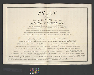
Plan of that part of Canada and the River St. Lawrence which lies between Cape Tourment and Dechambeaux on the north shore Point de la Caille and Lanbiniere on the south in which the city of Quebec and all the villages habitations and cultivated country in that extent are accurately lay'd down with all the different places of landing and embarkations the encampments entrenchments line of battle and principal movements of the British & French armies while this country was the seat of war : the whole from a survey carried on under the directions of the Honourable Brigr. General Murray, Governour of Quebec &; the tract of country contained in this plan was surveyed by the following officers viz, from St. Augustin to the river Montmorency on the north shore and from St. Nicholas to Point à la Ecaille on the south with all the back settlements, also the parishes on the south river by Capt. Holland of the Royal American Regiment. The island of Orleans surveyed by Capt. Lt. Spry engineer: from Dechambeaux to St. Augustin on the north and Lotbiniere to St. Antoine on the south shore by Lieutenant Peach of the 47th Regiment. From St. Antoine to St. Nicholas on the south and from Montmorency to Cape Tourment on the north shore by Ens. Pittmann of the 15th Regiment
This map is also available in American Revolutionary Geographies Online (ARGO), a collections portal especially built for material relating to the American Revolutionary War Era. Visit ARGO to learn more about this item and explore the historical geography of North America in the late eighteenth century.
Item Information
- Title:
- Plan of that part of Canada and the River St. Lawrence which lies between Cape Tourment and Dechambeaux on the north shore Point de la Caille and Lanbiniere on the south in which the city of Quebec and all the villages habitations and cultivated country in that extent are accurately lay'd down with all the different places of landing and embarkations the encampments entrenchments line of battle and principal movements of the British & French armies while this country was the seat of war : the whole from a survey carried on under the directions of the Honourable Brigr. General Murray, Governour of Quebec &; the tract of country contained in this plan was surveyed by the following officers viz, from St. Augustin to the river Montmorency on the north shore and from St. Nicholas to Point à la Ecaille on the south with all the back settlements, also the parishes on the south river by Capt. Holland of the Royal American Regiment. The island of Orleans surveyed by Capt. Lt. Spry engineer: from Dechambeaux to St. Augustin on the north and Lotbiniere to St. Antoine on the south shore by Lieutenant Peach of the 47th Regiment. From St. Antoine to St. Nicholas on the south and from Montmorency to Cape Tourment on the north shore by Ens. Pittmann of the 15th Regiment
- Date:
-
[ca. 1761]
- Format:
-
Documents
- Location:
- William L. Clements Library
- Collection (local):
-
William L. Clements Library Collection
- Extent:
- 1 ms. page ; 48.3 x 69.2 cm.
- Terms of Use:
-
The University of Michigan Library provides access to these materials for educational and research purposes. These materials may be under copyright. If you decide to use any of these materials, you are responsible for making your own legal assessment and securing any necessary permission. If you have questions about the collection, please contact the William L. Clements Library.
Contact host institution for more information.
- Language:
-
English
- Catalog Record:
-
Catalog record
- Notes:
-
Title page which corresponds to 1 key map (sheet 49), 1 "Explanation of references" (sheet 51) and 17 component maps (sheets 52-68) of part of the Saint Lawrence Valley.
Corresponding maps are individually cataloged and present bodies of water, islands, villages and fortifications between Cape Tourment and Dechambeaux.
Corresponding maps: [The St. Lawrence River from the Rapids of Richelieu to Cape Torment]. (sheet 49) -- Explanation of the references. (sheet 51) -- Plan of Québec with the positions of the British and French army's on the Heights of Abraham 13th of Sept. 1759 : Repetition plan no. 1. (sheet 52) -- Plan of the battle and situation of the British and French armys on the Heights of Abraham the 28th: of April 1760 : [Repetition plan no. 2.]. (sheet 53) -- Plan of Québec and the Heights of Abraham, shewing in particular the French encampment after the battle of the 28th: April, their batteries, & approaches; also the encampment of the garrison at their alarm posts and new works erected by them during the siege : Repetition plan no. 3. (sheet 54) -- Parish of Old Lorette. (sheet 55) -- Parish of Charlebourgh. (sheet 56) -- Parish of Beauport. Parish of L'Ange Gardien. Parish of Chateau Richer. (sheet 57) -- Parish of St. Joachim. Parish of St. Famille. Parish of St. Anne. Parish of St. François. (sheet 58) -- Continuation of the Grande Riviere with the village of Fariole lying near Cape Torment on the north shore. (sheet 59) -- Parish of Dechambeaux. Parish of Cape Sante. Parish of Lotbinière. Parish of St. Croix. (sheet 60) -- Parish of the Ecureuils. Parish of Point aux Trembles. Parish of St. Antoine. Parish of St. Croix. (sheet 61) -- Parish of St. Nicholas. The Parish of St. Augustin. (sheet 62) -- Parish of St. Foix. (sheet 63) -- Parish of St. Lawrence. Parish of Beaumont. Parish of St. Peter. (sheet 64) -- Parish of St. Michelle. Parish of St. John Baptist. Parish of St. Vertier. (sheet 65) -- Parish of Berthier. Parish of St. François. Parish of St. Thomas. (sheet 66) -- Point Levi [including the parishes of St. Joseph and St. Henry]. Parish of St. Charles. (sheet 67) -- [Parish of St. Charles]. (sheet 68).
Map is sheet 50 of the Murray Atlas of Canada.
- Identifier:
-
724
- Barcode:
-
B8296417


