Toggle navigation
LMEC Home
Exhibitions
Georeferencing
Tools for Teachers
Collections
My Favorites
Sign Up / Log In
Search
Search the map portal
Map Collection
Map Collection
Map Sets
Search
Search
Search for
Search In
All Fields
Creator
Title
Subject
Place
Search All Digital Collections
Advanced Search
2261 Results
My Search
Start Over
london
Remove constraint london
Filter your Search
Place
North and Central America
1,479
United States
921
Europe
363
Canada
347
North America
194
New York
128
Massachusetts
111
New England
104
more
Place
»
Topic
North America--Maps--Early works to 1800
137
Coasts--Nova Scotia--Maps
64
New England--Maps--Early works to 1800
57
United States--History--French and Indian War, 1754-1763--Maps
57
United States--History--French and Indian War, 1754-1763--Maps, Manuscript--Early works to 1800
56
United States--Maps--Early works to 1800
54
United States--History--Revolution, 1775-1783--Maps
40
Nova Scotia--Maps--Early works to 1800
39
more
Topic
»
Date
Date range begin
–
Date range end
Current results range from
1624
to
1999
View distribution
Creator
Des Barres, Joseph F. W. (Joseph Frederick Wallet), 1722-1824
242
Jefferys, Thomas, -1771
167
George, III, King of Great Britain, 1738-1820
149
George, IV, King of Great Britain, 1762-1830
148
Sayer, Robert, 1725-1794
115
Faden, William, 1749-1836
109
Moll, Herman, d. 1732
72
Robert Sayer and John Bennett (Firm)
57
more
Creator
»
Format
Maps/Atlases
2,219
Manuscripts
161
Prints
23
Drawings/Illustrations
15
Books
4
Objects/Artifacts
1
Georeferenced
Yes
137
No
2,124
Collection
American Revolutionary War-Era Maps
1,355
Norman B. Leventhal Map & Education Center Collection
1,305
Maritime Charts and Atlases
263
British Library Collection
163
William L. Clements Library Collection
160
Boston and New England Maps
152
Richard H. Brown Revolutionary War Map Collection at Mount Vernon
146
MacLean Collection Map Library
140
more
Collection
»
Available to use
No known restrictions
1,271
Creative Commons license
569
Search Constraints
Sort by relevance
relevance
title
date (asc)
date (desc)
Number of results to display per page
20 per page
10
per page
20
per page
50
per page
100
per page
View results as:
grid view
map view
Search Results
1001.
A map of the most inhabited part of Virginia containing the whole province of Maryland : with part of Pensilvania, New Jersey...
1002.
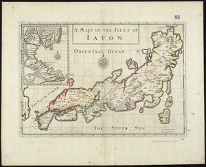
A mapp of the Isles of Iapon
1003.
Plan of Bahia Xagua on the south side of Cuba ; Plan of the Colorado Rocks, near the west end of Cuba
1004.
Plan of the attack against Basseterre on the island of Guadeloupe by a squadron of his Majesty's ships of war commanded by...
1005.
Plan of the city and suburbs of Carthagena ; Plan of the bay & town of Sta. Martha, on the coast of Tierra Firma
1006.
Plan of the harbour of San Fernando de Omoa ; A map of the Isthmus of Panama, drawn from Spanish surveys
1007.
Plan of Zisapata Bay ; Plan of the harbour of Carthagena
1008.
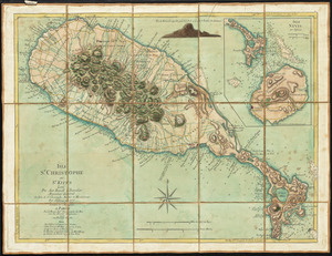
St. Christophers or St. Kitts
1009.
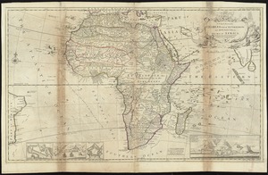
To the Right Honourable Charles, Earl of Peterborow, and Monmouth, &c. this map of Africa, according to ye newest and most...
1010.
Isle St. Christophe ou St. Kitts
1011.
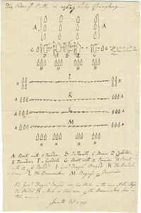
The order of battle in crossing Lake Champlane
1012.
Map of Nova Scotia, or Acadia : with the islands of Cape Breton and St. John's, from actual surveys
1013.
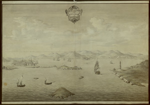
A VIEW of the TOWN & HARBOUR of LOUISBOURG
1014.
A Chart of the north part of America, describing the sea coast of Groenland, Dawies Streights, Baffins Bay, Hudsons Streights,...
1015.
A generall mapp of the continent and islands which bee adjacent to Jamaica : A new mapp of the Island of Jamaica
1016.
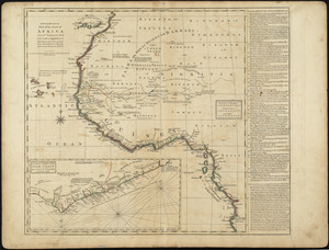
A new and correct map of the coast of Africa, from Sta. Cruz lat. 30 north. to the coast of Angola lat 11. S. with explanatory...
1017.
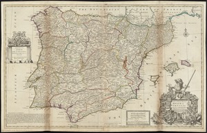
A new and exact map of Spain & Portugal divided into its kingdoms and principalities &c with ye principal roads and...
1018.
A new chart of the coast of New England, Nova Scotia, New France or Canada, with the islands of Newfoundld. Cape Breton St....
1019.
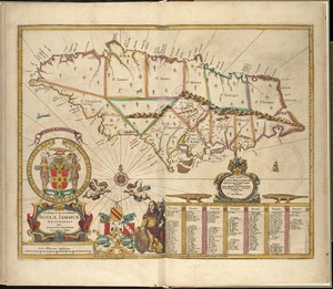
Novissima et accuratissima Insulae Jamaicae
1020.
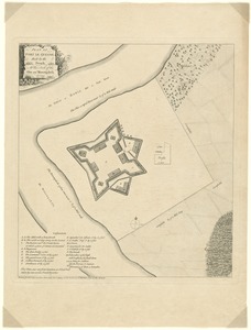
Plan of Fort le Quesne, built by the French at the fork of the Ohio and Monongahela in 1754
‹ Prev
Next ›
1
2
…
47
48
49
50
51
52
53
54
55
…
113
114