Toggle navigation
LMEC Home
Exhibitions
Georeferencing
Tools for Teachers
Collections
My Favorites
Sign Up / Log In
Search
Search the map portal
Map Collection
Map Collection
Map Sets
Search
Search
Search for
Search In
All Fields
Creator
Title
Subject
Place
Search All Digital Collections
Advanced Search
14021 Results
Filter your Search
Place
North and Central America
10,683
United States
8,692
Massachusetts
2,808
Suffolk (county)
1,682
Boston
1,638
Europe
1,420
Canada
1,009
New York
674
more
Place
»
Topic
Boston (Mass.)--Maps
748
City planning--Massachusetts--Boston--Maps
418
United States--History--Revolution, 1775-1783--Maps
331
United States--Maps
328
Real property--Massachusetts--Boston--Maps
254
Urban renewal--Massachusetts--Boston--Maps
254
North America--Maps--Early works to 1800
240
Massachusetts--Maps
234
more
Topic
»
Date
Date range begin
–
Date range end
Current results range from
1482
to
2023
View distribution
Creator
United States. Hydrographic Office
597
Boston Redevelopment Authority
404
Des Barres, Joseph F. W. (Joseph Frederick Wallet), 1722-1824
247
Jefferys, Thomas, -1771
172
Royal United Services Institute for Defence and Security Studies
160
George, III, King of Great Britain, 1738-1820
152
George, IV, King of Great Britain, 1762-1830
151
O.H. Bailey & Co
148
more
Creator
»
Format
Maps/Atlases
13,839
Manuscripts
985
Prints
102
Books
49
Drawings/Illustrations
44
Photographs
15
Objects/Artifacts
13
Documents
7
more
Format
»
Georeferenced
Yes
979
No
13,042
Collection
Norman B. Leventhal Map & Education Center Collection
9,110
American Revolutionary War-Era Maps
3,627
Boston and New England Maps
2,921
Urban Maps
2,480
Maritime Charts and Atlases
1,169
William L. Clements Library Collection
910
Library of Congress Collection
618
Boston Redevelopment Authority Collection
475
more
Collection
»
Available to use
No known restrictions
10,268
Creative Commons license
1,678
Search Constraints
Sort by relevance
relevance
title
date (asc)
date (desc)
Number of results to display per page
20 per page
10
per page
20
per page
50
per page
100
per page
View results as:
grid view
map view
Search Results
8921.
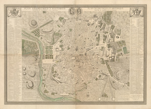
Plan geometrico y historico de la villa de Madrid y sus contornos = Plan geometrique et historique de la ville de Madrid et de...
8922.
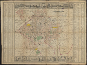
Plan géométrique de la ville de Bruxelles
8923.
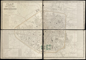
Plan illustré de la Ville de Bruxelles, comprenant les quartiers nouveaux & tous les agrandissements décrétés & projetés
8924.
Plan, Lake Champlain from Fort St. John's to Ticonderoga : with the soundings, rocks, shoals, and sands, surveyed in the years...
8925.
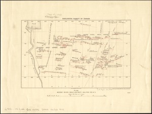
Plan Moose River gold district, Halifax Co., N.S
8926.
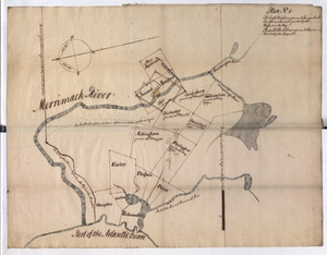
Plan No: 1 : [Eastern New Hampshire and Massachusetts]
8927.
Plan no. 1 of building lots near Spring St. Station West Roxbury belonging to the West Roxbury Land Co
8928.
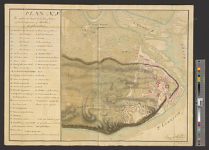
Plan (no. 1) To explain the report of the state of defence of the fortifications of Quebec
8929.
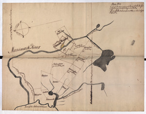
Plan No: 2 : [Eastern New Hampshire and Massachusetts]
8930.
Plan No: 2 : [Eastern New Hampshire and Massachusetts]
8931.
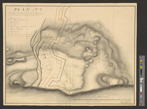
Plan (no. 2) shewing the ground whereon the citadel is proposed to be built : the ground lines of the present fortifications...
8932.
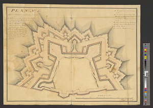
Plan (no. 3) of the citadel compleatly finished
8933.
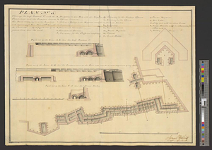
Plan no. 4 shewing the bastion A with its foundations and casemates and bastion B finish'd with its ambrazures and platforms C...
8934.
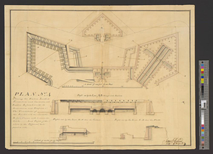
Plan (no. 5) shewing the half bastion C with its foundations and the rampart towards the river side, as far as the loop-hole...
8935.
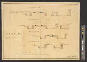
Plan no. 6 shewing the profils cut thro' the different works by the yellow lines seen on plan no. 3
8936.
Plan no II of land of George D. Welles situated in ward 16 Boston
8937.
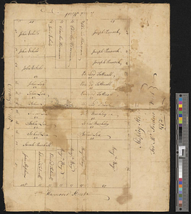
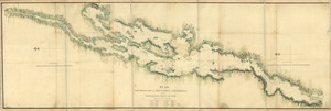
A Plan oe [i.e. of] the British lines on Boston Neck in August 1775
8938.
A plan of 8 lots of city land known as the Arsenal Lot : and 7 lots fronting on Providence St. to be sold at auction, on...
8939.
Plan of 82 building lots, in the town of Brighton, comprising 48 acres of the Parkman Farm next the estate of Saml. Bigelow...
8940.
Plan of a city block in Wilmington, Delaware : for Mr Fredrick Wirt 1772
‹ Prev
Next ›
1
2
…
443
444
445
446
447
448
449
450
451
…
701
702


![A Plan oe [i.e. of] the British lines on Boston Neck in August 1775](https://bpldcassets.blob.core.windows.net/derivatives/images/commonwealth:z603vj41n/image_thumbnail_300.jpg)