Toggle navigation
LMEC Home
Exhibitions
Georeferencing
Tools for Teachers
Collections
My Favorites
Sign Up / Log In
Search
Search the map portal
Map Collection
Map Collection
Map Sets
Search
Search
Search for
Search In
All Fields
Creator
Title
Subject
Place
Search All Digital Collections
Advanced Search
13680 Results
My Search
Start Over
Date facet yearly ssim
1800
to
1849
Remove constraint Date facet yearly ssim: <span class='from'>1800</span> to <span class='to'>1849</span>
Filter your Search
Place
North and Central America
10,344
United States
8,475
Massachusetts
2,789
Suffolk (county)
1,677
Boston
1,633
Europe
1,415
Canada
950
New York
649
more
Place
»
Topic
Boston (Mass.)--Maps
747
City planning--Massachusetts--Boston--Maps
418
United States--History--Revolution, 1775-1783--Maps
329
United States--Maps
322
Real property--Massachusetts--Boston--Maps
254
Urban renewal--Massachusetts--Boston--Maps
254
Massachusetts--Maps
231
Insurance surveys
197
more
Topic
»
Date
Date range begin
–
Date range end
Current results range from
1482
to
2023
View distribution
Creator
United States. Hydrographic Office
597
Boston Redevelopment Authority
404
Des Barres, Joseph F. W. (Joseph Frederick Wallet), 1722-1824
247
Royal United Services Institute for Defence and Security Studies
160
Jefferys, Thomas, -1771
154
George, III, King of Great Britain, 1738-1820
152
George, IV, King of Great Britain, 1762-1830
151
O.H. Bailey & Co
148
more
Creator
»
Format
Maps/Atlases
13,499
Manuscripts
985
Prints
102
Books
49
Drawings/Illustrations
44
Photographs
15
Objects/Artifacts
13
Documents
7
more
Format
»
Georeferenced
Yes
979
No
12,701
Collection
Norman B. Leventhal Map & Education Center Collection
9,096
American Revolutionary War-Era Maps
3,305
Boston and New England Maps
2,915
Urban Maps
2,471
Maritime Charts and Atlases
1,169
William L. Clements Library Collection
910
Library of Congress Collection
618
Boston Redevelopment Authority Collection
475
more
Collection
»
Available to use
No known restrictions
10,246
Creative Commons license
1,678
Search Constraints
Sort by relevance
relevance
title
date (asc)
date (desc)
Number of results to display per page
20 per page
10
per page
20
per page
50
per page
100
per page
View results as:
grid view
map view
Search Results
8901.
Plan of Canaan surveyed by Samuel Weston, dated May 20, 1795.
8902.
Plan of Canada or the province of Quebec from the uppermost settlements to the island of Coudre as surveyed by order of his...
8903.
Plan of Canton made by Joseph Hodges, dated October 1830
8904.
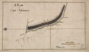
A Plan of Cape Antonia
8905.
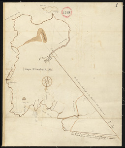
Plan of Cape Elizabeth, surveyor's name not given, dated 1794-1795.
8906.
PLAN of CARBONERA ISLAND situated at the Entrance of CARBONERA HARBOUR in CONCEPTION BAY NEWFOUNDLAND
8907.
Plan of Carillon ou [sic] Ticonderoga : which was quitted by the Americaines in the night from the 5th to the 6th of July 1777
8908.
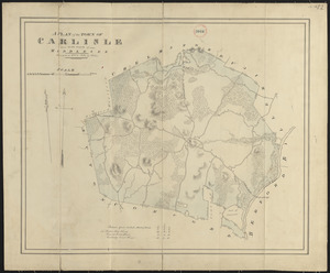
Plan of Carlisle made by John G. Hales, dated 1831
8909.
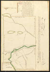
Plan of Carver surveyed by Nehemiah Cobb, dated 1794-5.
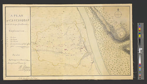
8910.
A plan of Cascasquias with the design of an enceinte
8911.
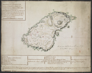
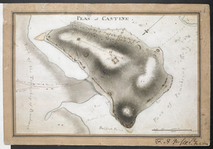
PLAN of CASTINE
8912.
[Plan of channels and flats as they were before the 200 feet outside of the Mill Dam was filled up]
8913.
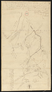
Plan of Charlemont made by Levi Leonard, dated September 1830
8914.
Plan of Charlemont surveyed by Jesse King, dated 1794-5.
8915.
Plan of Charlemont (Zoar) made by John Tobey, dated June 1839
8916.
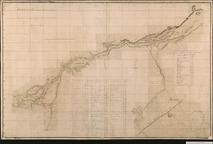
Plan of Charles River : from the Waltham line to Boston harbor
8917.
Plan of Charles River and Warren bridges, with the vicinity
8918.
A Plan of Charles Town the capitol of South Carolina, : with the harbour, islands, and forts; the attack on Fort Sulivan, by...
8919.
Plan of Charles Town, with the intrenchments, and encampment of His Majesty's troops, after the action of the 17th. June 1775
8920.
Plan of Charleston and its defenses 1780
‹ Prev
Next ›
1
2
…
442
443
444
445
446
447
448
449
450
…
683
684
![Plan of Carillon ou [sic] Ticonderoga](https://bpldcassets.blob.core.windows.net/derivatives/images/commonwealth:q524nk513/image_thumbnail_300.jpg)
![[Plan of channels and flats as they were before the 200 feet outside of the Mill Dam was filled up]](https://bpldcassets.blob.core.windows.net/derivatives/images/commonwealth:b8516207x/image_thumbnail_300.jpg)