Toggle navigation
LMEC Home
Exhibitions
Georeferencing
Tools for Teachers
Collections
My Favorites
Sign Up / Log In
Search
Search the map portal
Map Collection
Map Collection
Map Sets
Search
Search
Search for
Search In
All Fields
Creator
Title
Subject
Place
Search All Digital Collections
Advanced Search
13385 Results
Filter your Search
Place
North and Central America
9,353
United States
7,078
Suffolk (county)
1,664
Boston
1,621
Europe
1,035
Canada
949
Massachusetts
794
New York
532
more
Place
»
Topic
Boston (Mass.)--Maps
741
City planning--Massachusetts--Boston--Maps
418
United States--History--Revolution, 1775-1783--Maps
329
United States--Maps
315
Urban renewal--Massachusetts--Boston--Maps
254
Real property--Massachusetts--Boston--Maps
252
Massachusetts--Maps
219
Insurance surveys
197
more
Topic
»
Date
Date range begin
–
Date range end
Current results range from
1482
to
2023
View distribution
Creator
United States. Hydrographic Office
595
Boston Redevelopment Authority
403
Des Barres, Joseph F. W. (Joseph Frederick Wallet), 1722-1824
247
Royal United Services Institute for Defence and Security Studies
160
Jefferys, Thomas, -1771
154
George, III, King of Great Britain, 1738-1820
152
George, IV, King of Great Britain, 1762-1830
151
O.H. Bailey & Co
148
more
Creator
»
Format
Maps/Atlases
13,205
Manuscripts
985
Prints
102
Books
49
Drawings/Illustrations
44
Photographs
15
Objects/Artifacts
13
Documents
7
more
Format
»
Georeferenced
Yes
979
No
12,406
Collection
Norman B. Leventhal Map Center Collection
8,891
American Revolutionary War-Era Maps
3,305
Boston and New England Maps
2,804
Urban Maps
2,397
Maritime Charts and Atlases
1,150
William L. Clements Library Collection
910
Library of Congress Collection
618
Boston Redevelopment Authority Collection
475
more
Collection
»
Available to use
No known restrictions
9,952
Creative Commons license
1,677
Search Constraints
Sort by relevance
relevance
title
date (asc)
date (desc)
Number of results to display per page
20 per page
10
per page
20
per page
50
per page
100
per page
View results as:
grid view
map view
Search Results
8881.
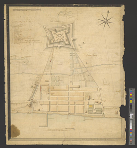
Plan of Fort le Quesne, built by the French at the fork of the Ohio and Monongahela in 1754
8882.
Plan of Fort le Quesne, built by the French at the fort of the Ohio and monongahela in 1754
8883.
Plan of Fort Lernoult and the town of Detroit
8884.
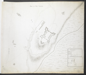
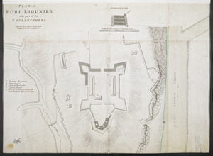
PLAN of FORT LIGONIER
8885.
A plan of Fort Ligonier done by Theodosius McDonald for George Morton : February 8th annoque domini 1760
8886.
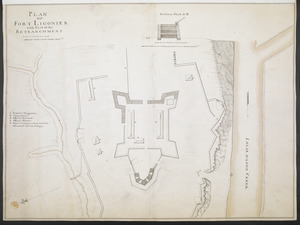
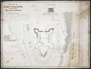
PLAN OF FORT LIGONIER with Part of the RETRANCHMENT
8887.
PLAN of FORT LIGONIER with part of the RETRENCHMENT
8888.
PLAN of FORT LIGONIER with part of the RETRENCHMENT
8889.
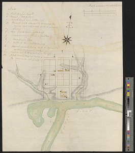
Plan of Fort Massachusetts - Rocklanding - 1792
8890.
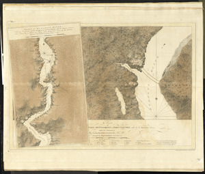
Plan of Fort Massachusetts in Georgia and the country adjacent - 1792
8891.
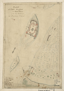
Plan of Fort Mifflin on Mud Island, with the batteries on Province Island
8892.
A plan of Fort Montgomery & Fort Clinton, taken by His Majesty's forces, under the command of Maj. Genl. Sir Henry Clinton, K:B
8893.
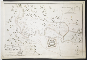
PLAN OF FORT NEW-PORT with ye Situation done by a Scale 100 feet to one Inch
8894.
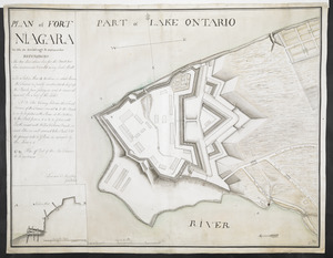
PLAN of FORT NIAGARA With its Buildings & outworks
8895.
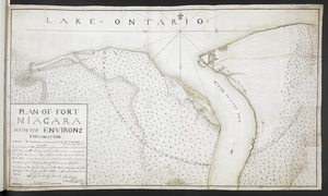
Plan of Fort Niagara, with its environ
8896.
PLAN OF FORT NIAGARA WITH ITS ENVIRONS
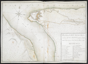
8897.
PLAN of FORT NIAGARA with its ENVIRONS, and the Attack made there-upon, in the Month of Iuly 1759
8898.
A plan of Fort Ontario
8899.
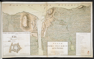
PLAN of FORT ONTARIO and its ENVIRONS
8900.
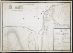
A PLAN OF FORT ONTARIO Built at OSWEGO in 1759
‹ Prev
Next ›
1
2
…
441
442
443
444
445
446
447
448
449
…
669
670