Toggle navigation
LMEC Home
Exhibitions
Georeferencing
Tools for Teachers
Collections
My Favorites
Sign Up / Log In
Search
Search the map portal
Map Collection
Map Collection
Map Sets
Search
Search
Search for
Search In
All Fields
Creator
Title
Subject
Place
Search All Digital Collections
Advanced Search
71 Results
My Search
Start Over
1697
Remove constraint 1697
Filter your Search
Place
North and Central America
24
North America
17
Europe
15
Africa
8
Saint Lawrence River
8
Canada
7
Cape Verde
6
South America
6
more
Place
»
Topic
North America--Maps--Early works to 1800
9
North America--Maps
8
Saint Lawrence River--Maps, Manuscript--Early works to 1800
4
South America--Maps
4
Fortification--Ontario, Lake (N.Y. and Ont.)--Maps, Manuscript--Early works to 1800
3
Ontario, Lake (N.Y. and Ont.)--Maps, Manuscript--Early works to 1800
3
Saint Lawrence River--Maps
3
Swedish-Polish War, 1655-1660--Maps--Early works to 1800
3
more
Topic
»
Date
Date range begin
–
Date range end
Current results range from
1689
to
1891
View distribution
Creator
Anville, Jean Baptiste Bourguignon d', 1697-1782
33
Coronelli, Vincenzo, 1650-1718
10
Dahlbergh, Erik Jönsson, greve, 1625-1703
8
Pufendorf, Samuel, Freiherr von, 1632-1694
8
Riegel, Christoph
8
Swidde, Willem, 1660 or 1661-1697
8
Labrosse, Paul, 1697-1769
7
Royal United Services Institute for Defence and Security Studies
7
more
Creator
»
Format
Maps/Atlases
66
Prints
5
Manuscripts
1
Georeferenced
Yes
6
No
65
Collection
Norman B. Leventhal Map & Education Center Collection
50
American Revolutionary War-Era Maps
27
British Library Collection
7
New York Public Library Collection
5
American Antiquarian Society Collection
3
MacLean Collection Map Library
2
Massachusetts Historical Society Map Collection
2
Boston and New England Maps
1
more
Collection
»
Available to use
No known restrictions
50
Creative Commons license
15
Search Constraints
Sort by relevance
relevance
title
date (asc)
date (desc)
Number of results to display per page
20 per page
10
per page
20
per page
50
per page
100
per page
View results as:
grid view
map view
Search Results
61.
Canada orientale nell' America Settentrionale
62.
North America : performed under the patronage of Louis Duke of Orleans, First Prince of the Blood
63.
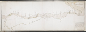
Lake Ontario & River S.t Laurence from the Lake to Fort William Augustus in Three Rivers, this was taken from a French Draft...
64.
Lake Ontario & River S.t Laurence from the Lake to Fort William Augustus in Three Rivers, this was taken from a French Draft...
65.
Lake Ontario & River S.t Laurence from the Lake to Fort William Augustus in Three Rivers, this was taken from a French Draft...
66.
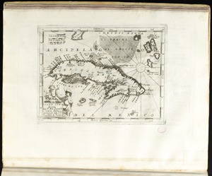
Isola Cuba
67.
[Mexico and Central America]
68.
La Louisiana, parte settentrionalle, scoperta sotto la protettione di Luigi XIV, Ré di Francia, etc
69.
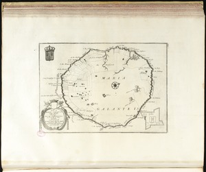
Isola di Maria Galante nelle Antilli, posseduta da S. M. Cristianissima in G. 15 M. 40 sett
70.
CARTE de la RIVIERE de KATARAKOUI : du cote du nord, qui donne la Connoissance des Chutes, Cascades, Troux, rapides, et mauvais...
71.
[Globe gore featuring North American coastline]
‹ Prev
Next ›
1
2
3
4


![Lake Ontario & River S.t Laurence from the Lake to Fort William Augustus in Three Rivers, this was taken from a French Draft that was on Board the Prise Williamson belonging to Monsr La Broquerie [east sheet]](https://bpldcassets.blob.core.windows.net/derivatives/images/commonwealth:hx11z135r/image_thumbnail_300.jpg)
![Lake Ontario & River S.t Laurence from the Lake to Fort William Augustus in Three Rivers, this was taken from a French Draft that was on Board the Prise Williamson belonging to Monsr La Broquerie [middle sheet]](https://bpldcassets.blob.core.windows.net/derivatives/images/commonwealth:hx11z1379/image_thumbnail_300.jpg)
![Lake Ontario & River S.t Laurence from the Lake to Fort William Augustus in Three Rivers, this was taken from a French Draft that was on Board the Prise Williamson belonging to Monsr La Broquerie [west sheet]](https://bpldcassets.blob.core.windows.net/derivatives/images/commonwealth:hx11z139v/image_thumbnail_300.jpg)
![[Mexico and Central America]](https://bpldcassets.blob.core.windows.net/derivatives/images/commonwealth:cj82m4685/image_thumbnail_300.jpg)

![[Globe gore featuring North American coastline]](https://bpldcassets.blob.core.windows.net/derivatives/images/commonwealth:qb98n804g/image_thumbnail_300.jpg)