Toggle navigation
LMEC Home
Exhibitions
Georeferencing
Tools for Teachers
Collections
My Favorites
Sign Up / Log In
Search
Search the map portal
Map Collection
Map Collection
Map Sets
Search
Search
Search for
Search In
All Fields
Creator
Title
Subject
Place
Search All Digital Collections
Advanced Search
14164 Results
Filter your Search
Place
North and Central America
10,811
United States
8,818
Massachusetts
2,820
Suffolk (county)
1,688
Boston
1,644
Europe
1,428
Canada
1,010
New York
683
more
Place
»
Topic
Boston (Mass.)--Maps
753
City planning--Massachusetts--Boston--Maps
419
United States--History--Revolution, 1775-1783--Maps
331
United States--Maps
331
Real property--Massachusetts--Boston--Maps
254
Urban renewal--Massachusetts--Boston--Maps
254
North America--Maps--Early works to 1800
241
Massachusetts--Maps
236
more
Topic
»
Date
Date range begin
–
Date range end
Current results range from
1482
to
2023
View distribution
Creator
United States. Hydrographic Office
597
Boston Redevelopment Authority
404
Des Barres, Joseph F. W. (Joseph Frederick Wallet), 1722-1824
247
Jefferys, Thomas, -1771
172
United States. National Ocean Service
170
Royal United Services Institute for Defence and Security Studies
160
George, III, King of Great Britain, 1738-1820
152
George, IV, King of Great Britain, 1762-1830
151
more
Creator
»
Format
Maps/Atlases
13,978
Manuscripts
985
Prints
102
Books
53
Drawings/Illustrations
44
Photographs
15
Objects/Artifacts
13
Documents
7
more
Format
»
Georeferenced
Yes
979
No
13,185
Collection
Norman B. Leventhal Map & Education Center Collection
9,162
American Revolutionary War-Era Maps
3,629
Boston and New England Maps
2,936
Urban Maps
2,511
Maritime Charts and Atlases
1,169
William L. Clements Library Collection
910
Library of Congress Collection
618
Boston Redevelopment Authority Collection
475
more
Collection
»
Available to use
No known restrictions
10,408
Creative Commons license
1,678
Search Constraints
Sort by relevance
relevance
title
date (asc)
date (desc)
Number of results to display per page
20 per page
10
per page
20
per page
50
per page
100
per page
View results as:
grid view
map view
Search Results
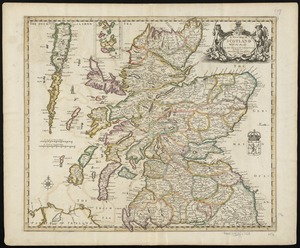
7601.
A new map of Scotland with the roads
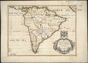
7602.
A new map of South America : shewing it's general divisions, chief cities & towns, rivers, mountains &c
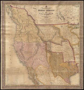
7603.
A new map of Texas, Oregon, and California with the regions adjoining
7604.
New map of the American overland route showing its connections, and land grants of 30,000,000 acres
7605.
A new map of the Baltick &c : shewing all the dominions about it with ye great or post roads and principal cross-roads
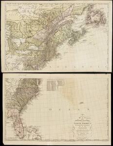
7606.
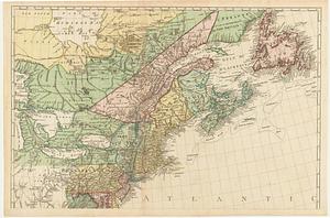
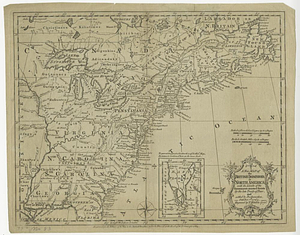
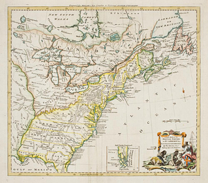
A new map of the British colonies in North America, shewing the seat of the present war, taken from the best surveys, compared...
7607.
A new map of the British colonies in North America, shewing the seat of the present war, taken from the best surveys, compared...
7608.
A new map of the British colonies in North America, shewing the seat of the present war, taken from the best surveys, compared...
7609.
A new map of the British dominions in North America with the limits of the governments annexed thereto by the late treaty of...
7610.
A new map of the British empire in Nth. America
7611.
A new map of the British empire in Nth. America, drawn from the latest authorities
7612.
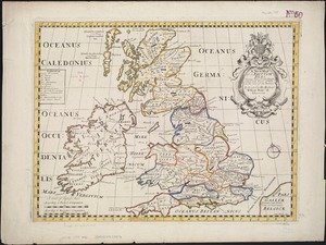
A new map of the Brittish Isles shewing their antient people, cities, and towns of note, in the time of the Romans : dedicated...
7613.
A new map of the Brittish Isles shewing their present genl. divisions, cities, and such other towns, or places, as answer to...
7614.
New map of the central portion of Boston
7615.
A New map of the Cherokee nation : with the names of the towns & rivers they are situated on No. lat from 34 to 36
7616.
A new map of the Cherokee nation with the names of the towns & rivers : they are situated on no. lat. from 34 to 36
7617.
New map of the City of Buffalo
7618.
The new map of the City of Elmira
7619.
The new map of the City of Elmira
7620.
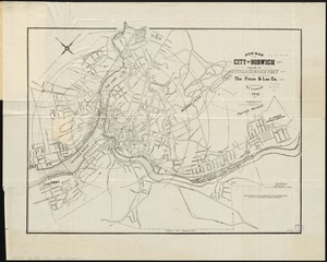
New map of the city of Norwich
‹ Prev
Next ›
1
2
…
377
378
379
380
381
382
383
384
385
…
708
709