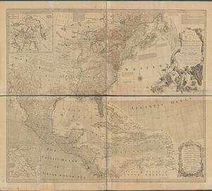
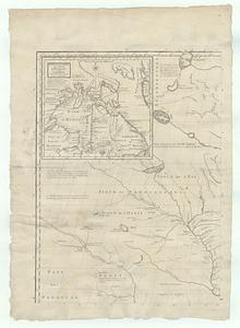
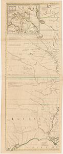
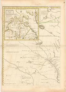
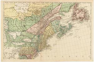
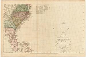
A new map of the British colonies in North America, shewing the seat of the present war, taken from the best surveys, compared with and improved from manuscripts of several noblemen and gentlemen

This map is also available in American Revolutionary Geographies Online (ARGO), a collections portal especially built for material relating to the American Revolutionary War Era. Visit ARGO to learn more about this item and explore the historical geography of North America in the late eighteenth century.
Item Information
- Title:
- A new map of the British colonies in North America, shewing the seat of the present war, taken from the best surveys, compared with and improved from manuscripts of several noblemen and gentlemen
- Engraver:
- Andrews, John, 1736-1809
- Publisher:
- Andrews, John, 1736-1809
- Publisher:
- Dury, Andrew
- Date:
-
January 16, 1777
- Format:
-
Maps/Atlases
- Location:
- MacLean Collection Map Library
- Collection (local):
-
MacLean Collection Map Library
- Subjects:
-
North America--Maps--Early works to 1800
- Places:
-
North America (area)
- Extent:
- 2 maps ; 475 x 784 mm and 509 x 782 mm
- Terms of Use:
-
Public Domain/No known restrictions on use. Contact host institution to download image.
Contact host institution for more information.
- Publisher:
-
London :
John Andrews, at M.r Branches, n.o 40 corner of Buckingham Street, Strand ; & Andrew Dury in Dukes Court, S.t Martins Lane, Charing Cross
- Edition:
- First state
- Language:
-
English
- Identifier:
-
MC_487
- Call #:
-
487