Toggle navigation
LMEC Home
Exhibitions
Georeferencing
Tools for Teachers
Collections
My Favorites
Sign Up / Log In
Search
Search the map portal
Map Collection
Map Collection
Map Sets
Search
Search
Search for
Search In
All Fields
Creator
Title
Subject
Place
Search All Digital Collections
Advanced Search
2261 Results
My Search
Start Over
london
Remove constraint london
Filter your Search
Place
North and Central America
1,492
United States
943
Europe
363
Canada
347
North America
194
New York
129
Massachusetts
117
New England
104
more
Place
»
Topic
North America--Maps--Early works to 1800
137
Coasts--Nova Scotia--Maps
64
New England--Maps--Early works to 1800
57
United States--History--French and Indian War, 1754-1763--Maps
57
United States--History--French and Indian War, 1754-1763--Maps, Manuscript--Early works to 1800
56
United States--Maps--Early works to 1800
54
United States--History--Revolution, 1775-1783--Maps
40
Nova Scotia--Maps--Early works to 1800
39
more
Topic
»
Date
Date range begin
–
Date range end
Current results range from
1624
to
1999
View distribution
Creator
Des Barres, Joseph F. W. (Joseph Frederick Wallet), 1722-1824
242
Jefferys, Thomas, -1771
167
George, III, King of Great Britain, 1738-1820
149
George, IV, King of Great Britain, 1762-1830
148
Sayer, Robert, 1725-1794
115
Faden, William, 1749-1836
109
Moll, Herman, d. 1732
72
Robert Sayer and John Bennett (Firm)
57
more
Creator
»
Format
Maps/Atlases
2,219
Manuscripts
161
Prints
23
Drawings/Illustrations
15
Books
4
Objects/Artifacts
1
Georeferenced
Yes
137
No
2,124
Collection
American Revolutionary War-Era Maps
1,355
Norman B. Leventhal Map & Education Center Collection
1,305
Maritime Charts and Atlases
263
British Library Collection
163
William L. Clements Library Collection
160
Boston and New England Maps
152
Richard H. Brown Revolutionary War Map Collection at Mount Vernon
146
MacLean Collection Map Library
140
more
Collection
»
Available to use
No known restrictions
1,271
Creative Commons license
569
Search Constraints
Sort by relevance
relevance
title
date (asc)
date (desc)
Number of results to display per page
20 per page
10
per page
20
per page
50
per page
100
per page
View results as:
grid view
map view
Search Results
661.
Italia cum insulis et regionibus finitimis
662.
Kingdom of the Caliphs
663.
A map of the island of Guadaloupe
664.
A new and exact map of France divided into all its provinces and acquisitions, according to the newest observations, and that...
665.
A new map of Great Britain : according to the newest and most exact observations
666.
A new map of the Brittish Isles shewing their antient people, cities, and towns of note, in the time of the Romans : dedicated...
667.
Orbis Romani pars orientalis
668.
A plan of Port Royal in South Carolina
669.
Plan of the city of Washington, in the territory of Columbia, ceded by the States of Virginia and Maryland to the United States...
670.
Plan of the town of Basse Terre the capital of Guadaloupe from an authentic survey
671.
Scotland
672.
France divided into circles and departments
673.
Map fourth division railway mail service
674.
An accurate map of North and South Carolina with their Indian frontiers, shewing in a distinct manner all the mountains,...
675.
An accurate map of Rhode Island, part of Connecticut and Massachusets, shewing Admiral Arbuthnot's station in blocking up...
676.
An accurate map of Rhode Island, part of Connecticut and Massachusets, shewing Admiral Arbuthnot's station in blocking up...
677.
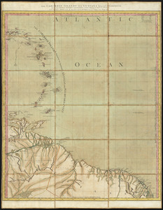
The Caribbee Islands and Guayana
678.
A chart of the coast of Barbaria with the western, Canaria, & Cape de Verd, isles
679.
A chart of the coast of New England, from Beverly to Scituate harbour, including the ports of Boston and Salem
680.
Coast of New Hampshire and Massachusetts from Great Boars Head to Marblehead Harbor
‹ Prev
Next ›
1
2
…
30
31
32
33
34
35
36
37
38
…
113
114