Toggle navigation
LMEC Home
Exhibitions
Georeferencing
Tools for Teachers
Collections
My Favorites
Sign Up / Log In
Search
Search the map portal
Map Collection
Map Collection
Map Sets
Search
Search
Search for
Search In
All Fields
Creator
Title
Subject
Place
Search All Digital Collections
Advanced Search
190 Results
My Search
Start Over
Date
1925
to
1929
Remove constraint Date: <span class='from'>1925</span> to <span class='to'>1929</span>
Filter your Search
Place
North and Central America
163
United States
158
Massachusetts
49
Boston
32
Suffolk (county)
32
Asia
11
Bristol (county)
11
Europe
8
more
Place
»
Topic
Fire risk assessment
23
Insurance surveys
23
Textile factories
19
Boston (Mass.)--Maps
17
Cotton manufacture
9
Pictorial maps
6
Tokyo (Japan)--Maps
5
Landowners--Massachusetts--Boston--Maps
4
more
Topic
»
Date
1925
to
1929
[remove]
190
Date range begin
–
Date range end
Current results range from
1770
to
1999
1925
to
1925
57
1926
to
1926
55
1927
to
1927
56
1928
to
1928
67
1929
to
1929
38
Creator
Geological Survey (U.S.)
23
Associated Factory Mutual Fire Insurance Companies
12
Associated Mutual Insurance Companies
8
United States. Forest Service
7
Boston (Mass.). Department of Parks
6
Good, L. S.
5
Mehurin, E. L.
5
American Geographical Society of New York
4
more
Creator
»
Format
Maps/Atlases
189
Objects/Artifacts
1
Photographs
1
Georeferenced
Yes
6
No
184
Collection
Norman B. Leventhal Map & Education Center Collection
160
Boston and New England Maps
40
American Textile History Museum Image Collection
23
Urban Maps
21
Massachusetts Real Estate Atlases
4
David Judkins Weaver Papers
3
American Revolutionary War-Era Maps
1
Campus Maps from Phillips Academy Archives and Special Collections
1
more
Collection
»
Available to use
No known restrictions
157
Creative Commons license
4
Search Constraints
Sort by relevance
relevance
title
date (asc)
date (desc)
Number of results to display per page
20 per page
10
per page
20
per page
50
per page
100
per page
View results as:
grid view
map view
Search Results
41.
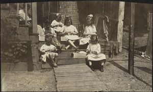
Family of Mrs. Donovan, Roxbury
42.
Flathead National Forest, Montana
43.
Franklin Park general plan for zoological garden
44.
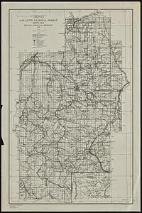
Gallatin National Forest, Montana
45.
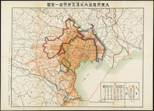
Gas and water-supply in greater Tokyo - 1928
46.
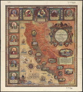
A general map of California during Spanish and Mexican occupation, 1542-1847
47.
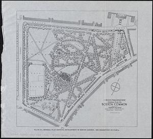
General plan for Boston Common
48.
General plan for Columbus Park, Strandway, South Boston
49.
General plan of Mt. Hope cemetery showing surrounding streets and the general scheme of interior roads, paths, and arrangement...
50.
Geologic map of copper range from Gratiot to La Salle, Michigan
51.
Geologic map of Oklahoma
52.
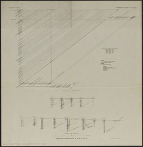
Geologic sections in T. 56 N., R. 33 W.
53.
Geologic sections in T. 56 N., Rs. 32 and 33 W.
54.
George Washington's map, accompanying his "journal to the Ohio", 1754
55.
The Gilt Edge Silk Mills, New Bedford, Mass. [insurance map]
56.
Gonic Manufacturing Co., Rochester, Gonic, N.H., Tenements. [insurance map]
57.
Grand Mesa National Forest, Colorado
58.
Grinnell Manufacturing Corporation "Nos. 1 & 2 Mills" (Cotton), New Bedford, Mass. [insurance map]
59.
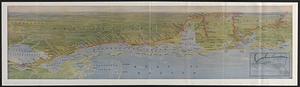
The Gulf Coast
60.
Hagstrom's map of Brooklyn (New York City) : house-number and subway guide
‹ Prev
Next ›
1
2
3
4
5
6
7
…
9
10


![The Gilt Edge Silk Mills, New Bedford, Mass. [insurance map]](https://bpldcassets.blob.core.windows.net/derivatives/images/commonwealth:ww72bz92x/image_thumbnail_300.jpg)
![Gonic Manufacturing Co., Rochester, Gonic, N.H., Tenements. [insurance map]](https://bpldcassets.blob.core.windows.net/derivatives/images/commonwealth:ww72c032v/image_thumbnail_300.jpg)
![Grinnell Manufacturing Corporation "Nos. 1 & 2 Mills" (Cotton), New Bedford, Mass. [insurance map]](https://bpldcassets.blob.core.windows.net/derivatives/images/commonwealth:ww72bz42q/image_thumbnail_300.jpg)