Toggle navigation
LMEC Home
Exhibitions
Georeferencing
Tools for Teachers
Collections
My Favorites
Sign Up / Log In
Search
Search the map portal
Map Collection
Map Collection
Map Sets
Search
Search
Search for
Search In
All Fields
Creator
Title
Subject
Place
Search All Digital Collections
Advanced Search
125 Results
My Search
Start Over
Date
1745
to
1749
Remove constraint Date: <span class='from'>1745</span> to <span class='to'>1749</span>
Filter your Search
Place
North and Central America
84
Canada
37
United States
31
Louisbourg
21
Africa
19
North America
16
Cape Verde
12
South America
9
more
Place
»
Topic
Manuscript maps--Early works to 1800
17
Louisbourg (N.S.)--Maps, Manuscript--Early works to 1800
14
Louisbourg (N.S.)--History--Siege, 1745--Maps, Manuscript--Early works to 1800
13
Military maps--Early works to 1800
7
Cape Verde--Maps--Early works to 1800
6
Military art and science--Nova Scotia--Louisbourg--Maps, Manuscript--Early works to 1800
6
North America--Maps--Early works to 1800
6
United States--History--King George’s War, 1744-1748--Maps, Manuscript--Early works to 1800
6
more
Topic
»
Date
1745
to
1749
[remove]
125
Date range begin
–
Date range end
Current results range from
1699
to
1800
1745
to
1745
58
1746
to
1746
48
1747
to
1747
68
1748
to
1748
40
1749
to
1749
48
Creator
Bastide, John Henry, approximately 1700-1770
15
Dumont de Montigny
14
George, III, King of Great Britain, 1738-1820
13
George, IV, King of Great Britain, 1762-1830
13
Royal United Services Institute for Defence and Security Studies
11
Amherst, Jeffery Amherst, Baron, 1717-1797
9
Durell, Philip, -1766
9
Bellin, Jacques Nicolas, 1703-1772
8
more
Creator
»
Format
Maps/Atlases
122
Manuscripts
32
Prints
2
Drawings/Illustrations
1
Georeferenced
Yes
3
No
122
Collection
American Revolutionary War-Era Maps
79
Norman B. Leventhal Map & Education Center Collection
49
British Library Collection
28
William L. Clements Library Collection
19
Newberry Library Collection
16
MacLean Collection Map Library
5
Maritime Charts and Atlases
4
Mapping Boston Collection
3
more
Collection
»
Available to use
No known restrictions
48
Creative Commons license
37
Search Constraints
Sort by relevance
relevance
title
date (asc)
date (desc)
Number of results to display per page
20 per page
10
per page
20
per page
50
per page
100
per page
View results as:
grid view
map view
Search Results
41.
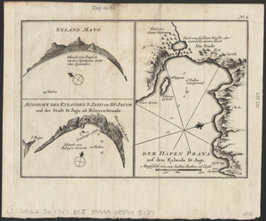
Eyland Mayo ; Aussicht des eylandes S. Jago od. St Jacob und der stadt St Jago od. Ribeyro Grande ; Der hafen Praya auf dem...
42.
La Floride divisée en Floride et Caroline
43.
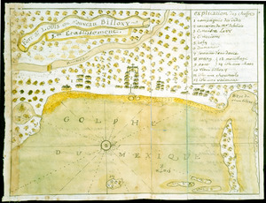
Fort St. Loüis ou Nouveau Billoxy, 3eme etablissement
44.
Gezigt van Porto Grande, in 't eiland St. Vincent = Vüe de Porto Grande dans l'ile de St. Vincent
45.
Grondtekening van de stad en forten van St. Iago = Plan de la ville et des forts de St. Yago
46.
Grundriss der stadt und der forts von St. Jago od. Jacob
47.
Grundriss von der bay der insel St. Vincent einer von den Eylanden des grünen Vorgebirges
48.
The Gulf coast from the Mississippi Delta to the Bay of St. Joseph
49.
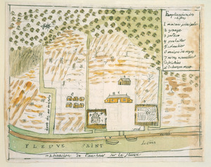
Habitation de l'autheur sur le fleuve
50.
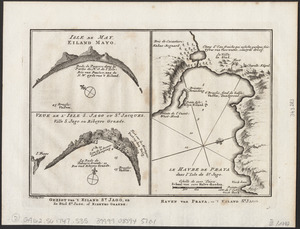
Isle de May ; Veue de l'isle de S. Jago ou St. Jacques, Ville S. Jago ou Ribeyro Grande ; Le havre de Praya dans l'isle de St....
51.
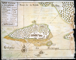
Isle Massacre ou Dauphine
52.
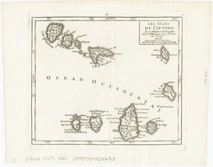
Les Isles du Cap-Verd
53.
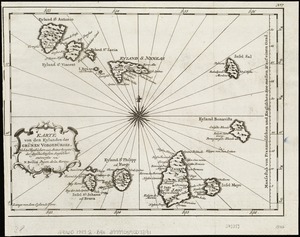
Karte von den Eylanden des Grünen Vorgebürges, nach den Tagebüchern und Anmerkungen der geschicktesten Seefahrer
54.
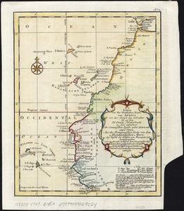
Karte von der westlichen kuste von Africa : von der strasse bey Gibraltar bis zu dem XI grade norderbreite ...wahrnehmungen...
55.
Les lacs du Canada et Nouvelle Angleterre
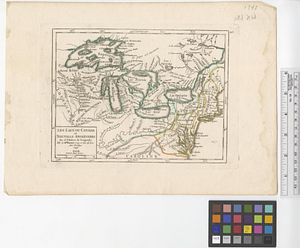
56.
A large draught of New England, New York and Long Island
57.
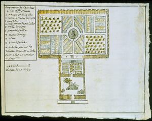
Logement de l'autheur a la Nlle. Orleans
58.
Louisbourg, latitude 45⁰ 50' north
59.
Map no. I
60.
A map of lot no 1 in the Hardenbergh Patent
‹ Prev
Next ›
1
2
3
4
5
6
7