Isle Massacre ou Dauphine
This map is also available in American Revolutionary Geographies Online (ARGO), a collections portal especially built for material relating to the American Revolutionary War Era. Visit ARGO to learn more about this item and explore the historical geography of North America in the late eighteenth century.
Item Information
- Title:
- Isle Massacre ou Dauphine
- Description:
-
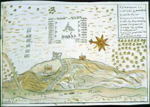
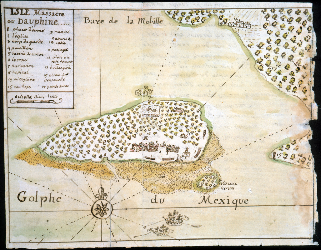
Map of the French settlement at Dauphin Island in Mobile Bay as it appeared ca. 1719. Includes drawings of individual buildings and two ships offshore; keyed to numbers 1-17; from army officer Dumont de Montigny's 1747 manuscript memoire of his experiences in Louisiana between 1715-1737.
- Creator:
- Dumont de Montigny
- Date:
-
[1747]
- Format:
-
Maps/Atlases
Manuscripts
- Location:
- Newberry Library
- Collection (local):
-
Louis C. Karpinski Map Collection
- Subjects:
-
Manuscript maps--Early works to 1800
Dauphin Island (Ala.)--Maps--Early works to 1800
- Places:
-
AlabamaMobile (county)Dauphin Island (island)
- Extent:
- 1 ms. map : hand col. ; 164 x 217 mm.
- Terms of Use:
-
No known copyright restrictions.
Contact host institution for more information.
- Scale:
-
Scale [ca. 1:200,000]
- Language:
-
French
- Catalog Record:
-
https://i-share-nby.primo.exlibrisgroup.com/permalink/01CARLI_NBY/i5mcb2/alma991477188805867
- Notes:
-
Note on verso: Golphe du Méxìque. No. 2, page 55.
Pen-and-ink and watercolor (green, yellow).
No. 2 of 23 maps and drawings detached and bound together, from: Dumont de Montigny. Memoire de Lxx Dxx Officiere Ingenieur, contenant les evenemens qui se sont passés à la Louisiane depuis 1715 jusqu'a present [1747]
Ms. memoire adapted by Jean Baptiste Le Mascrier and published as Dumont de Montigny, Mémoires historiques sur la Louisiane. Paris: C.J.B. Bauche, 1753.
- Notes (date):
-
This date is inferred.
- Call #:
-
Ayer MS 257 map 2 (NLO)