Toggle navigation
LMEC Home
Exhibitions
Georeferencing
Tools for Teachers
Collections
My Favorites
Sign Up / Log In
Search
Search the map portal
Map Collection
Map Collection
Map Sets
Search
Search
Search for
Search In
All Fields
Creator
Title
Subject
Place
Search All Digital Collections
Advanced Search
74 Results
My Search
Start Over
1917
Remove constraint 1917
Filter your Search
Place
North and Central America
45
United States
39
Boston
7
Suffolk (county)
7
New York
6
Canada
4
Europe
4
World
4
more
Place
»
Topic
Boston (Mass.)--Maps
4
United States--Maps
4
Fire risk assessment
3
Insurance surveys
3
World maps
3
Adirondack Mountains (N.Y.)--Maps
2
Chile--Maps
2
Cotton manufacture
2
more
Topic
»
Date
Date range begin
–
Date range end
Current results range from
1830
to
1959
View distribution
Creator
Richard Mayer (Firm)
7
Bromley, George Washington
4
Bromley, Walter Scott
4
C.S. Hammond & Company
4
Curtis, Lionel, 1872-1955
4
Illinois State Geological Survey
4
Associated Mutual Insurance Companies
3
G.W. Bromley & Co.
3
more
Creator
»
Format
Maps/Atlases
72
Photographs
2
Books
1
Georeferenced
Yes
5
No
69
Collection
Norman B. Leventhal Map Center Collection
64
Boston and New England Maps
5
Urban Maps
5
American Textile History Museum Image Collection
3
Robert E. Diefenbach Map Collection at Phillips Academy
3
Massachusetts Real Estate Atlases
2
Town plans, 1830
2
Available to use
No known restrictions
69
Search Constraints
Sort by relevance
relevance
title
date (asc)
date (desc)
Number of results to display per page
20 per page
10
per page
20
per page
50
per page
100
per page
View results as:
grid view
map view
Search Results
41.
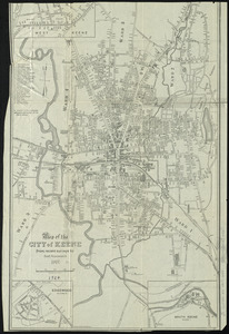
Map of the city of Keene, from recent surveys
42.
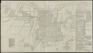
Map of the city of Savannah and vicinity
43.
Military map of the United States of America showing location of all forces in training
44.
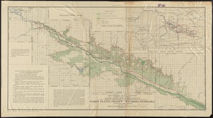
North Platte Project, Wyoming-Nebraska
45.
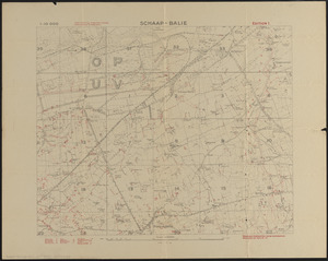
Schaap-balie
46.
Stovel's map of Winnipeg, including St. Boniface and surrounding suburbs
47.
Topographic map of Hardin County, Illinois
48.
Topographic map of Lawrence County, Illinois
49.
Hammond's complete map of the Bronx
50.
Subject nationalities of the German alliance : from the Allies' peace terms as stated in their reply to President Wilson's note...
51.
Bay State Street Ry. Co's lines and connections
52.
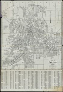
Map of Akron, Ohio : prepared for Akron Chamber of Commerce
53.
Map of White Pass & Yukon Route and connections
54.
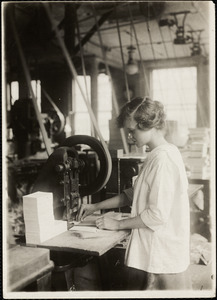
15-year old girl punching cards. Boston Index Card Co., 113 Purchase Street.
55.
Atlas of the city of Boston : Boston proper and Back Bay
56.
Atlas of the city of Boston : Boston proper and Back Bay : from actual surveys and official plans
57.
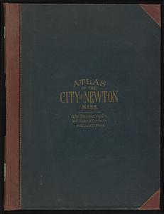
Atlas of the city of Newton, Massachusetts
58.
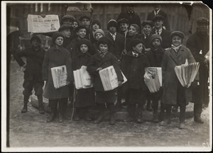
Boston Globe Newsies
59.
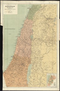
The Daily telegraph war map no. 23
60.
Diagram to illustrate contrast between British and Chinese Empires
‹ Prev
Next ›
1
2
3
4