Toggle navigation
LMEC Home
Exhibitions
Georeferencing
Tools for Teachers
Collections
My Favorites
Sign Up / Log In
Search
Search the map portal
Map Collection
Map Collection
Map Sets
Search
Search
Search for
Search In
All Fields
Creator
Title
Subject
Place
Search All Digital Collections
Advanced Search
35 Results
My Search
Start Over
g3312
Remove constraint g3312
Filter your Search
Place
North and Central America
35
Ontario, Lake
6
United States
6
Michigan, Lake
5
Superior, Lake
5
Canada
4
Michigan
4
Saint Lawrence River
4
more
Place
»
Topic
Nautical charts--Ontario, Lake (N.Y. and Ont.)
6
Ontario, Lake (N.Y. and Ont.)--Navigation--Maps
6
Michigan, Lake--Maps
5
Nautical charts--Michigan, Lake
5
Nautical charts--Saint Marys River (Mich. and Ont.)
4
Saint Marys River (Mich. and Ont.)--Maps
4
Huron, Lake (Mich. and Ont.)--Maps
3
Nautical charts--Superior, Lake
3
more
Topic
»
Date
Date range begin
–
Date range end
Current results range from
1746
to
1902
View distribution
Creator
U.S. Lake Survey
26
Comstock, C. B. (Cyrus Ballou), 1831-1910
11
Dougal, William H., 1822-1895
11
Mueller, J. U. (John U.)
10
Macomb, J. N. (John N.), 1810 or 1811-1889
9
Meade, George Gordon, 1815-1872
9
Raynolds, W. F. (William Franklin), 1820-1894
7
United States. Topographical Bureau
6
more
Creator
»
Format
Maps/Atlases
35
Georeferenced
Yes
1
No
34
Collection
Norman B. Leventhal Map & Education Center Collection
35
Maritime Charts and Atlases
23
American Revolutionary War-Era Maps
2
Available to use
No known restrictions
35
Search Constraints
Sort by relevance
relevance
title
date (asc)
date (desc)
Number of results to display per page
10 per page
10
per page
20
per page
50
per page
100
per page
View results as:
grid view
map view
Search Results
21.
Sketch of the navigation through East Neebish Rapids, River St. Marys
22.
Sketch of the navigation through East Neebish Rapids River St. Marys
23.
South end of Lake Huron and head of the St. Clair River
24.
South end of Lake Michigan
25.
Topographical plan of the north shore of Lake Huron shewing recent surveys
26.
West end of Lake Erie and Detroit River : from surveys under the direction of the Topographical Bureau of the War Department,...
27.
Lac Superieur et autres lieux ou sont les missions des peres de la Compagnie de Iesus comprises sous le nom d'Outaouacs
28.
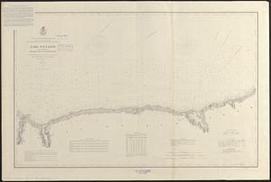
Lake Ontario
29.
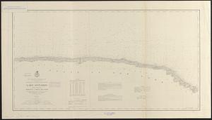
Lake Ontario
30.
Lake Ontario
‹ Prev
Next ›
1
2
3
4