Toggle navigation
LMEC Home
Exhibitions
Georeferencing
Tools for Teachers
Collections
My Favorites
Sign Up / Log In
Search
Search the map portal
Map Collection
Map Collection
Map Sets
Search
Search
Search for
Search In
All Fields
Creator
Title
Subject
Place
Search All Digital Collections
Advanced Search
14164 Results
Filter your Search
Place
North and Central America
10,832
United States
8,868
Massachusetts
2,832
Suffolk (county)
1,688
Boston
1,644
Europe
1,428
Canada
1,010
New York
684
more
Place
»
Topic
Boston (Mass.)--Maps
753
City planning--Massachusetts--Boston--Maps
419
United States--History--Revolution, 1775-1783--Maps
331
United States--Maps
331
Real property--Massachusetts--Boston--Maps
254
Urban renewal--Massachusetts--Boston--Maps
254
North America--Maps--Early works to 1800
241
Massachusetts--Maps
236
more
Topic
»
Date
Date range begin
–
Date range end
Current results range from
1482
to
2023
View distribution
Creator
United States. Hydrographic Office
597
Boston Redevelopment Authority
404
Des Barres, Joseph F. W. (Joseph Frederick Wallet), 1722-1824
247
Jefferys, Thomas, -1771
172
United States. National Ocean Service
170
Royal United Services Institute for Defence and Security Studies
160
George, III, King of Great Britain, 1738-1820
152
George, IV, King of Great Britain, 1762-1830
151
more
Creator
»
Format
Maps/Atlases
13,978
Manuscripts
985
Prints
102
Books
53
Drawings/Illustrations
44
Photographs
15
Objects/Artifacts
13
Documents
7
more
Format
»
Georeferenced
Yes
979
No
13,185
Collection
Norman B. Leventhal Map & Education Center Collection
9,162
American Revolutionary War-Era Maps
3,629
Boston and New England Maps
2,936
Urban Maps
2,511
Maritime Charts and Atlases
1,169
William L. Clements Library Collection
910
Library of Congress Collection
618
Boston Redevelopment Authority Collection
475
more
Collection
»
Available to use
No known restrictions
10,408
Creative Commons license
1,678
Search Constraints
Sort by relevance
relevance
title
date (asc)
date (desc)
Number of results to display per page
20 per page
10
per page
20
per page
50
per page
100
per page
View results as:
grid view
map view
Search Results
5041.
Manchester, N.H : 1876
5042.
Manchester Ship Canal : general map of the district showing canals, rivers, railways, and roads
5043.
The Manchu Empire and the European powers, 1644-1912, A.D.
5044.
Manhattan : first city of America
5045.
Manicouagan Shoals; Havre St. Nicholas; Bay of the Seven Islands
5046.
Manitoba
5047.
Manitoba : map showing disposition of lands
5048.
Manitoba : map showing disposition of lands
5049.
Manitoba : map showing disposition of lands
5050.
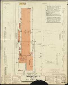
Manomet Mills "Mill No. 4" (Cotton Mill), New Bedford, Mass.
5051.
Mansfield, Massachusetts : 1888
5052.
Manufacturing center of Lynn, Mass : 1879
5053.
[Manuscript map of coast from Maine to Delaware]
5054.
[Manuscript map of New England and eastern Canada, showing the routes of Champlain's voyage]
5055.
Manuscript map of the United States
5056.
Manuscript maps of U.S. states
5057.
Manuscript maps of U.S. states, possibly drawn by a schoolchild
5058.
Manuscript plan of the Bulfinch Triangle, Boston, MA : [text]
5059.
Manuscript plan of the Bulfinch Triangle, Boston, MA : [sheet 2]
5060.
Manuscript plan of the Bulfinch Triangle, Boston, MA : [sheet 1]
‹ Prev
Next ›
1
2
…
249
250
251
252
253
254
255
256
257
…
708
709


![[Manuscript map of coast from Maine to Delaware]](https://bpldcassets.blob.core.windows.net/derivatives/images/commonwealth:x633f976h/image_thumbnail_300.jpg)
![[Manuscript map of New England and eastern Canada, showing the routes of Champlain's voyage]](https://bpldcassets.blob.core.windows.net/derivatives/images/commonwealth:qb98n8061/image_thumbnail_300.jpg)


