Toggle navigation
LMEC Home
Exhibitions
Georeferencing
Tools for Teachers
Collections
My Favorites
Sign Up / Log In
Search
Search the map portal
Map Collection
Map Collection
Map Sets
Search
Search
Search for
Search In
All Fields
Creator
Title
Subject
Place
Search All Digital Collections
Advanced Search
40 Results
My Search
Start Over
Date
1938
Remove constraint Date: <span class='single'>1938</span>
Filter your Search
Place
North and Central America
35
United States
32
Boston
13
Suffolk (county)
13
Massachusetts
12
New England
6
Canada
3
Providence (county)
3
more
Place
»
Topic
Boston (Mass.)--Maps
8
New England--Maps--Early works to 1800--Facsimiles
3
Real property--Massachusetts--Boston--Maps
3
Boone, Daniel, 1734-1820
2
Landowners--Massachusetts--Boston--Maps
2
New England--Maps
2
1676
1
America--Maps
1
more
Topic
»
Date
1938
[remove]
40
Date range begin
–
Date range end
Current results range from
1770
to
1999
1938
to
1938
40
Creator
Chase, Ernest Dudley, 1878-1966
4
Home Owners' Loan Corporation
4
Sampson, Murdock & Co.
3
G.W. Bromley & Co.
2
Boston (Mass.). Department of Parks. Board of Commissioners
1
Boston Elevated Railway Company
1
Buck Printing Co.
1
Champlain Transportation Company
1
more
Creator
»
Format
Maps/Atlases
39
Photographs
1
Georeferenced
Yes
1
No
39
Collection
Norman B. Leventhal Map & Education Center Collection
30
Boston and New England Maps
9
Urban Maps
7
Mapping Inequality Collection
4
Massachusetts Real Estate Atlases
2
American Revolutionary War-Era Maps
1
American Textile History Museum Image Collection
1
Lucius Beebe Memorial Library Historic Maps
1
more
Collection
»
Available to use
No known restrictions
31
Creative Commons license
5
Search Constraints
Sort by relevance
relevance
title
date (asc)
date (desc)
Number of results to display per page
20 per page
10
per page
20
per page
50
per page
100
per page
View results as:
grid view
map view
Search Results
21.
A map of New England and New York
22.
Map of the Back Bay Fens showing the public ways bordering and crossing them and the neighboring newly laid out parts of...
23.
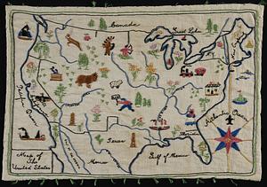
Map of the United States
24.
A mapp of New England
25.
Midsummer's marvels
26.
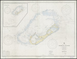
North Atlantic Ocean, Bermuda Islands : from British surveys to 1926, with additions and corrections to 1936
27.
Now see America by Grace Line
28.
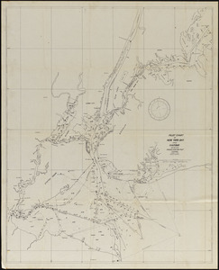
Pilot chart of New York Bay and Harbor for use with Krause's New York pilot courses
29.
Plan of corner of Centry & Beacon St's -- 1741
30.
Plan of the burnt district : showing proposed improvements in streets. Nov. 12th 1872
31.
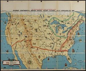
Present continental United States, except Alaska, as it appeared in 1609
32.
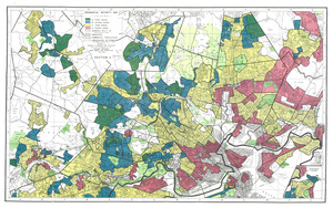
Residential security map of Boston, Mass.
33.
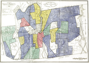
Residential security map of Pawtucket and Central Falls, R.I.
34.
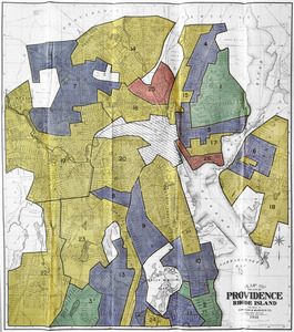
Residential security map of Providence, R.I.
35.
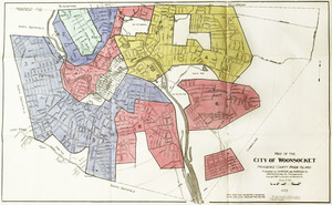
Residential security map of Woonsocket, R.I
36.
A small map of the sea coast of New England together with the outlines of several of the provinces lying thereon, 1738
37.
The south part of New-England, as it is planted this yeare, 1635
38.
To his excellency William Shirley Esqr., Captain General and Commander in Chief, in and over his Majesty's province of the...
39.
Town of Nahant
40.
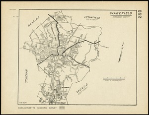
Wakefield, Massachusetts
‹ Prev
Next ›
1
2