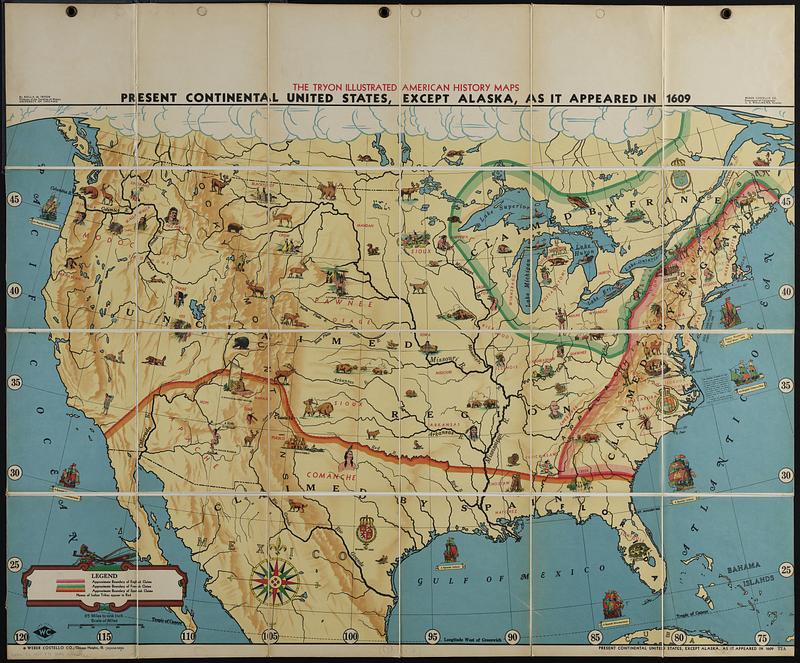
Present continental United States, except Alaska, as it appeared in 1609
Item Information
- Title:
- Present continental United States, except Alaska, as it appeared in 1609
- Title (alt.):
-
Tryon illustrated American history map T2A - 1609
- Cartographer:
- Tryon, Rolla M. (Rolla Milton), 1875-1954
- Publisher:
- Weber Costello Company
- Name on Item:
-
by Rolla M. Tryon, Professor of the teaching of history, University of Chicago ; Weber Costello Co., Department of Cartography, A.E. Wallmeyer, Director
- Date:
-
[ca. 1930–1939]
- Format:
-
Maps/Atlases
- Location:
-
Boston Public Library
Norman B. Leventhal Map & Education Center - Collection (local):
-
Norman B. Leventhal Map & Education Center Collection
- Subjects:
-
United States--History--Colonial period, ca. 1600-1775--Maps
United States--Historical geography--Maps
Indians of North America--United States--Historical geography--Maps
- Places:
-
United States
- Extent:
- 1 map : color ; 83 x 122 cm, folded in cover 28 x 22 cm
- Terms of Use:
-
No known copyright restrictions.
No known restrictions on use.
- Publisher:
-
Chicago Heights, Illinois :
Weber Costello Co.
- Scale:
-
Scale 1:4,118,400. 65 miles to one inch
- Language:
-
English
- Notes:
-
Relief shown by shading.
Shows boundaries of English, French, and Spanish claims.
Includes illustrations of Native Americans, activities, animals, and European ships.
- Identifier:
-
06_01_019122
- Call #:
-
G3701.S2 1930 .T79
- Barcode:
-
39999085971362


