Toggle navigation
LMEC Home
Exhibitions
Georeferencing
Tools for Teachers
Collections
My Favorites
Sign Up / Log In
Search
Search the map portal
Map Collection
Map Collection
Map Sets
Search
Search
Search for
Search In
All Fields
Creator
Title
Subject
Place
Search All Digital Collections
Advanced Search
30 Results
My Search
Start Over
Date
1712
Remove constraint Date: <span class='single'>1712</span>
Filter your Search
Place
North and Central America
16
United States
7
North America
5
New York
4
Europe
3
Africa
2
Asia
2
Cuba
2
more
Place
»
Topic
North America--Maps--Early works to 1800
4
America--Maps--Early works to 1800
2
Cuba--Maps--Early works to 1800
2
Jamaica--Maps--Early works to 1800
2
Western Hemisphere--Maps--Early works to 1800
2
World maps--Early works to 1800
2
1715–1718
1
Africa--Early works to 1800--Maps
1
more
Topic
»
Date
1712
[remove]
30
Date range begin
–
Date range end
Current results range from
1699
to
1800
1712
to
1712
30
Creator
Moll, Herman, d. 1732
4
Aa, Pieter van der, 1659-1733
2
Burghers, M.
2
Chatelain, Henri Abraham.
2
Homann, Johann Baptist, 1663-1724
2
Keulen, Johannes van, 1654-1715
2
Nolin, Jean Baptiste, 1686-1762
2
Hayashi, Yoshinaga
1
more
Creator
»
Format
Maps/Atlases
30
Manuscripts
2
Georeferenced
Yes
2
No
28
Collection
Norman B. Leventhal Map & Education Center Collection
21
American Revolutionary War-Era Maps
8
William L. Clements Library Collection
7
Library of Congress Collection
1
MacLean Collection Map Library
1
Maritime Charts and Atlases
1
Urban Maps
1
Available to use
No known restrictions
21
Creative Commons license
1
Search Constraints
Sort by relevance
relevance
title
date (asc)
date (desc)
Number of results to display per page
20 per page
10
per page
20
per page
50
per page
100
per page
View results as:
grid view
map view
Search Results
21.
Pas kaart van de zuyd kust van Cuba en van geheel Yamaica en and're bygeleegen plaatsen
22.
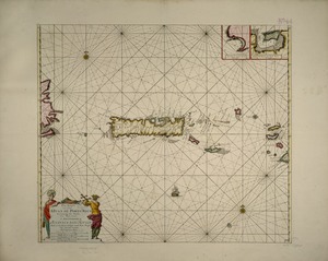
Pas kaart van t eyland S. Iuan de Porto Rico, met d eylanden daar beoosten
23.
River valley with several foothills and swamp
24.
Shinsen zouho Kyo oezu
25.
This map of South America, according to the newest and most exact observations
26.
To the Right Honourable John Lord Sommers, Baron of Evesham in ye county of Worcester, president of Her Majesty's most...
27.
To the Right Honourable William, Lord Cowper, Lord High Chancellor of Great Britain, this map of Asia : according to ye newest...
28.
A tract of land granted to George Murray and Jacobas Bruyn lying & being in the county of Ulster on the west side of the Wall...
29.
Triangles on Mercator projection between St. Augustine and Cape Breton and St. Augustine and Cape Ortegal
30.
Virginia Marylandia et Carolina in America septentrionali Brittannorum industria excultæ
‹ Prev
Next ›
1
2