Toggle navigation
LMEC Home
Exhibitions
Georeferencing
Tools for Teachers
Collections
My Favorites
Sign Up / Log In
Search
Search the map portal
Map Collection
Map Collection
Map Sets
Search
Search
Search for
Search In
All Fields
Creator
Title
Subject
Place
Search All Digital Collections
Advanced Search
61 Results
My Search
Start Over
1912
Remove constraint 1912
Filter your Search
Place
North and Central America
48
United States
39
Massachusetts
13
Boston
9
Suffolk (county)
9
Asia
5
Essex (county)
5
Canada
4
more
Place
»
Topic
Landowners--Massachusetts--Boston--Maps
5
Real property--Massachusetts--Boston--Maps
5
Boston (Mass.)--Maps
4
Fire risk assessment
3
Insurance surveys
3
Textile factories
3
Buildings--Massachusetts--Boston--Maps
2
China--Maps
2
more
Topic
»
Date
Date range begin
–
Date range end
Current results range from
1756
to
2022
View distribution
Creator
Geological Survey (U.S.)
6
Bromley, George Washington
5
Bromley, Walter Scott
5
Gray, O. W. (Ormando Wyllis), 1829-1912
4
Argentina. Ejército. Estado Mayor General
3
Associated Mutual Insurance Companies
3
Bartholomew, J. G. (John George), 1860-1920
3
G.W. Bromley & Co.
3
more
Creator
»
Format
Maps/Atlases
61
Books
1
Manuscripts
1
Georeferenced
Yes
9
No
52
Collection
Norman B. Leventhal Map & Education Center Collection
49
Boston and New England Maps
11
Urban Maps
8
Massachusetts Real Estate Atlases
6
American Textile History Museum Image Collection
3
American Revolutionary War-Era Maps
1
British Library Collection
1
Campus Maps from Phillips Academy Archives and Special Collections
1
more
Collection
»
Available to use
No known restrictions
47
Creative Commons license
2
Search Constraints
Sort by relevance
relevance
title
date (asc)
date (desc)
Number of results to display per page
20 per page
10
per page
20
per page
50
per page
100
per page
View results as:
grid view
map view
Search Results
21.
Library map of Vermont, 1914
22.
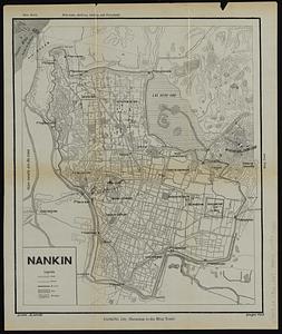
Nankin
23.
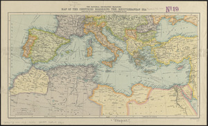
The National Geographic magazine map of the countries bordering the Mediterranean Sea
24.
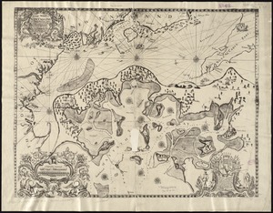
A new mapp of New England from Cape Codd to Cape Sables : describing all the sands, shoals, rocks and difficultyes together...
25.
Ziron 1920 political map
26.
Map of the Virginian Railway
27.
Map of Connecticut River in the states of Massachusetts & Connecticut : in nine sheets
28.
Das Deutsche Reich : in 4 Blättern
29.
Watershed of the Lake of the Woods
30.
A Correct Plan of the Province of New Hampshire together with part of Hudsons River from Albany to Lake George and from thence...
31.
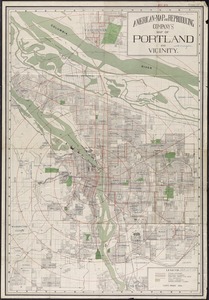
American Map and Reproducing Company's map of Portland and vicinity
32.
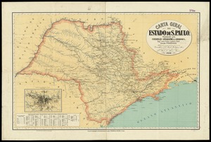
Carta geral do estado de S. Paulo
33.
France as divided into departments
34.
Map of North America : reduced from map on scale of 1:5,000,000
35.
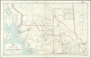
Northern interior
36.
Atlas of the city of Boston : Boston proper and Back Bay : from actual surveys and official plans
37.
Atlas of the town of Marblehead, Massachusetts : based on plans in the office of the Board of Assessors
38.
Capital Cordoba
39.
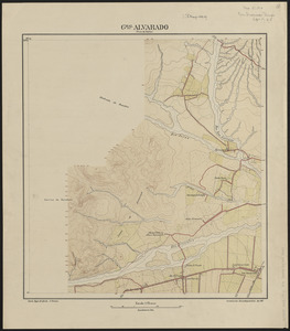
Gral. Alvarado (prov. de Salta)
40.
Hammond's complete map of Jersey City, Bayonne and Hoboken
‹ Prev
Next ›
1
2
3
4