Toggle navigation
LMEC Home
Exhibitions
Georeferencing
Tools for Teachers
Collections
My Favorites
Sign Up / Log In
Search
Search the map portal
Map Collection
Map Collection
Map Sets
Search
Search
Search for
Search In
All Fields
Creator
Title
Subject
Place
Search All Digital Collections
Advanced Search
97 Results
My Search
Start Over
1854
Remove constraint 1854
Filter your Search
Place
North and Central America
55
United States
49
Massachusetts
21
Europe
18
Asia
17
Japan
8
Suffolk (county)
7
Boston
6
more
Place
»
Topic
Crimean War, 1853-1856--Maps
8
United States--Maps
6
Nautical charts--Saint Marys River (Mich. and Ont.)
4
Saint Marys River (Mich. and Ont.)--Maps
4
Black Sea Region--Maps
3
Boston (Mass.)--Maps
3
Harbors--Massachusetts--Boston--Maps
3
Turkey--Maps
3
more
Topic
»
Date
Date range begin
–
Date range end
Current results range from
1822
to
1944
View distribution
Creator
United States. Hydrographic Office
10
U.S. Lake Survey
7
Dougal, William H., 1822-1895
6
Siebert, Selmar
6
Macomb, J. N. (John N.), 1810 or 1811-1889
5
Collins, Henry George
4
Knorr, E. R. (Ernest Rudolph)
4
Lucas, Fielding, 1781-1854
4
more
Creator
»
Format
Maps/Atlases
92
Prints
4
Manuscripts
2
Ephemera
1
Objects/Artifacts
1
Georeferenced
Yes
9
No
88
Collection
Norman B. Leventhal Map & Education Center Collection
93
Boston and New England Maps
22
Maritime Charts and Atlases
17
Urban Maps
16
Mapping Boston Collection
2
American Revolutionary War-Era Maps
1
MacLean Collection Map Library
1
New York Public Library Collection
1
more
Collection
»
Available to use
No known restrictions
92
Creative Commons license
3
Search Constraints
Sort by relevance
relevance
title
date (asc)
date (desc)
Number of results to display per page
20 per page
10
per page
20
per page
50
per page
100
per page
View results as:
grid view
map view
Search Results
21.
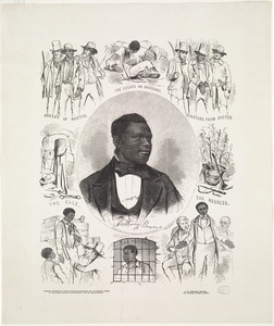
Anthony Burns
22.
Geographical, historical, and statistical map of Massachusetts
23.
Geographical, statistical, and historical map of Rhode Island
24.
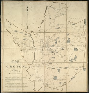
A map of the town of Groton, Middlesex County, Mass
25.
The whole story in a nutshell!
26.
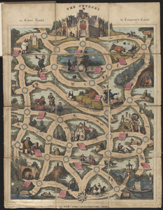
The journey, or, cross roads to conqueror's castle : a new and interesting game
27.
The travellers; or, a tour through Europe
28.
Localities of one thousand cases of intestinal diseases (diarrhoea, cholera-infantum & dysentery) in children, for the months...
29.
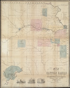
Map of Eastern Kansas
30.
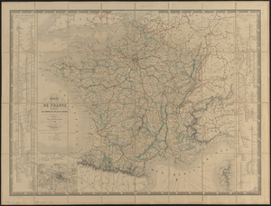
Carte de France indiquant les chemins de fer et les routes, avec les distances en kilomètres
31.
Colton's map of the United States of America, the British provinces, Mexico and the West Indies : showing the country from the...
32.
Map of the United States, showing by colors the area of freedom and slavery, and the territories whose destiny is yet to be...
33.
South Pacific, Fiji or Viti Group, Ngau Island and Mumbolithe Reef
34.
Map of Oregon and upper California, from the surveys of John Charles Frémont and other authorities
35.
Gulf of Pechelee, China, Great Wall and town of Shaw-hai-wei in lat. 40.4 N. - lon. 120.2 E.
36.
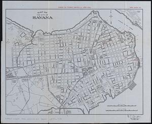
Map of the city of Havana : [casos de fiebre amarilla, muertes de niños menores, y muertes de tuberculosis]
37.
Plan of South Bay showing the Harbor Commissioners lines
38.
Indian Territory
39.
[Notice for] View of Dedham
40.
Peace map of the world united : a pictorial history of transportation and communications from Jonah to the jet plane as paths...
‹ Prev
Next ›
1
2
3
4
5


![[Notice for] View of Dedham](https://bpldcassets.blob.core.windows.net/derivatives/images/commonwealth:q524nh961/image_thumbnail_300.jpg)
