Toggle navigation
LMEC Home
Exhibitions
Georeferencing
Tools for Teachers
Collections
My Favorites
Sign Up / Log In
Search
Search the map portal
Map Collection
Map Collection
Map Sets
Search
Search
Search for
Search In
All Fields
Creator
Title
Subject
Place
Search All Digital Collections
Advanced Search
90 Results
My Search
Start Over
1803
Remove constraint 1803
Filter your Search
Place
North and Central America
69
United States
61
North America
11
Europe
10
New York
7
Massachusetts
5
Canada
4
Ohio
4
more
Place
»
Topic
North America--Maps--Early works to 1800
7
United States--Maps
7
United States--Maps--Early works to 1800
5
Georgia--Maps
3
Manhattan (New York, N.Y.)--Maps
3
Maryland--Maps
3
New York (N.Y.)--Administrative and political divisions--Maps
3
North America--Maps
3
more
Topic
»
Date
Date range begin
–
Date range end
Current results range from
1753
to
1932
View distribution
Creator
Barker, W. (William), active 1795-1803
32
Carey, Mathew, 1760-1839
32
Burr, David H., 1803-1875
8
Brion de la Tour, Louis, 1743-1803
5
Lewis, Samuel, 1753 or 4-1822
5
Esnauts et Rapilly
4
Arrowsmith, Aaron, 1750-1823
3
Dorman, Moses, 1803-1877
3
more
Creator
»
Format
Maps/Atlases
90
Georeferenced
Yes
8
No
82
Collection
Norman B. Leventhal Map & Education Center Collection
58
American Revolutionary War-Era Maps
30
MacLean Collection Map Library
15
Boston and New England Maps
10
Urban Maps
9
New York Public Library Collection
5
American Antiquarian Society Collection
3
Richard H. Brown Revolutionary War Map Collection at Mount Vernon
3
more
Collection
»
Available to use
No known restrictions
61
Creative Commons license
9
Search Constraints
Sort by relevance
relevance
title
date (asc)
date (desc)
Number of results to display per page
20 per page
10
per page
20
per page
50
per page
100
per page
View results as:
grid view
map view
Search Results
21.
The world, on Mercator's projection : showing the different routes to California, and distance by each; routes of different...
22.
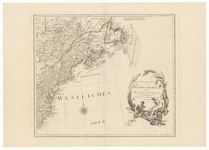
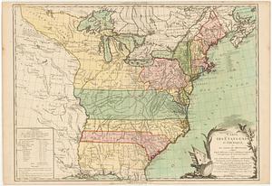
L'Amerique Septentrionale, ou se remarquent les Etats Unis
23.
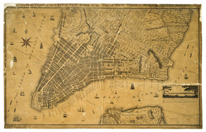
A new & accurate plan of the city of New York in the state of New York in North America
24.
General karte von Nord America samt den Westindischen Inseln
25.
A general plan of the harbours of Port Royal and Kingston Jamaica with the channels leading thereto, and the kays and shoals...
26.
Generalkarte von Nordamerika samt den Westindischen Inseln
27.
Georgia from the latest authorities
28.
Glasgow
29.
Virginia
30.
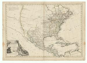
Allgemeine charte von Nord America als den sitz des krieges zwischen den Konigl. Engl. truppen u:den provinzialen
31.
L'Amérique Septentrionale, ou se remarquent les Etats Unis
32.
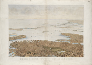
Bird's eye view of Boston
33.
Carte des Etats-Unis d'Amérique, et du cours du Mississipi : redigée d'après différentes cartes et relations anglaises, et les...
34.
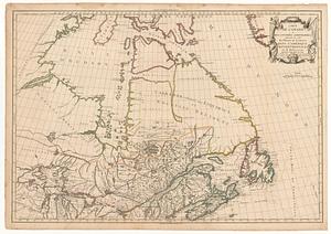
Carte du Canada et des contrées limitrophes, formant la suite du théatre de la guerre dans l'Amérique Septentrionale
35.
A chart of the West Indies, from the latest marine journals and surveys
36.
A chart of the world, according to Mercators projection, shewing the latest discoveries of Capt. Cook
37.
Delaware, from the best authorities
38.
Georgia, from the latest authorities
39.
Kentucky, reduced from Elihu Barker's large map
40.
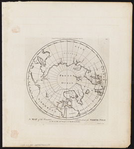
A map of the countries situate about the North Pole as far as the 50th. degree of north latitude
‹ Prev
Next ›
1
2
3
4
5