Toggle navigation
LMEC Home
Exhibitions
Georeferencing
Tools for Teachers
Collections
My Favorites
Sign Up / Log In
Search
Search the map portal
Map Collection
Map Collection
Map Sets
Search
Search
Search for
Search In
All Fields
Creator
Title
Subject
Place
Search All Digital Collections
Advanced Search
54 Results
My Search
Start Over
g3200
Remove constraint g3200
Filter your Search
Place
World
53
Asia
1
Europe
1
Topic
World maps--Early works to 1800
27
World maps
21
World maps--Early works to 1800--Facsimiles
4
Cook, James, 1728-1779
2
1700
1
2001
1
Asia--Maps
1
Byron, John, 1723-1786
1
more
Topic
»
Date
Date range begin
–
Date range end
Current results range from
1513
to
2005
View distribution
Creator
Burghers, M.
2
L'Isle, Guillaume de, 1675-1726
2
Robert de Vaugondy, Didier, 1723-1786
2
Senex, John, d. 1740
2
Arrowsmith, Aaron, 1750-1823
1
Babin, Céleste
1
Bowles, John, 1701-1779
1
Bowles, Thomas, 1694-1773
1
more
Creator
»
Format
Maps/Atlases
54
Manuscripts
5
Georeferenced
No
54
Collection
Norman B. Leventhal Map Center Collection
53
American Revolutionary War-Era Maps
3
Sidney R. Knafel Map Collection at Phillips Academy
1
Available to use
No known restrictions
51
Search Constraints
Sort by relevance
relevance
title
date (asc)
date (desc)
Number of results to display per page
20 per page
10
per page
20
per page
50
per page
100
per page
View results as:
grid view
map view
Search Results
21.
Mappmonde ou description generale du globe terrestre
22.
A Mercators chart
23.
A new and accurat map of the world drawne according to ye truest descriptions latest discoveries & best observations yt have...
24.
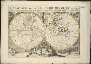
A new map of the terraqueous globe according to the ancient discoveries and most general divisions of it into continents and...
25.
A new map of the terraqueous globe according to the latest discoveries and most general divisions of it into continents and oceans
26.
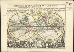
A new map of the whole world with the trade winds according to ye latest and most exact observations
27.
A new map of the world from the latest observations
28.
Nouus planiglobii terrestris per utrumque polum conspectus
29.
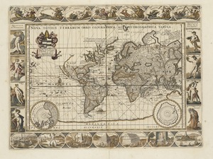
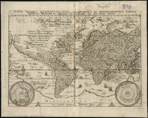
Nova totius terrarum orbis geographica ac hydrographica tabula
30.
Nova totius terrarum orbis geographica ac hydrographica tabula = Wahre Biltnüss des Gantzen Erden Kraÿses mit allen seinen...
31.
The official map of the world : showing the four quarters of the globe on the quarter-spherical or orange peel projection
32.
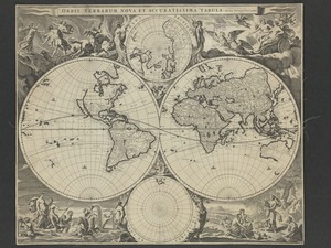
Orbis terrarum nova et accuratissima tabula
33.
Orbis vetus in utrâque continente juxtà mentem Sansonianam distinctus, nec non observationibus astronomicis
34.
Planiglobii terrestris mappa universalis utrumq hemisphærium orient. et occidentale repræsentans ex IV mappis generalibus =...
35.
Political map of the world, April 2001
36.
Stanford's library map of the world on Mercator's projection
37.
A variation chart
38.
What's up? South! : world map
39.
The world
40.
The world, according to the latest discoveries
‹ Prev
Next ›
1
2
3