Toggle navigation
LMEC Home
Exhibitions
Georeferencing
Tools for Teachers
Collections
My Favorites
Sign Up / Log In
Search
Search the map portal
Map Collection
Map Collection
Map Sets
Search
Search
Search for
Search In
All Fields
Creator
Title
Subject
Place
Search All Digital Collections
Advanced Search
13518 Results
My Search
Start Over
Date facet yearly ssim
1550
to
1599
Remove constraint Date facet yearly ssim: <span class='from'>1550</span> to <span class='to'>1599</span>
Filter your Search
Place
North and Central America
10,232
United States
8,367
Massachusetts
2,778
Suffolk (county)
1,675
Boston
1,631
Europe
1,386
Canada
949
New York
640
more
Place
»
Topic
Boston (Mass.)--Maps
746
City planning--Massachusetts--Boston--Maps
418
United States--History--Revolution, 1775-1783--Maps
329
United States--Maps
321
Real property--Massachusetts--Boston--Maps
254
Urban renewal--Massachusetts--Boston--Maps
254
Massachusetts--Maps
230
Insurance surveys
197
more
Topic
»
Date
Date range begin
–
Date range end
Current results range from
1482
to
2023
View distribution
Creator
United States. Hydrographic Office
596
Boston Redevelopment Authority
404
Des Barres, Joseph F. W. (Joseph Frederick Wallet), 1722-1824
247
Royal United Services Institute for Defence and Security Studies
160
Jefferys, Thomas, -1771
154
George, III, King of Great Britain, 1738-1820
152
George, IV, King of Great Britain, 1762-1830
151
O.H. Bailey & Co
148
more
Creator
»
Format
Maps/Atlases
13,337
Manuscripts
985
Prints
102
Books
49
Drawings/Illustrations
44
Photographs
15
Objects/Artifacts
13
Documents
7
more
Format
»
Georeferenced
Yes
979
No
12,539
Collection
Norman B. Leventhal Map & Education Center Collection
9,022
American Revolutionary War-Era Maps
3,305
Boston and New England Maps
2,900
Urban Maps
2,425
Maritime Charts and Atlases
1,167
William L. Clements Library Collection
910
Library of Congress Collection
618
Boston Redevelopment Authority Collection
475
more
Collection
»
Available to use
No known restrictions
10,085
Creative Commons license
1,677
Search Constraints
Sort by relevance
relevance
title
date (asc)
date (desc)
Number of results to display per page
20 per page
10
per page
20
per page
50
per page
100
per page
View results as:
grid view
map view
Search Results
3301.
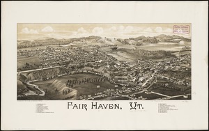
Fair Haven, Vt
3302.
Fairbanks Street, Brighton
3303.
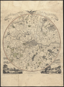
Fairburn's map of the country twelve miles round London
3304.
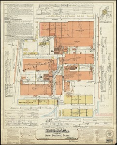
Fairhaven Mills (Cotton Mill), New Bedford, Mass.
3305.
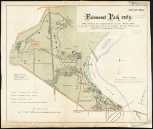
Fairmount Park 1869 : map showing the improvements on the west-side of the river from Girard Avenue to George's Hill and...
3306.
Fairmount Park, Philadelphia, 1868 : with limits, as prescribed in Act of Assembly, approved March 26th, 1868 : showing the...
3307.
Fakaafo or Bowditch Island ; Nuku-Nono or Duke of Clarence Island ; Oatáfu or Duke of York Island
3308.
Fakaafo or Bowditch Island ; Nuku-Nono or Duke of Clarence Island ; Oatáfu or Duke of York Island
3309.
Fall River Industrial Buildings Inc. (Bldg.), United Rayon Mills, (Ten.), I. Schneirerson & Sons, Inc. (Ten.), Fall River,...
3310.
Fall River Village ; Map of the town of Fall River, Bristol County, Massachusetts
3311.
Falmouth Harbour
3312.
Falmouth Harbour
3313.
Falmouth, Maine
3314.
Falmouth Neck : as it was when destroyed by Mowett, Oct. 18, 1775
3315.
Falulah Paper Company (Paper Board), Fitchburg, Mass. [insurance map]
3316.
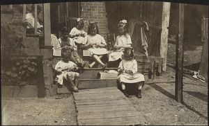
Family of Mrs. Donovan, Roxbury
3317.
Fangaloa Bay, north side of Upolu
3318.
Farnsworth Co. (Woolen Mill), Lisbon, Me. [insurance map]
3319.
Farnsworth Company, Lisbon, Me., Tenements, P.O. Lisbon Centre, Me. [insurance map]
3320.
Farnsworth Company (Wool), Lisbon, Me. P.O. Lisbon Centre, Me. [insurance map]
‹ Prev
Next ›
1
2
…
162
163
164
165
166
167
168
169
170
…
675
676


![Fall River Industrial Buildings Inc. (Bldg.), United Rayon Mills, (Ten.), I. Schneirerson & Sons, Inc. (Ten.), Fall River, Mass. [insurance map]](https://bpldcassets.blob.core.windows.net/derivatives/images/commonwealth:4j03df657/image_thumbnail_300.jpg)


![Falulah Paper Company (Paper Board), Fitchburg, Mass. [insurance map]](https://bpldcassets.blob.core.windows.net/derivatives/images/commonwealth:ww72bx74s/image_thumbnail_300.jpg)

![Farnsworth Co. (Woolen Mill), Lisbon, Me. [insurance map]](https://bpldcassets.blob.core.windows.net/derivatives/images/commonwealth:4j03dc45b/image_thumbnail_300.jpg)
![Farnsworth Company, Lisbon, Me., Tenements, P.O. Lisbon Centre, Me. [insurance map]](https://bpldcassets.blob.core.windows.net/derivatives/images/commonwealth:4j03df31d/image_thumbnail_300.jpg)
![Farnsworth Company (Wool), Lisbon, Me. P.O. Lisbon Centre, Me. [insurance map]](https://bpldcassets.blob.core.windows.net/derivatives/images/commonwealth:2r36vc212/image_thumbnail_300.jpg)