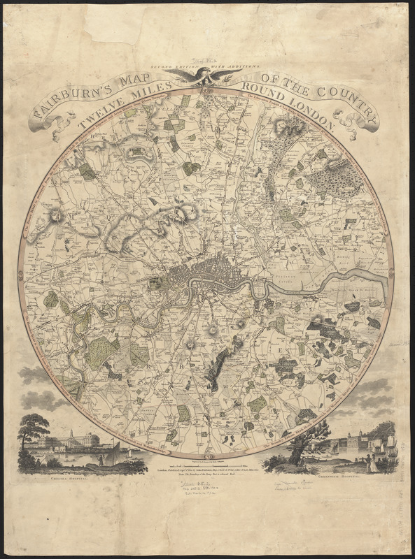
Fairburn's map of the country twelve miles round London
Item Information
- Title:
- Fairburn's map of the country twelve miles round London
- Engraver:
- Bourne, E. (Ebenezer), 1763?-1838
- Publisher:
- Fairburn, John
- Name on Item:
-
engraved by E. Bourne
- Date:
-
1800
- Format:
-
Maps/Atlases
- Location:
-
Boston Public Library
Norman B. Leventhal Map & Education Center - Collection (local):
-
Norman B. Leventhal Map & Education Center Collection
- Subjects:
-
London (England)--Maps
- Places:
-
EnglandLondon
- Extent:
- 1 map : color ; 49 cm in diameter, on sheet 74 x 55 cm
- Terms of Use:
-
No known copyright restrictions.
No known restrictions on use.
- Publisher:
-
London :
John Fairburn
- Scale:
-
Scale approximately 1:83,500
- Language:
-
English
- Notes:
-
Conservation of this piece was funded by Maureen O'Donnell in honor of Timothy F. O'Donnell.
Relief shown by hachures. Depths shown by soundings.
Includes illustrations of Chelsea Hospital and Greenwich Hospital.
- Identifier:
-
06_01_014892
- Call #:
-
G5754.L7 1800 .F35
- Barcode:
-
39999065707570


