Toggle navigation
LMEC Home
Exhibitions
Georeferencing
Tools for Teachers
Collections
My Favorites
Sign Up / Log In
Search
Search the map portal
Map Collection
Map Collection
Map Sets
Search
Search
Search for
Search In
All Fields
Creator
Title
Subject
Place
Search All Digital Collections
Advanced Search
13680 Results
My Search
Start Over
Date facet yearly ssim
1550
to
1599
Remove constraint Date facet yearly ssim: <span class='from'>1550</span> to <span class='to'>1599</span>
Filter your Search
Place
North and Central America
10,344
United States
8,475
Massachusetts
2,789
Suffolk (county)
1,677
Boston
1,633
Europe
1,415
Canada
950
New York
649
more
Place
»
Topic
Boston (Mass.)--Maps
747
City planning--Massachusetts--Boston--Maps
418
United States--History--Revolution, 1775-1783--Maps
329
United States--Maps
322
Real property--Massachusetts--Boston--Maps
254
Urban renewal--Massachusetts--Boston--Maps
254
Massachusetts--Maps
231
Insurance surveys
197
more
Topic
»
Date
Date range begin
–
Date range end
Current results range from
1482
to
2023
View distribution
Creator
United States. Hydrographic Office
597
Boston Redevelopment Authority
404
Des Barres, Joseph F. W. (Joseph Frederick Wallet), 1722-1824
247
Royal United Services Institute for Defence and Security Studies
160
Jefferys, Thomas, -1771
154
George, III, King of Great Britain, 1738-1820
152
George, IV, King of Great Britain, 1762-1830
151
O.H. Bailey & Co
148
more
Creator
»
Format
Maps/Atlases
13,499
Manuscripts
985
Prints
102
Books
49
Drawings/Illustrations
44
Photographs
15
Objects/Artifacts
13
Documents
7
more
Format
»
Georeferenced
Yes
979
No
12,701
Collection
Norman B. Leventhal Map & Education Center Collection
9,096
American Revolutionary War-Era Maps
3,305
Boston and New England Maps
2,915
Urban Maps
2,471
Maritime Charts and Atlases
1,169
William L. Clements Library Collection
910
Library of Congress Collection
618
Boston Redevelopment Authority Collection
475
more
Collection
»
Available to use
No known restrictions
10,246
Creative Commons license
1,678
Search Constraints
Sort by relevance
relevance
title
date (asc)
date (desc)
Number of results to display per page
20 per page
10
per page
20
per page
50
per page
100
per page
View results as:
grid view
map view
Search Results
3221.
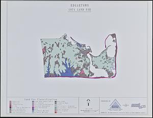
Edgartown 1971 to 1985 land use change
3222.
Edgartown, Duke's County, Martha's Vineyard Id., Mass
3223.
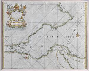
Edinburg Firth
3224.
Edinburgh
3225.
Edinburgh in 1886
3226.
Egleston Square improvement program
3227.
Egmont Harbor
3228.
Egmont Harbor
3229.
Egmont Harbor
3230.
Egypt and the basin of the Nile
3231.
Egypte nommée dans le pays Missir
3232.
Egyptian Empire B.C. 1450
3233.
The Egyptian gazette war map no. 3
3234.
Eight survey tracts along the Kanawha River, W.Va : showing land granted to George Washington and others
3235.
Eight views of the world
3236.
Eiland van St. Filippus, of van Fuego, met zyn vuurberg = Ile de St. Philipe ou de Fuego avec son volcan
3237.
[Ein grund-riss von der Festung Duquessne wie sie ausgesehen hat, ehe sie die Frankosen zerstoren aben, und zum theil noch...
3238.
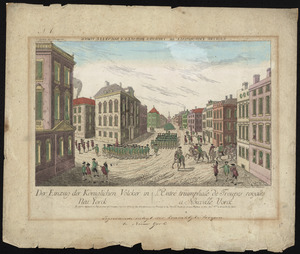
Der einzug der königlichen völcker in Neu Yorck
3239.
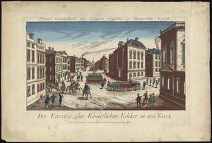
Der einzug der königlichen völcker in Neu Yorck = : L'entré triumphale de troupes royales á Nouvelle Yorck
3240.
Eisenbahn, post und dampfschiffskarte von Europa = Railway, steam-boat and post map of Europe = Carte des chemins de fer, voies...
‹ Prev
Next ›
1
2
…
158
159
160
161
162
163
164
165
166
…
683
684


![[Ein grund-riss von der Festung Duquessne wie sie ausgesehen hat, ehe sie die Frankosen zerstoren aben, und zum theil noch aussiehet]](https://bpldcassets.blob.core.windows.net/derivatives/images/commonwealth:z603vv49q/image_thumbnail_300.jpg)