Toggle navigation
LMEC Home
Exhibitions
Georeferencing
Tools for Teachers
Collections
My Favorites
Sign Up / Log In
Search
Search the map portal
Map Collection
Map Collection
Map Sets
Search
Search
Search for
Search In
All Fields
Creator
Title
Subject
Place
Search All Digital Collections
Advanced Search
462 Results
My Search
Start Over
pennsylvania
Remove constraint pennsylvania
Filter your Search
Place
North and Central America
457
United States
412
Pennsylvania
265
Philadelphia
63
Philadelphia (county)
63
Maryland
38
New York
36
Virginia
35
more
Place
»
Topic
Pennsylvania--Maps
51
Pennsylvania--Maps--Early works to 1800
38
Philadelphia (Pa.)--Maps
22
Maryland--Maps
18
United States--History--Revolution, 1775-1783--Maps
17
Virginia--Maps
16
Philadelphia (Pa.)--Maps--Early works to 1800
15
New Jersey--Maps--Early works to 1800
14
more
Topic
»
Date
Date range begin
–
Date range end
Current results range from
1689
to
1990
View distribution
Creator
O.H. Bailey & Co
19
George, III, King of Great Britain, 1738-1820
15
George, IV, King of Great Britain, 1762-1830
14
Mitchell, S. Augustus, (Samuel Augustus), Jr
14
Royal United Services Institute for Defence and Security Studies
14
Fisk, E. F.
13
Hutchins, Thomas, 1730-1789
13
International Correspondence Schools
13
more
Creator
»
Format
Maps/Atlases
453
Manuscripts
50
Books
4
Photographs
3
Drawings/Illustrations
2
Georeferenced
Yes
36
No
426
Collection
Norman B. Leventhal Map & Education Center Collection
252
American Revolutionary War-Era Maps
240
William L. Clements Library Collection
64
Urban Maps
53
British Library Collection
34
Library of Congress Collection
30
MacLean Collection Map Library
25
Richard H. Brown Revolutionary War Map Collection at Mount Vernon
20
more
Collection
»
Available to use
No known restrictions
256
Creative Commons license
107
Search Constraints
Sort by relevance
relevance
title
date (asc)
date (desc)
Number of results to display per page
20 per page
10
per page
20
per page
50
per page
100
per page
View results as:
grid view
map view
Search Results
261.
A rough sketch of the field of battle, near Turtle Creek, of the 9th July, with the disposition of the British troops, and...
262.
Topographical map, Gettysburg-Antietam
263.
Plans & Sections of Houses for Officers & Barracks for Soldiers near the City of Philadelphia
264.
Plans & Sections of Houses for Officers & Barracks for Soldiers near the City of Philadelphia
265.
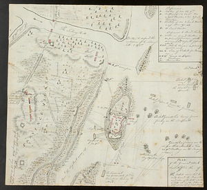
[Fort Pitt]
266.
Plans & Sections of Houses for Officers & Barracks for Soldiers near the City of Philadelphia
267.
Susquehanna & Sinnemahoning
268.
Seat of war in the environs of Philadeliphia
269.
Seat of war in the environs of Philadeliphia
270.
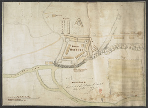
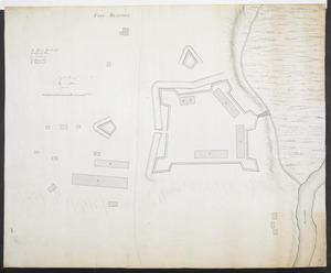
FORT BEDFORD
271.
FORT BEDFORD
272.
Philadelphia : dedicated to his excellency Sir Henry Clinton K.B. general and commander in chief of his majesty's forces,...
273.
American camp at Valley Forge
274.
Bird's eye view of Wilkes-Barre, Pa : 1872
275.
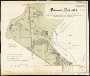
Fairmount Park 1869 : map showing the improvements on the west-side of the river from Girard Avenue to George's Hill and...
276.
A map of that part of Pensylvania now the principle seat of war in America wherein may be seen the situation of Philadelphia,...
277.
Plan of the general attack on Fort Mifflin
278.
Plan of Washingtons position
279.
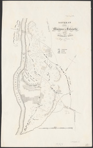
Retreat of the Marquis de Lafayette from Barren Hill, May 20th, 1778
280.
[Map showing Fort Pitt, Fort Duquesne and Fort Mercer]
‹ Prev
Next ›
1
2
…
10
11
12
13
14
15
16
17
18
…
23
24

![[Fort Pitt]](https://bpldcassets.blob.core.windows.net/derivatives/images/commonwealth:hx11xz65w/image_thumbnail_300.jpg)


![[Map showing Fort Pitt, Fort Duquesne and Fort Mercer]](https://bpldcassets.blob.core.windows.net/derivatives/images/commonwealth:hx11z222w/image_thumbnail_300.jpg)