Toggle navigation
LMEC Home
Exhibitions
Georeferencing
Tools for Teachers
Collections
My Favorites
Sign Up / Log In
Search
Search the map portal
Map Collection
Map Collection
Map Sets
Search
Search
Search for
Search In
All Fields
Creator
Title
Subject
Place
Search All Digital Collections
Advanced Search
2843 Results
My Search
Start Over
atlas
Remove constraint atlas
Filter your Search
Place
North and Central America
1,647
United States
987
Europe
464
Massachusetts
348
Canada
271
Asia
190
South America
189
Suffolk (county)
163
more
Place
»
Topic
Landowners--Massachusetts--Boston--Maps
115
Real property--Massachusetts--Boston--Maps
106
United States--Maps
87
Boston (Mass.)--Maps
63
United States--History--French and Indian War, 1754-1763--Maps
63
Saint Lawrence River--Maps
41
Nautical charts--Early works to 1800
39
North America--Maps--Early works to 1800
36
more
Topic
»
Date
Date range begin
–
Date range end
Current results range from
1482
to
2023
View distribution
Creator
United States. Hydrographic Office
582
Des Barres, Joseph F. W. (Joseph Frederick Wallet), 1722-1824
118
Ptolemy, 2nd cent
100
Bromley, George Washington
99
Bromley, Walter Scott
97
G.W. Bromley & Co.
75
Carey, Mathew, 1760-1839
74
Paullin, Charles Oscar, 1868 or 1869-1944
70
more
Creator
»
Format
Maps/Atlases
2,827
Manuscripts
58
Books
37
Prints
8
Documents
5
Drawings/Illustrations
1
Georeferenced
Yes
142
No
2,701
Collection
Norman B. Leventhal Map & Education Center Collection
2,386
Maritime Charts and Atlases
1,150
American Revolutionary War-Era Maps
504
Boston and New England Maps
374
Urban Maps
250
Massachusetts Real Estate Atlases
144
William L. Clements Library Collection
92
Mapping Boston Collection
61
more
Collection
»
Available to use
No known restrictions
2,292
Creative Commons license
158
Search Constraints
Sort by relevance
relevance
title
date (asc)
date (desc)
Number of results to display per page
20 per page
10
per page
20
per page
50
per page
100
per page
View results as:
grid view
map view
Search Results
2241.
A view of the east end of the Isle Sable ... : The eastern end of the Isle Sable ... ; A view taken from the south side of the...
2242.
Vineyard Sound and Buzzards Bay, Massachusetts
2243.
West End of the Isle of Sable from the northward ... : Wreckers Den near the Pond ... ; North Shore ; North Shore of Isle Sable
2244.
White Haven
2245.
White Islands Harbour : Port Stephen's ; Liscomb Harbour ; Houlton Harbour ; River St. Mary
2246.
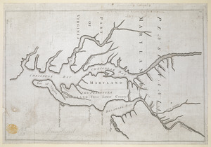
Proposed Maryland / Pennsylvania Boundary
2247.
An accurate map of North America : Describing and distinguishing the British and Spanish dominions of this great continent;...
2248.
Aethiopia superior vel interior : vulgo Abissinorum, sive Presbiteri Ioannis imperium
2249.
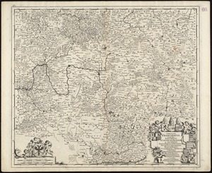
Circulus Franconius, in quo sunt episcopatus Wurtzburg, Bamberg et Aichstet : Status equitum Teutonicor ducatus Coburgensis :...
2250.
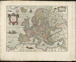
Europa exactissime descripta
2251.
Fezzae et Marocchi regna Africae celeberrima
2252.
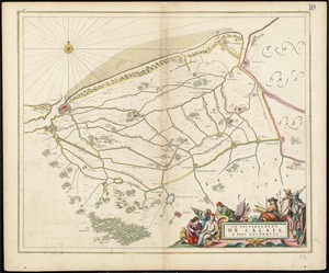
Le gouvernement de Calais, & pays reconquis
2253.
Guiana sive Amazonum regio
2254.
Languedoc
2255.
Mappa geographica Americae Septentrionalis : ad emendatiora exemplaria adhuc edita jussu Acad. reg. scient. et eleg. litt....
2256.
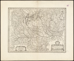
Mediolanum ducatus
2257.
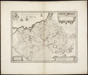
Meklenburg Ducatus
2258.
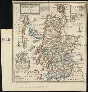
A new and correct map of Scotland and the Isles : containing all ye cities, market towns, boroughs &c., the principal roads,...
2259.
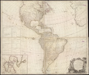
A new map of the whole continent of America, divided into North and South and West Indies : wherein are exactly described the...
2260.
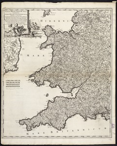
Occidentalior Regni Angliae districtus comprehendens principatum Walliae et Glocestriae ducatum comitatus et provincias...
‹ Prev
Next ›
1
2
…
109
110
111
112
113
114
115
116
117
…
142
143