Toggle navigation
LMEC Home
Exhibitions
Georeferencing
Tools for Teachers
Collections
My Favorites
Sign Up / Log In
Search
Search the map portal
Map Collection
Map Collection
Map Sets
Search
Search
Search for
Search In
All Fields
Creator
Title
Subject
Place
Search All Digital Collections
Advanced Search
1070 Results
My Search
Start Over
Back Bay Boston
Remove constraint Back Bay Boston
Filter your Search
Place
North and Central America
821
United States
521
Massachusetts
229
Suffolk (county)
176
Boston
171
Canada
115
South America
62
Asia
61
more
Place
»
Topic
Boston (Mass.)--Maps
60
City planning--Massachusetts--Boston--Maps
48
Back Bay (Boston, Mass.)--Maps
46
North America--Maps--Early works to 1800
34
Landowners--Massachusetts--Boston--Maps
26
Real property--Massachusetts--Boston--Maps
25
New England--Maps--Early works to 1800
24
Nova Scotia--Maps--Early works to 1800
24
more
Topic
»
Date
Date range begin
–
Date range end
Current results range from
1565
to
2020
View distribution
Creator
United States. Hydrographic Office
276
Des Barres, Joseph F. W. (Joseph Frederick Wallet), 1722-1824
64
Boston Redevelopment Authority
35
Jefferys, Thomas, -1771
24
Sayer, Robert, 1725-1794
24
Franke, M. (Max)
23
U.S. Lake Survey
22
United States Exploring Expedition (1838-1842)
21
more
Creator
»
Format
Maps/Atlases
1,056
Manuscripts
69
Drawings/Illustrations
10
Objects/Artifacts
3
Prints
3
Books
1
Georeferenced
Yes
54
No
1,016
Collection
Norman B. Leventhal Map & Education Center Collection
932
Maritime Charts and Atlases
477
Boston and New England Maps
258
American Revolutionary War-Era Maps
230
Urban Maps
136
Boston Redevelopment Authority Collection
54
Mapping Boston Collection
39
Library of Congress Collection
35
more
Collection
»
Available to use
No known restrictions
933
Creative Commons license
112
Search Constraints
Sort by relevance
relevance
title
date (asc)
date (desc)
Number of results to display per page
20 per page
10
per page
20
per page
50
per page
100
per page
View results as:
grid view
map view
Search Results
201.
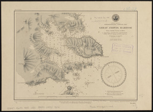
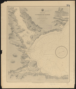
North America, Newfoundland, Despair Bay, Great Jervis Harbor : from a British survey in 1884-5
202.
Plan of South Bay showing the Harbor Commissioners lines
203.
Carte de la ville, baye et environs de Baston
204.
Massachusetts Bay with the coast from Cape Ann to Cape Cod
205.
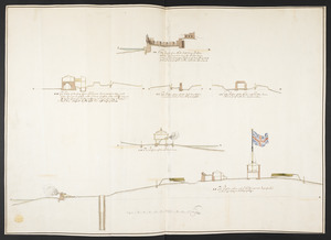
The Respective Profiles belonging to the great Iconografical Draughts of Castle Island in the Bay of Boston
206.
West Indies, n. coast of St. Domingo, Manzanillo Bay
207.
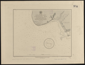
North America, west coast of lower California, Colnett Bay : from a survey in 1886 by the officers of the U.S.S. Ranger,...
208.
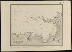
Central America, west coast of Costa Rica, Juanilla Bay : from a survey in 1885 by the officers of the U.S.S. Ranger, Commander...
209.
Central America, west coast of Costa Rica, Uvita Bay : from a survey in 1885 by the officers of the U.S.S. Ranger, Commander...
210.
North America, east coast, Bay of Fundy, northern part : from British surveys
211.
North America, east coast, Bay of Fundy, southern part : from British and United States surveys
212.
Central America, west coast of Costa Rica, Murcielago Bay : from a survey in 1885 by the officers of the U.S.S. Ranger,...
213.
Dominion of Canada, Nova Scotia, Guysborough Harbor (Chedabucto Bay) : from a British survey in 1850
214.
South America, coast of Peru, Callao Bay and vicinity : from a British survey in 1840, and a French survey in 1876
215.
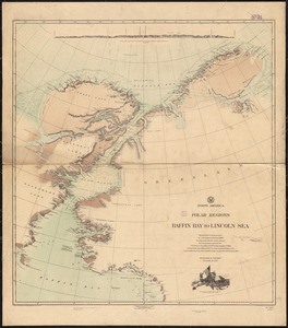
North America, polar regions, Baffin Bay to Lincoln Sea : showing the recent discoveries by civil engineer R.E. Peary, U.S.N.,...
216.
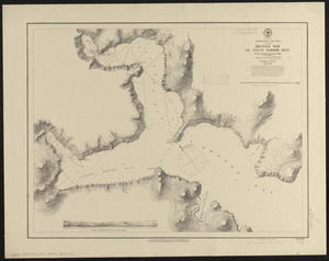
Newfoundland, east coast, Orange Bay or Great Harbor Deep : from a French survey in 1870
217.
Metropolitan District Commission combined sewer overflow project Dorchester Bay area
218.
Fayal Id., Horta and Pim Bays ; Azores, Fayal Channel
219.
Newfoundland, east coast, harbors in Trinity Bay, sheet II : from British surveys, corrected to 1874
220.
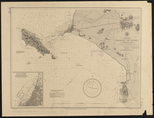
Coast of Maine from Frenchman Bay to Mosquito Harbor
‹ Prev
Next ›
1
2
…
7
8
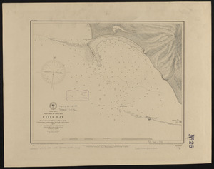
9
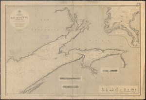
10
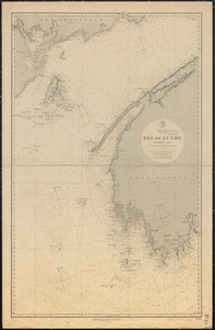
11
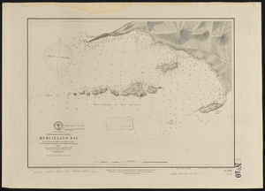
12
13
14
15
…
53
54