Toggle navigation
LMEC Home
Exhibitions
Georeferencing
Tools for Teachers
Collections
My Favorites
Sign Up / Log In
Search
Search the map portal
Map Collection
Map Collection
Map Sets
Search
Search
Search for
Search In
All Fields
Creator
Title
Subject
Place
Search All Digital Collections
Advanced Search
460 Results
My Search
Start Over
Date
1700
to
1749
Remove constraint Date: <span class='from'>1700</span> to <span class='to'>1749</span>
Filter your Search
Place
North and Central America
272
United States
116
Europe
69
Canada
64
North America
53
South America
48
Africa
39
France
22
more
Place
»
Topic
North America--Maps--Early works to 1800
29
Manuscript maps--Early works to 1800
24
America--Maps--Early works to 1800
19
Western Hemisphere--Maps--Early works to 1800
19
South America--Maps--Early works to 1800
16
Louisbourg (N.S.)--Maps, Manuscript--Early works to 1800
14
Louisbourg (N.S.)--History--Siege, 1745--Maps, Manuscript--Early works to 1800
13
West Indies--Maps--Early works to 1800
12
more
Topic
»
Date
1700
to
1749
[remove]
460
Date range begin
–
Date range end
Current results range from
1668
to
1800
1700
to
1704
53
1705
to
1709
50
1710
to
1714
57
1715
to
1719
50
1720
to
1724
59
1725
to
1729
44
1730
to
1734
75
1735
to
1739
90
1740
to
1744
77
1745
to
1749
125
Creator
Moll, Herman, d. 1732
60
George, III, King of Great Britain, 1738-1820
40
George, IV, King of Great Britain, 1762-1830
39
L'Isle, Guillaume de, 1675-1726
25
Bellin, Jacques Nicolas, 1703-1772
17
Royal United Services Institute for Defence and Security Studies
17
Bastide, John Henry, approximately 1700-1770
15
Bowles, John, 1701-1779
14
more
Creator
»
Format
Maps/Atlases
451
Manuscripts
70
Drawings/Illustrations
5
Prints
3
Georeferenced
Yes
25
No
435
Collection
Norman B. Leventhal Map & Education Center Collection
300
American Revolutionary War-Era Maps
129
British Library Collection
73
Maritime Charts and Atlases
46
Boston and New England Maps
33
William L. Clements Library Collection
28
Newberry Library Collection
22
Urban Maps
17
more
Collection
»
Available to use
No known restrictions
296
Creative Commons license
102
Search Constraints
Sort by relevance
relevance
title
date (asc)
date (desc)
Number of results to display per page
20 per page
10
per page
20
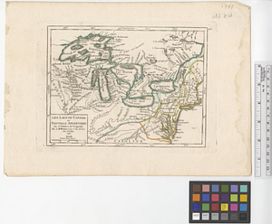
per page
50
per page
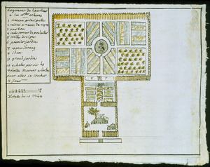
100
per page
View results as:
grid view
map view
Search Results
181.
The island of Barbadoes : divided into its parishes, with the roads, paths, &c. according to an actual and accurate survey
182.
The island of Bermudos divided into its tribes, with the castles, forts &c
183.
The island of Jamaica
184.
The island of Jamaica, divided into its principal parishes, with the roads &c
185.
The island of St. Christophers, alias St. Kitts
186.
[Island of St. Peters]
187.
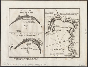
Isle de May ; Veue de l'isle de S. Jago ou St. Jacques, Ville S. Jago ou Ribeyro Grande ; Le havre de Praya dans l'isle de St....
188.
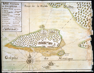
Isle Massacre ou Dauphine
189.
The isle of California : New Mexico : Louisiane : The river Misisipi, and the lakes of Canada
190.
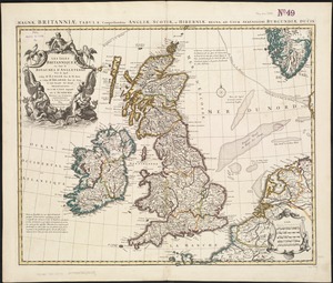
Les Isles Britanniques ou sont le royaumes d'Angleterre
191.
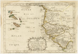
Isles de Cap Verd coste, et pays des Negres
192.
Les Isles du Cap-Verd
193.
L'Italie : publiée sous les auspices de Monseigneur le Duc d'Orleans, Prémier Prince du Sang
194.
Karte von den Eylanden des Grünen Vorgebürges, nach den Tagebüchern und Anmerkungen der geschicktesten Seefahrer
195.
Karte von der westlichen kuste von Africa : von der strasse bey Gibraltar bis zu dem XI grade norderbreite ...wahrnehmungen...
196.
Les lacs du Canada et Nouvelle Angleterre
197.
A large draft of the island Antegua
198.
A large draught of New England, New York and Long Island
199.
Logement de l'autheur a la Nlle. Orleans
200.
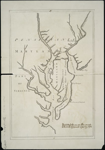
Lord Baltimore's own plan : proposed Maryland/Pennsylvania boundary
‹ Prev
Next ›
1
2
…
6
7
8
9
10
11
12
13
14
…
22
23


![[Island of St. Peters]](https://bpldcassets.blob.core.windows.net/derivatives/images/commonwealth:cj82m507n/image_thumbnail_300.jpg)