Toggle navigation
LMEC Home
Exhibitions
Georeferencing
Tools for Teachers
Collections
My Favorites
Sign Up / Log In
Search
Search the map portal
Map Collection
Map Collection
Map Sets
Search
Search
Search for
Search In
All Fields
Creator
Title
Subject
Place
Search All Digital Collections
Advanced Search
199 Results
My Search
Start Over
1879
Remove constraint 1879
Filter your Search
Place
North and Central America
129
United States
102
Massachusetts
47
Europe
38
Boston
24
Suffolk (county)
24
Asia
16
France
11
more
Place
»
Topic
Boston (Mass.)--Aerial views
9
Belgium--Maps
7
Boston (Mass.)--Maps
7
Europe--Maps
7
France--Maps
7
World War, 1914-1918--France--Maps
7
World War, 1914-1918--Belgium--Maps
6
World War, 1914-1918--Europe--Maps
6
more
Topic
»
Date
Date range begin
–
Date range end
Current results range from
1830
to
1948
View distribution
Creator
United States. Hydrographic Office
37
Gross, Alexander, 1879-1958
29
Bailey, O. H. (Oakley Hoopes), 1843-1947
13
Barnett, E. (Edward), 1799-1879
9
O.H. Bailey & Co
8
Owen, Richard (Navy Commander)
6
Eldridge, George, 1821-1879
5
Smith, T.
4
more
Creator
»
Format
Maps/Atlases
198
Manuscripts
5
Documents
1
Objects/Artifacts
1
Georeferenced
Yes
18
No
181
Collection
Norman B. Leventhal Map & Education Center Collection
194
Boston and New England Maps
54
Urban Maps
53
Maritime Charts and Atlases
45
Massachusetts Real Estate Atlases
3
American Revolutionary War-Era Maps
1
David Judkins Weaver Papers
1
MacLean Collection Map Library
1
more
Collection
»
Available to use
No known restrictions
195
Search Constraints
Sort by relevance
relevance
title
date (asc)
date (desc)
Number of results to display per page
20 per page
10
per page
20
per page
50
per page
100
per page
View results as:
grid view
map view
Search Results
181.
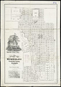
Plan of Humboldt, Humboldt County, Iowa
182.
Plan of Sherburne Bluffs, Nantucket, Mass
183.
Prussia
184.
Railway map of the New England states, engraved expressly for the Pathfinder railway guide
185.
Specialkarte der Asiatischen Türkey : oestliches blatt
186.
A topographicall description and admeasurement of the yland of Barbados in the West Indyaes : with the mrs. names of the...
187.
Topographische karte der gegend um Berlin
188.
Yosemite Valley
189.
Plan of Washington made by Luke Barber, dated May 9, 1831
190.
Proposed improvement of Back Bay
191.
Brésil
192.
Gray's new map of Clay Center, Clay County, Kansas
193.
Map of Boston : showing health districts and undrained and filled land
194.
Maps of Europe
195.
New map of central London divided into quarter mile squares
196.
New map of the American overland route showing its connections, and land grants of 30,000,000 acres
197.
Philips' new map of Central Europe
198.
Russell's map of Paris and fortifications
199.
U.S. Coast Survey classification and rules for the miscellaneous lettering of names &c. on the map, not connected with title or...
‹ Prev
Next ›
1
2
…
6
7
8
9
10