Toggle navigation
LMEC Home
Exhibitions
Georeferencing
Tools for Teachers
Collections
My Favorites
Sign Up / Log In
Search
Search the map portal
Map Collection
Map Collection
Map Sets
Search
Search
Search for
Search In
All Fields
Creator
Title
Subject
Place
Search All Digital Collections
Advanced Search
722 Results
My Search
Start Over
Subject
aerial views
Remove constraint Subject: aerial views
Filter your Search
Place
North and Central America
654
United States
624
Massachusetts
295
Suffolk (county)
65
Boston
63
New Hampshire
55
Connecticut
53
Middlesex (county)
53
more
Place
»
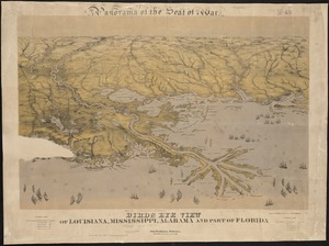
Topic
Boston (Mass.)--Aerial views
42
Franco-Prussian War, 1870-1871--Aerial views
7
Aerial views
6
France--History--1789-1900--Aerial views
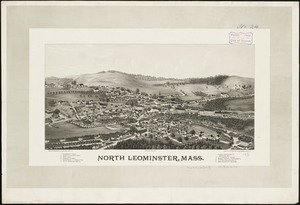
6
Germany--History--1789-1900--Aerial views
6
United States--History--Revolution, 1775-1783--Maps
6
Boston (Mass.)--History--Revolution, 1775-1783--Aerial views--Early works to 1800
5
Boston (Mass.)--History--Siege, 1775-1776--Aerial views--Early works to 1800
5
more
Topic
»
Date
Date range begin
–
Date range end
Current results range from
1493
to
2020
View distribution
Creator
O.H. Bailey & Co
146
Norris, George E.
51
Burleigh, L. R., 1853-1923
47
Bailey, O. H. (Oakley Hoopes), 1843-1947
41
Poole, A. F.
22
Bailey, H. H. (Howard Heston), 1836-1878
20
Bachmann, John, fl. 1849-1885
8
Fowler, T. M. (Thaddeus Mortimer), 1842-1922
8
more
Creator
»
Format
Maps/Atlases
699
Prints
18
Manuscripts
12
Drawings/Illustrations
11
Georeferenced
Yes
5
No
717
Collection
Norman B. Leventhal Map & Education Center Collection
694
Urban Maps
575
Boston and New England Maps
449
American Revolutionary War-Era Maps
30
Richard H. Brown Revolutionary War Map Collection at Mount Vernon
11
Boston Redevelopment Authority Collection
8
William L. Clements Library Collection
7
Library of Congress Collection
4
more
Collection
»
Available to use
No known restrictions
691
Creative Commons license
20
Search Constraints
Sort by relevance
relevance
title
date (asc)
date (desc)
Number of results to display per page
20 per page
10
per page
20
per page
50
per page
100
per page
View results as:
grid view
map view
Search Results
41.
St. Stephen, New Brunswick and Calais, Maine : 1889
42.
Three Rivers, Mass
43.
United States International Exhibition : Bird's-eye view of Fairmount Park, showing the centennial buildings in course of...
44.
La vue a vol d'oiseau de l'Abbaye de Saint-Martin de Laon (de l'Ordre de Prémontré)
45.
Wakefield and Peace Dale, Rhode Island : 1888
46.
West Newton, Massachusetts
47.
Wood's Holl [sic], Falmouth, Mass
48.
Cape Cod and the islands
49.
Cottage City, Martha's Vineyard, Mass
50.
Rochester, N.H : Gonic and East-Rochester, 1884
51.
Birds eye view of Louisiana, Mississippi, Alabama and part of Florida
52.
Clyde, River Point and Arctic, Rhode Island
53.
Antrim, N.H. and Clinton Village : 1887
54.
Bloys
55.
East Douglas, Mass : 1886
56.
Franklin and Franklin Falls, N.H : Merrimack County, 1884
57.
Hyde Park, Massachusetts : 1890
58.
Jamaica Plain, Massachusetts : Ward 23, City of Boston, 1891
59.
North Leominster, Mass
60.
South Norwalk and Norwalk, Conn : 1875
‹ Prev
Next ›
1
2
3
4
5
6
7
…
36
37


![Wood's Holl [sic], Falmouth, Mass](https://bpldcassets.blob.core.windows.net/derivatives/images/commonwealth:qb98n7935/image_thumbnail_300.jpg)